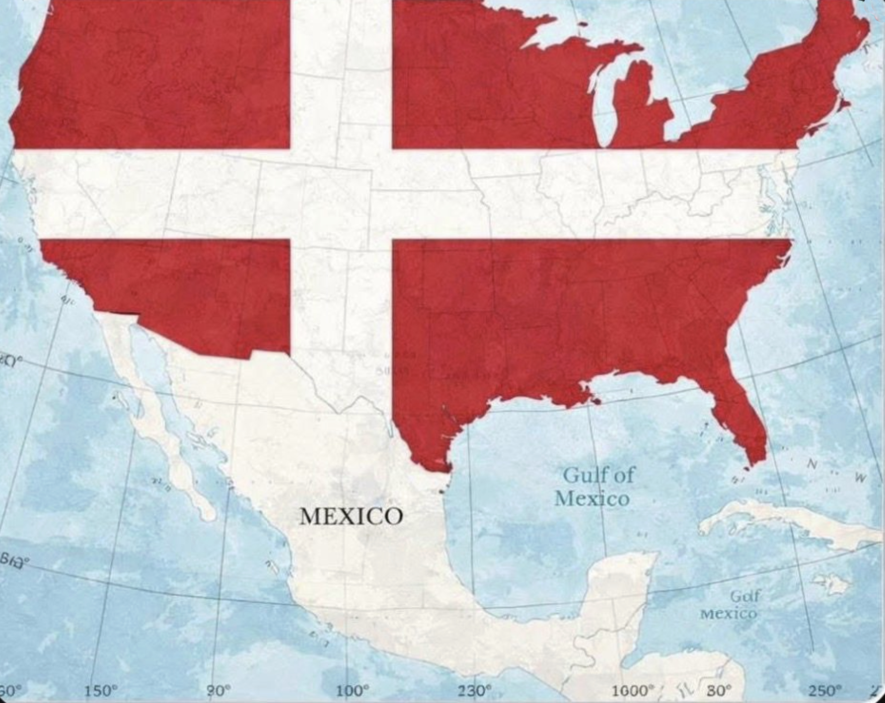
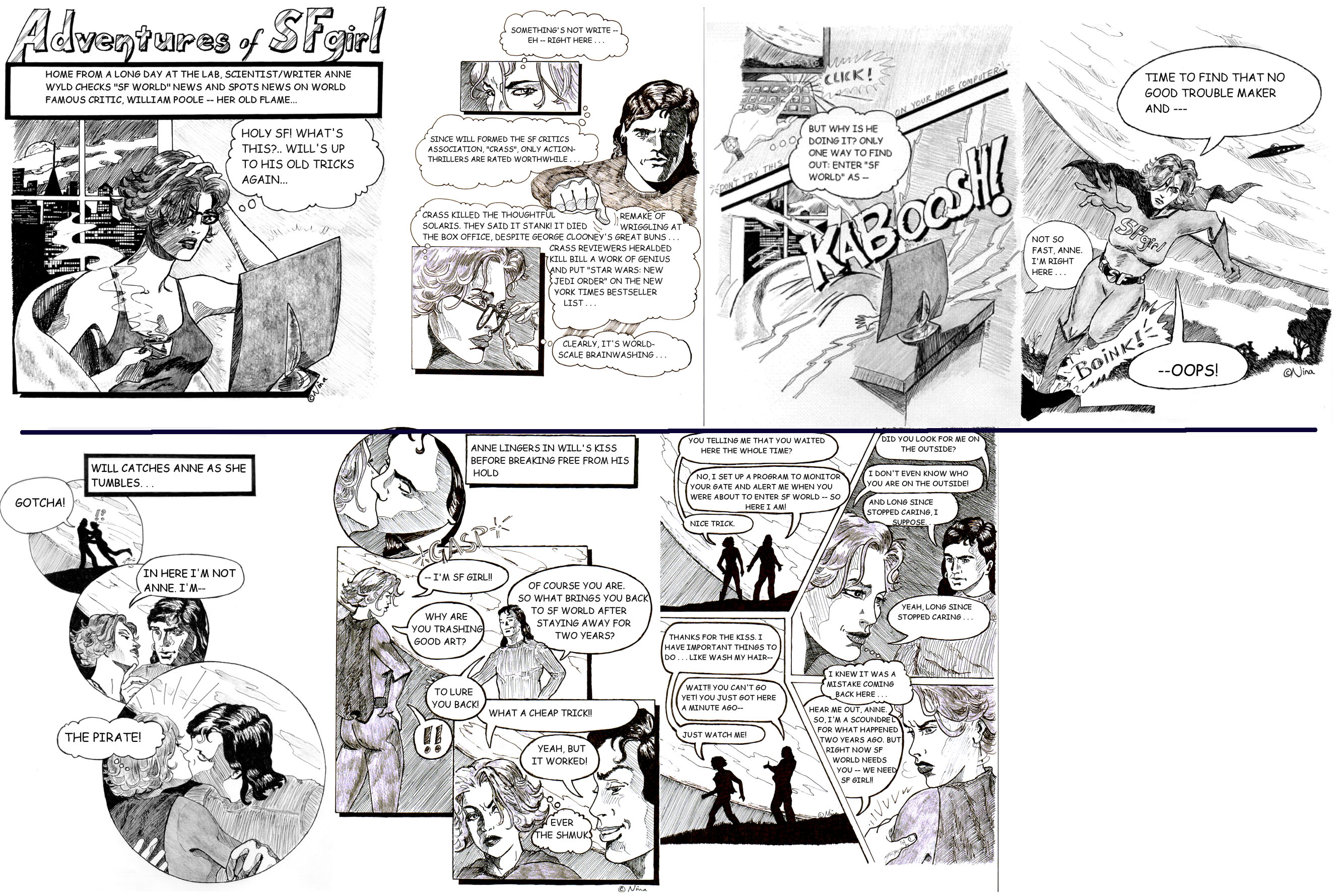
I recently came across a wonderful—though rather cheeky—proposition on LinkedIn by Christian Thalacker-Heldenstein (EU Climate Pact Ambassador) to the world—with particular relevance to the United States of America:
An Important Announcement from the Bicycling Kingdom of Denmark🇩🇰 Dear Friends, Colleagues, and Youth of Our Planet: In light of recent global events, and in the spirit of offering constructive solutions, the Bicycling Kingdom of Denmark proposes bold, compassionate, and frankly, hyggelig* action.
We are formally announcing our intention to annex the territory formerly known as the United States of America. Why? Because every human deserves clean water, trustworthy government, and happiness.
Our proposal is simple. Upon peaceful integration, all American residents will be offered:
>Seamless Path to Danish (and EU) Citizenship: No complicated paperwork. Just a pleasant 50km scenic bike ride and a short oral exam on proper bicycling hand signals. >$150/Month Universal Healthcare: Includes preventive care, mental well-being, and a complimentary handmade candle & wool blanket at every visit (HyggeCare™). >Scandinavian-Style Education: Forest Kindergartens, where iphone-screens are replaced with pinecones, and critical thinking is honed by building shelters from the rain. >Western Europe-Style Hate-free Speech & Governance: Council meetings are live-streamed with free wienerbrød. Hate-speech + Corruption-convictions leads to 100 hours of community kayak sessions.
Here’s the transformation in your daily livskvalitet (quality of life):
>Bicycle Infrastructure Everywhere: Heated bike lanes in winter, solar-powered path lights, and bridges that whisper encouraging proverbs as you cross. >Harbor Saunas & Year-Round Swimming: Every coastline and lake will be cleaned for swimming. >Michelin-Starred Street Food: We will match our global per-capita record. Say hello to gourmet smørrebrød food trucks. >Sensible Gun Education & Laws: As per Danish standards. All safety courses include “Conflict Resolution with Pastries.” >The “Ming” Mandate: A national policy fostering togetherness. Loneliness will be tackled with community chess.
We will phase in key changes:
Year 1: Car-free city centers, free city bike rollout, and mandatory fika (coffee break) at 3PM. Year 2: All waterways swimmable; polluters sentenced to 1000 hours of community kayaking. Year 3: Wind turbines installed nationwide, each painted by local artists.
This is not a conquest. It is an intervention. An offer of hygge, clean air, and civil society.
Your guns will be respectfully exchanged for a finely-tuned custom-made bicycle. Your stress will be swapped out. Your application for a better life is waiting at your nearest full-service bakery.
What interested me, besides the ingenious nature of the piece itself, was the varied response to its obvious satirical message. Most embraced the satire with creative pithy comments: “I for one welcome our new Danish overlords.” “I’m in! I may or may not already be part of an underground cell working on this…” “Great! … Make America original again!”
Said one Canadian: “If the US is taken over by Denmark, Canada will have a much more like-minded and friendly neighbour…and I won’t be afraid to cross the border to visit!” To which Thalacker-Heldenstein responded, “We need bigger red-&-white carpets.” Others fixed on the “conflict resolution with pastries” courses. Yet others offered their countries to be annexed—from the UK, France, Germany and Italy to New Zealand.
Others just didn’t get it. One American’s offended response seemed to validate the satire: “Silly Europeans, always trying to come up with solutions for what ails the United States…”
First generation Latino American, Richard M. Alva also didn’t buy that these offerings of “hygge, clean air, and civil society” would make Americans happy. In a sad thesis on the American psyche, he offered:
“‘If Americans had what Denmark has: free healthcare, free college, a year of maternity leave, five weeks of vacation, pensions, hygge, we’d suddenly be happy.’ I don’t buy it.
Those benefits only work if a culture knows how to receive them. Most Americans don’t. We’re too individualistic, too competitive, too quick to turn every gift into an advantage.
Free education requires humility, not entitlement. Paid maternity leave only matters if family actually outranks productivity. Paid vacation only works if people are willing to stop working without guilt. Universal healthcare assumes we see health as a shared good, not a competitive edge.
As a first-generation Latino ‘American,’ this feels obvious. Many of our cultures value family and rest even when money is tight. In the U.S., money quietly outranks everything.
Americans aren’t unhappy because they lack perks. They’re unhappy because they defend a rat race they secretly hate. Freedom without restraint doesn’t make you happy. It just makes you tired.”
.
.
Oh well … So much for hygge … I’d welcome a Danish-annexed United States of America as my southern neighbour; After all, I am a huge fan of cycling and trading a gun for a bike seems like a steal of a deal. I’m also not so much an apple pie fan—but give me a Honningkage and I’m yours!
.
Hygge (pronounced hyoo-guh): a quality of coziness and comfortable conviviality that engenders a feeling of contentment or well-being (regarded as a defining characteristic of Danish culture).
.
Nina Munteanu is an award-winning novelist and short story writer of eco-fiction, science fiction and fantasy. She also has three writing guides out: The Fiction Writer; The Journal Writer; and The Ecology of Writing and teaches fiction writing and technical writing at university and online. Check the Publications page on this site for a summary of what she has out there. Nina teaches writing at the University of Toronto and has been coaching fiction and non-fiction authors for over 20 years. You can find Nina’s short podcasts on writing on YouTube. Check out this site for more author advice from how to write a synopsis to finding your muse and the art and science of writing.
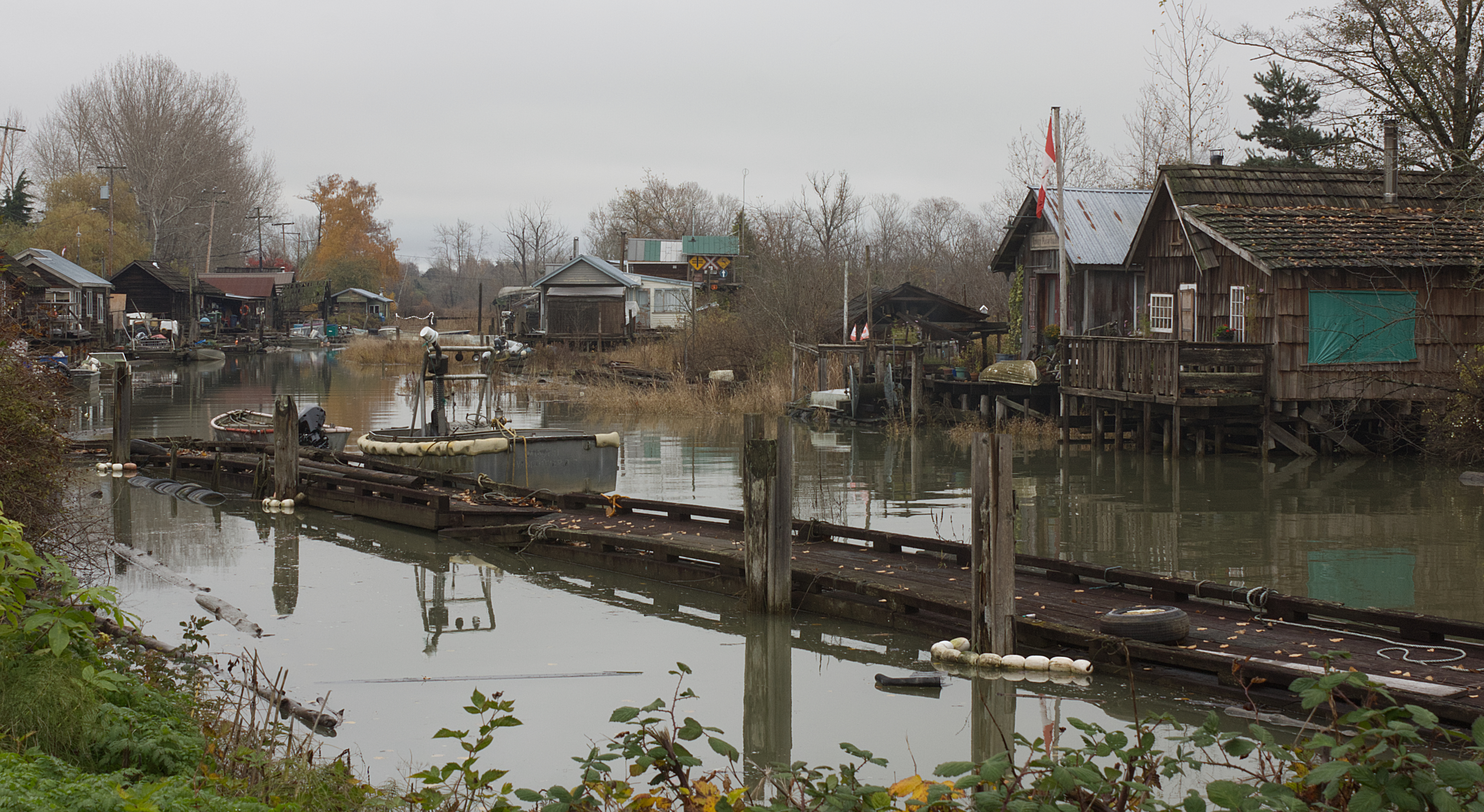
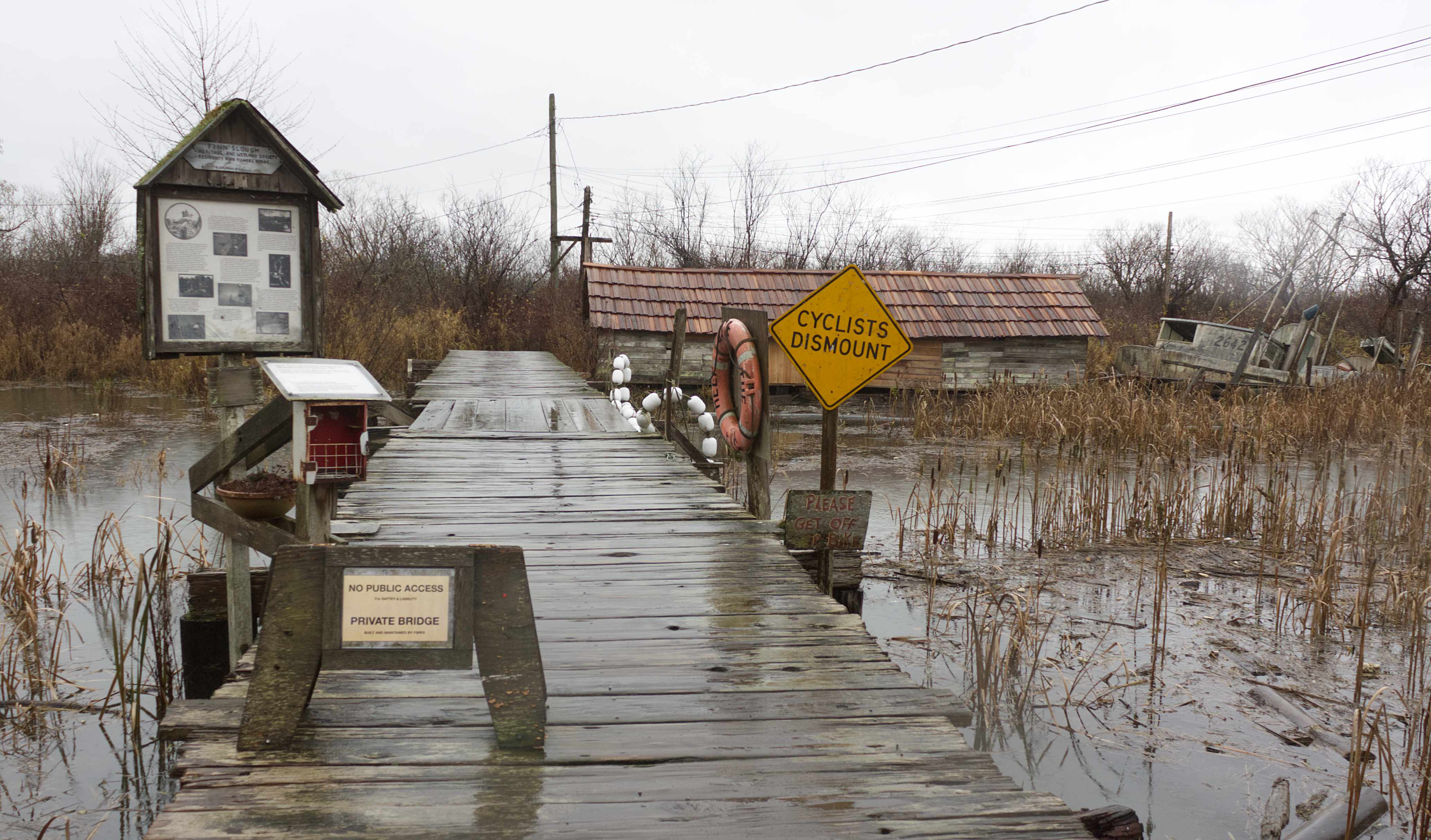
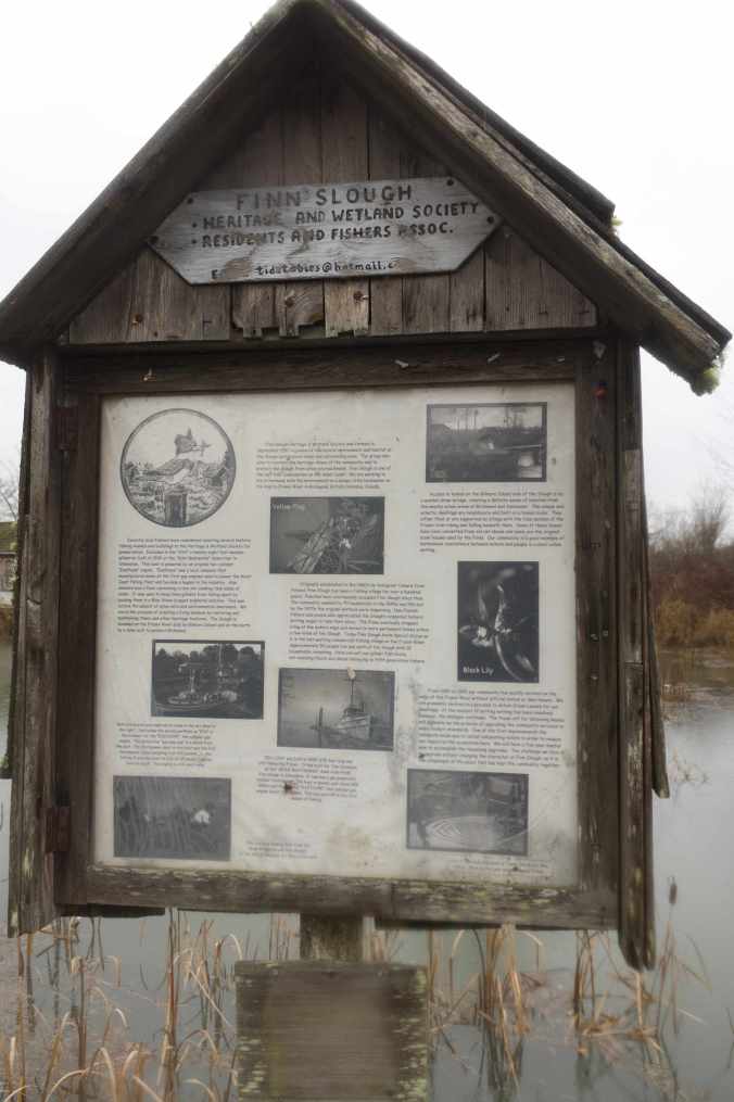
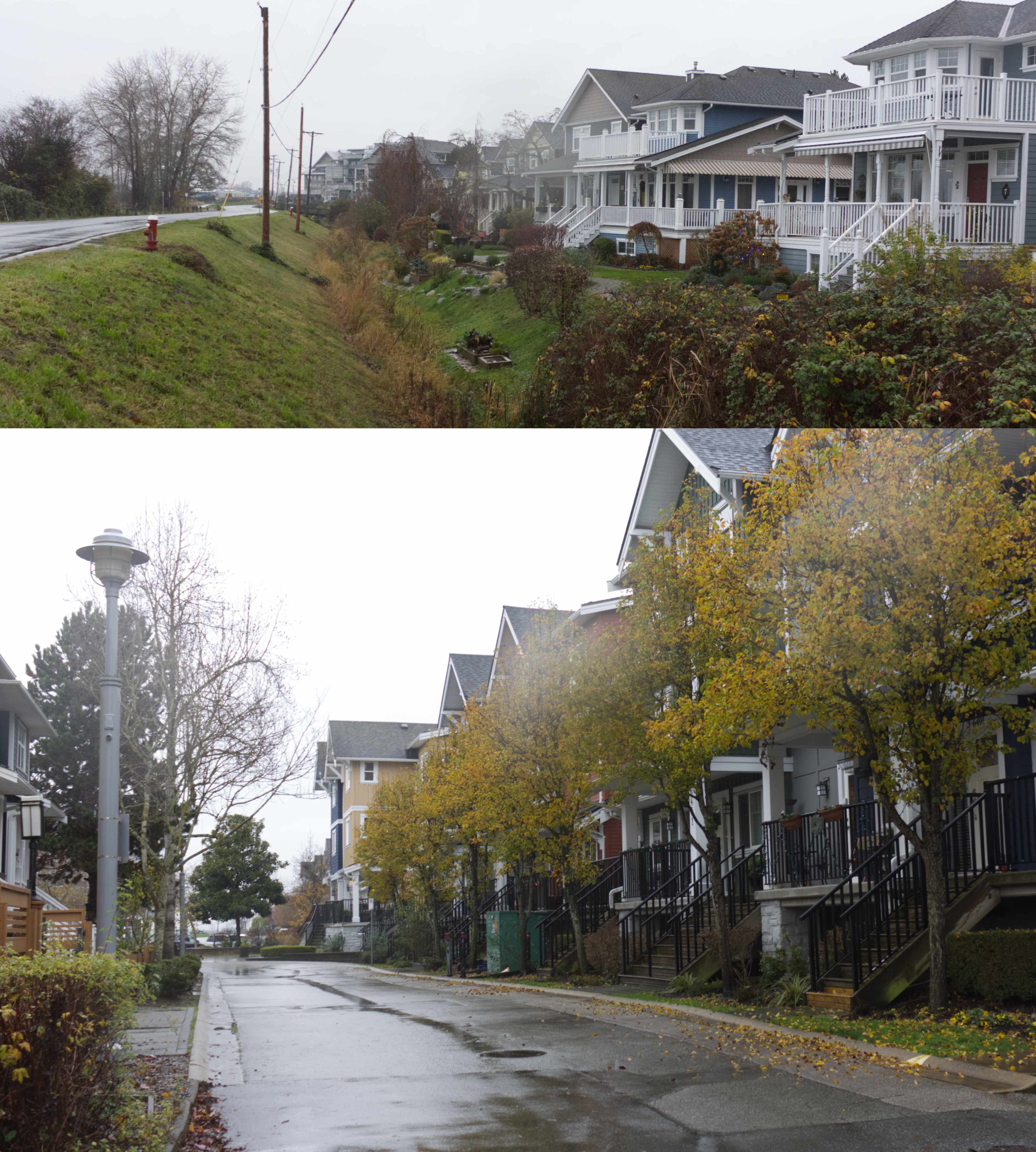
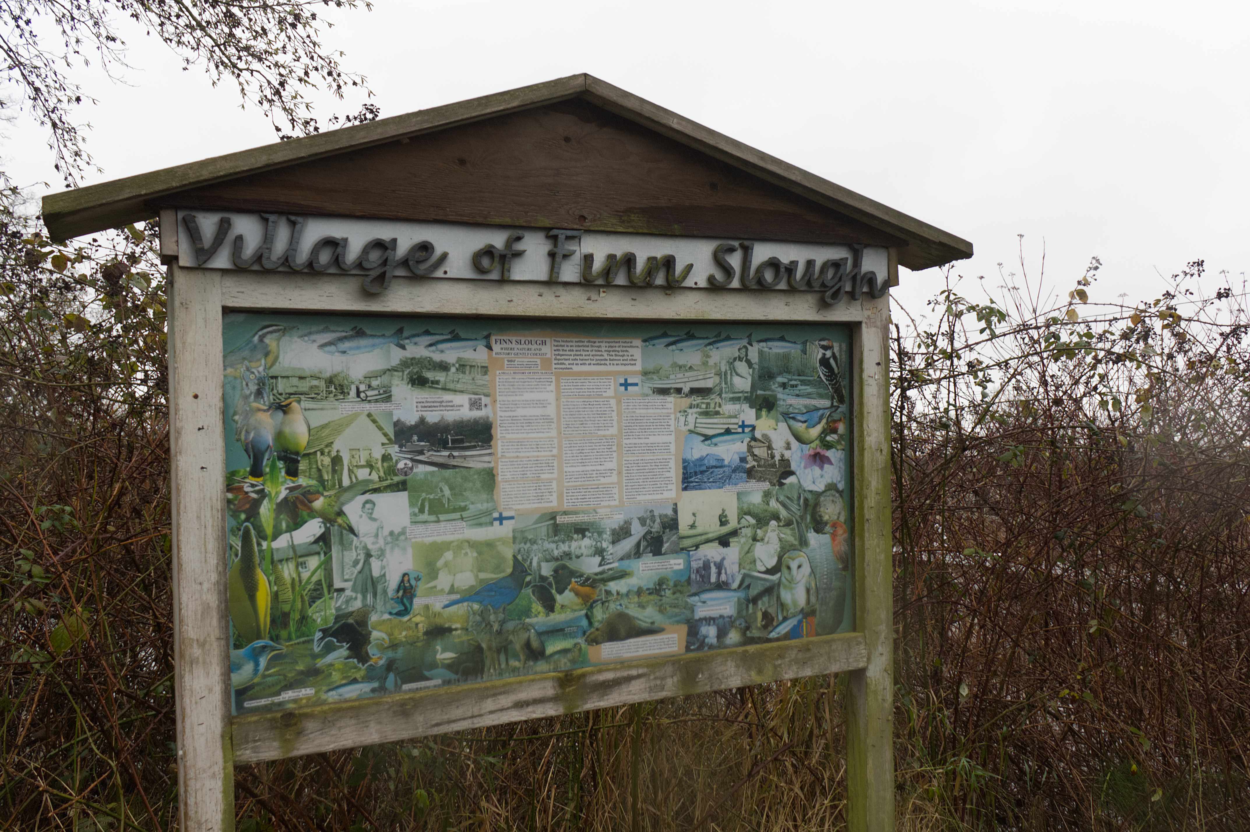
Not long ago, I went for a drive through the pastoral area of Lulu Island and ended up heading south along No. 4 Road in Steveston. As I wound my way toward Dyke Road, I found myself revisiting an old haunt from years ago: the little homesteader community—former Finnish fishing village—of Finn Slough. I remember first discovering this rather charming and eclectic settlement perched on stilted houses along the marsh of Finn Slough back in the 1980s when I briefly lived in Richmond. A sign by the bridge across the slough to Gilmour Island, where Number 4 Road meets Dyke Rd, provides a history of the Finnish community by Historian and Archivist David Dorrington who describes Finn Slough as a place “where nature and history gently coexist.”
.
Finn Slough bridge to Gilmour Island, BC (photo by Nina Munteanu)
.
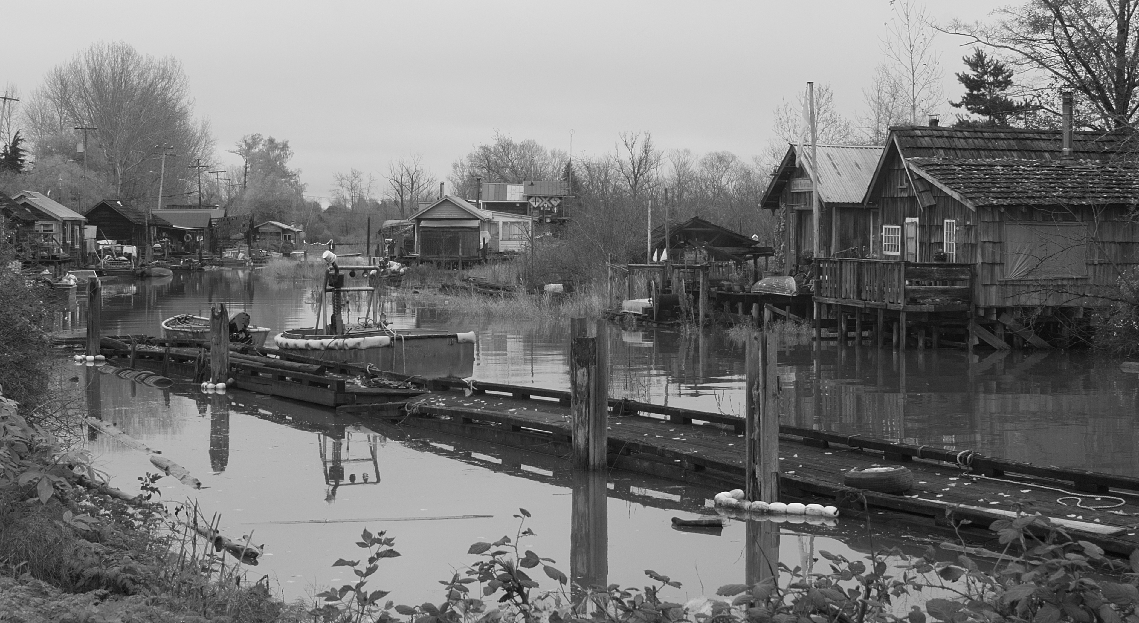
The area was settled in the late 1880s by immigrant Finnish fishermen and their families, seeking a new life from the poverty and repression of the Russian empire in Finland. They built their buildings on pilings to accommodate the changing tides. One of the first and most important buildings was a sauna. The fishing community also built bluestone tanks, used to clean their linen nets. They also had rack floats and net sheds. In those days—when downtown Richmond didn’t exist—it would take an entire day to go one way from Finn Slough to Vancouver (now a 30-minute drive). Steveston was pretty much only canneries. Once a week, says the sign, the Finnish community would dress up in their ‘best clothes’ and take several boats to Steveston, Ladner or New Westminster to buy the week’s supplies. And if the weather was good, they would have a picnic on one of the river islands and sing along with accordion music. The homesteader village established without property boundaries, city ordinances, provincial regulations or any governing body.
.
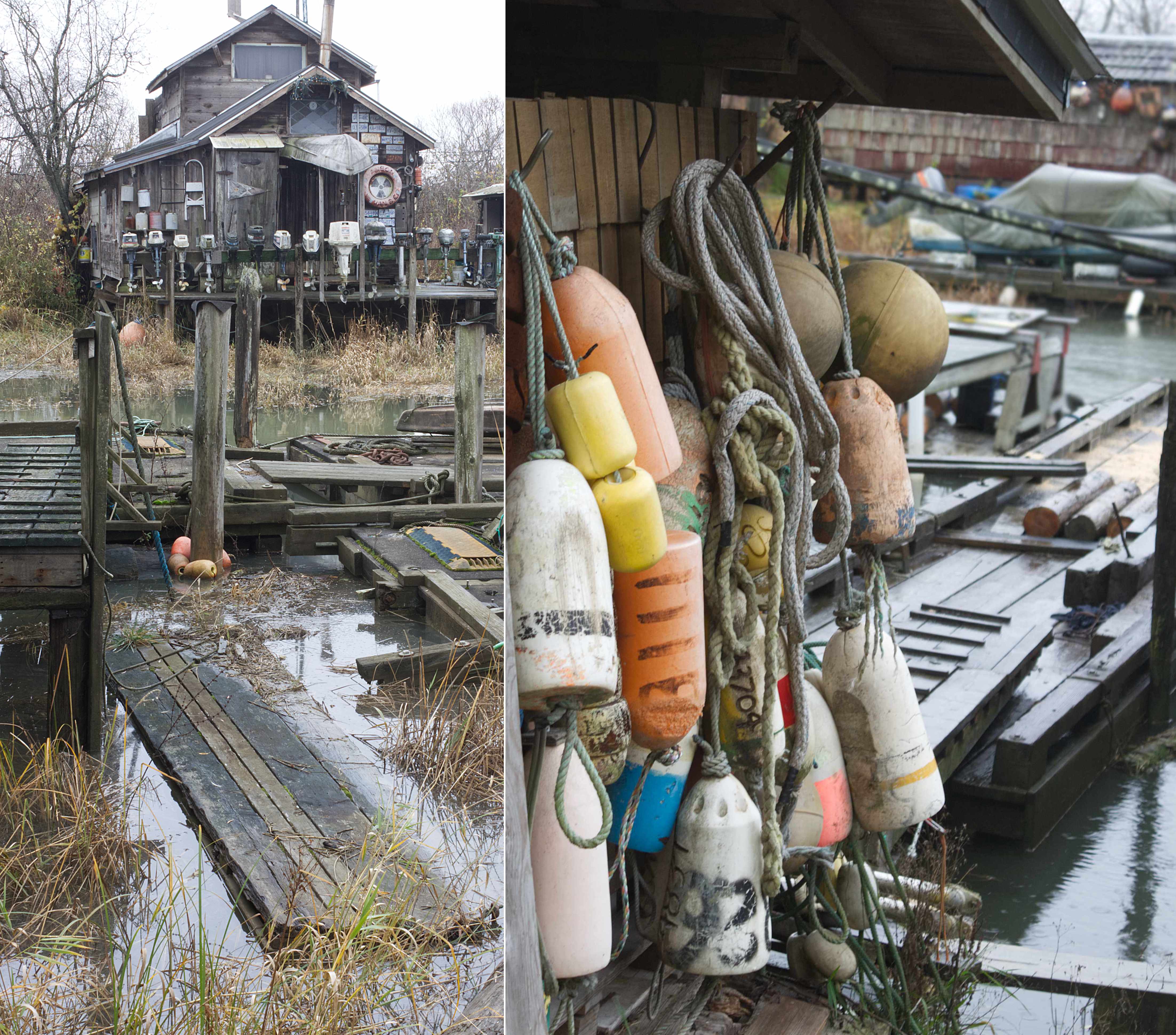
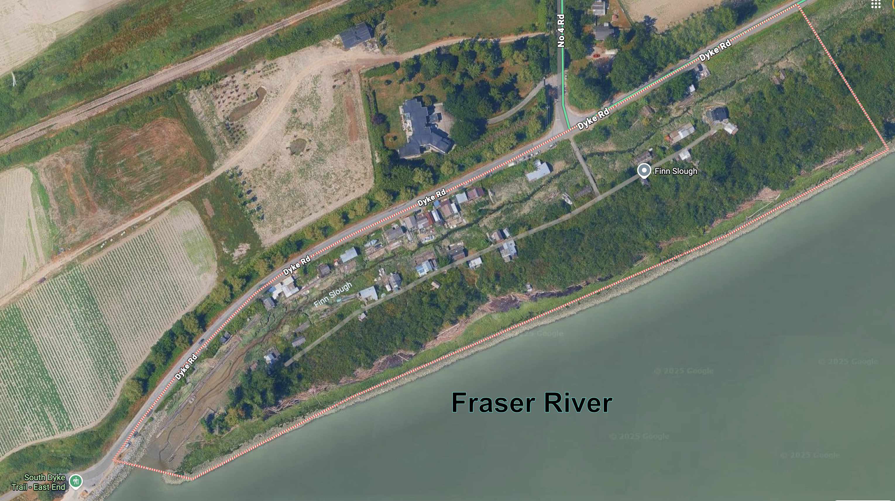
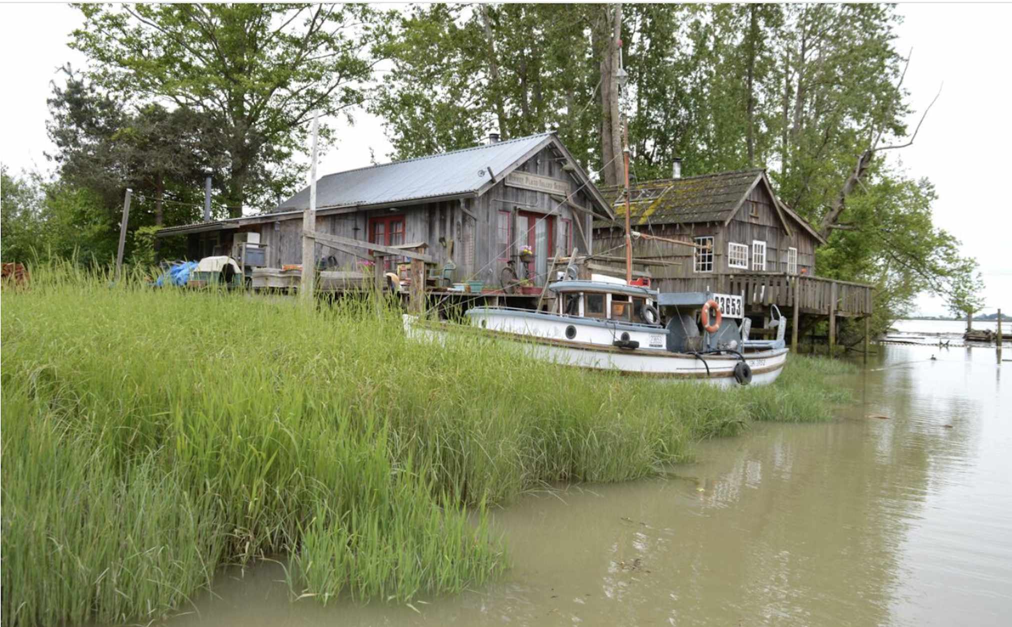
It was raining as I got out my camera to capture some of the eccentric houses on pilings, half-collapsed sheds, beached boats at low tide, old fishnet shacks with funky marine décor, scow houses with signs like “Don’t Mess with Nature”, and house boats floating with the tides. One stilted house featured an entrance way roof made by an inverted boat and a porch railing made of boat engines.
Finn Slough, BC (photo by Nina Munteanu)
.
Marine-decorated houses on pilings in Finn Slough, BC (photos by Nina Munteanu)
.
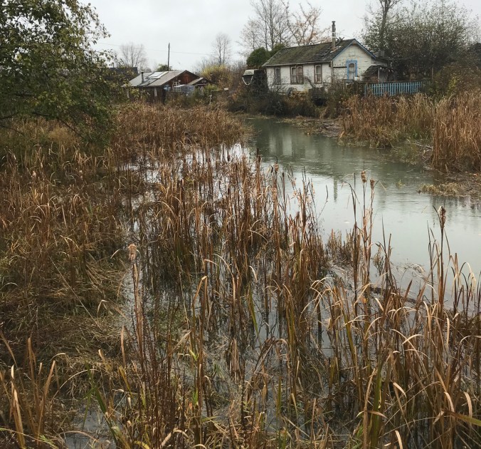
This settlement was built by Finnish fishermen over a hundred years ago. I had visions of people rowing their boats around the slough—to the various wharfs, boardwalks, houses on pilings, and shores. Fishing for various Pacific Salmon (Chinook, Coho, Pink and Sockeye), Steelhead, Lingcod, Halibut, and Sturgeon. I’m told that this relic fishing village was one of several fishing shantytowns scattered along the shores of the Fraser River. Around 70 households existed in Finn Slough in the ‘40s to ‘50s; 30 people live there now. Most, I’m told, are an eclectic mixture of artists, musicians, and actors. Dorrington writes: “This historic settler village and important natural habitat is an intertidal Slough—a place of transitions, with the ebb and flow of tides, migrating birds, indigenous plants and animals. This Slough is an important safe haven for juvenile Salmon and other wildlife, as with all wetlands, it is an important ecosystem.”
.
Aerial photo showing Finn Slough in relation to the Fraser River (image by Google)
.
Blogger Eve Lazarus contemplates the colourful history of this unique settlement that some call charming and others would describe as a chaotic decrepit mess of squatters in a drowning marsh: “the back-to-the-landers, the evil property developer from back east who wants to pave over the shanty town with condos and a park, and a few levels of government that would rather fill pot holes than be caught up in this drama. Ironically, it’s the red tape that seems to be the saviour in this story.”
I walked gingerly on the rickety wooden bridge that leads to several homes on Gilmour Island and stopped at the sign warning me that I was crossing at my own risk. I found myself thinking ‘who lives here? What kind of person chooses to stay here, in this uncertain environment where the direct effects of climate change relentlessly threaten?
I thought of this as I drove west along Dyke Road toward No. 2 Road and encountered the contrast of posh Steveston Waterfront Estate houses with safe river views from behind dykes.
Sign on history of Finn Slough, BC (photo by Nina Munteanu)
.
New riverview subdivision of townhomes in Steveston, BC (photos by Nina Munteanu)
.
Finn Slough & Climate Change
Finn Slough close to mouth to Fraser River (photo by Gordon Katic, CBC)
.
Gordon Katic of CBC tells us that Finn Slough lies on the front lines of climate change. “Nestled on the banks of the Fraser River, this community will eventually be overcome by flooding as sea levels rise.” I’m not surprised; the slough community lies on the edge of a saltwater marsh. Coastal erosion from increased tanker traffic in the Fraser River has also increased, impacting the marsh’s ability to act as a buffer for wave action.
As climate-change increases the frequency and severity of flooding and coastal storm surges, BC municipalities are preparing for the sea level to rise by half a meter by the year 2050. Actions include investment in protective dikes. But Finn Slough’s homesteader community sits outside the dike system. Several homes have already flooded from seasonal high tides. Even the boardwalks that connected the homes flooded, leaving people stranded. Tamsin Lyle, engineer with Ebbwater Consulting says bleakly, “It’s not a good news story. Probably 60-70 years from now, this entire piece of land is going to be underwater every single day.”
Meantime, the community is finding ways to cope with the rise. One is simply to raise the houses currently on stilts. Gus Jacobson, community elder of Finn Slough, told the CBC that over his lifetime living there, the water has risen at least 18 inches. Jacobson is helping others in the community to raise their houses, docks, boardwalks and bridge. According to Jacobson, Finn Slough’s motto is “sisu”, a Finnish word that roughly translates to “stubborn perseverance.” The sign in front of the bridge defines “sisu” as Finnish for: endurance, resilience, tenacity, determination, perseverance and strength of will.
.
Finn Slough village sign on Dyke Road, Steveston, BC (photo by Nina Munteanu)
.
Stephen Sheppard, professor of landscape planning at the University of British Columbia, noted that the best option is a managed retreat: “Managed retreat refers to a strategy where over time the community or infrastructure that is at risk to sea level rise would get pulled back—literally removed—or in essence, relocated, or they might relocate themselves.”
.
Finn Slough is one of the last tidal communities on the West Coast and the last working commercial fishing village on the Fraser River. For over a hundred years this community has existed without official status or land tenure.
.
Charmed or doomed by climate change? Will the community adapt and prevail or exodus in the frustration and defeat of a ‘managed retreat’? Lyle gave CBC her prognosis: “I suspect that Finn Slough is going to be our canary in the region [Lulu Island].”
.
Finn Slough, BC (photo by Nina Munteanu)
.
References:
Dorrington, David. “Finn Slough: where nature and history gently coexist,” sign located at Dyke Rd. at end of No. 4 Rd.
Katic, Gordon. 2017. “As a BC fishing village is slowly submerged, meet the people who refuse to leave.” CBC Radio, October 2. 2017
Lazarus, Eva. 2013. “Steveston’s Finn Slough.” Eve Lazarus Blog, September, 2013.
.
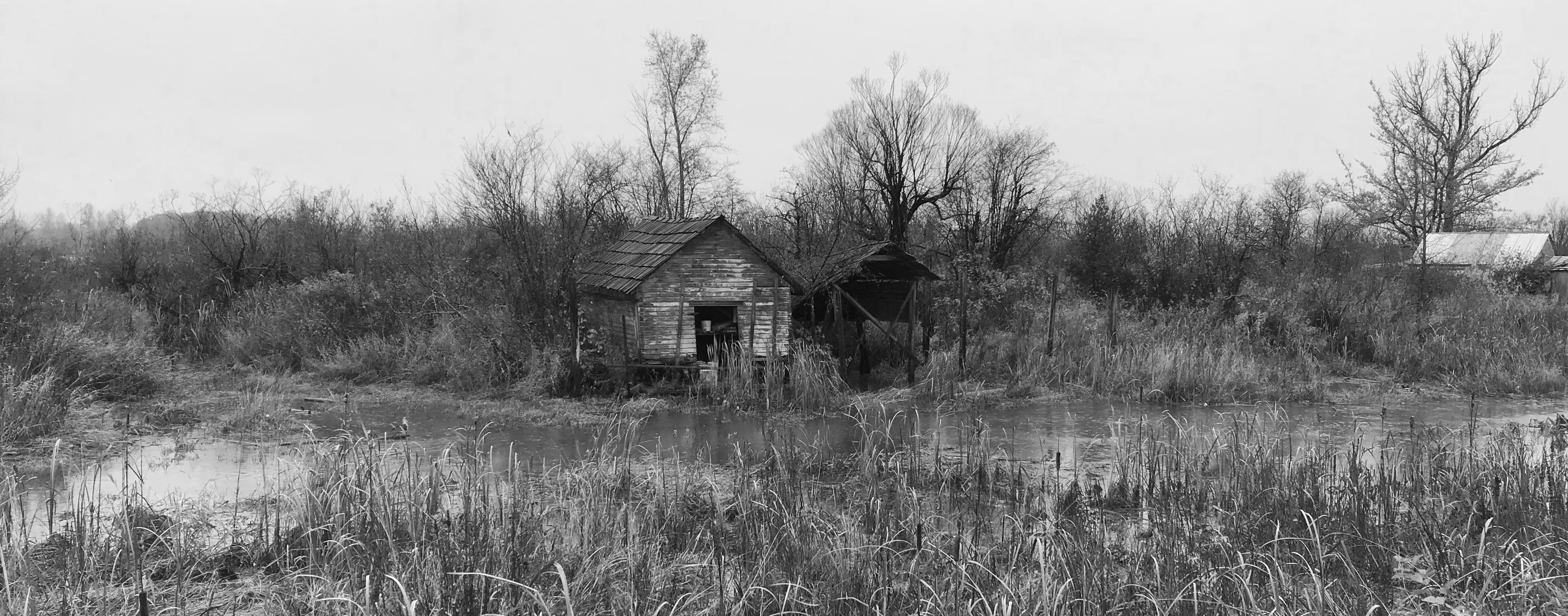
Finn Slough old shed, BC (photo by Nina Munteanu)
.
Nina Munteanu is an award-winning novelist and short story writer of eco-fiction, science fiction and fantasy. She also has three writing guides out: The Fiction Writer; The Journal Writer; and The Ecology of Writing and teaches fiction writing and technical writing at university and online. Check the Publications page on this site for a summary of what she has out there. Nina teaches writing at the University of Toronto and has been coaching fiction and non-fiction authors for over 20 years. You can find Nina’s short podcasts on writing on YouTube. Check out this site for more author advice from how to write a synopsis to finding your muse and the art and science of writing.
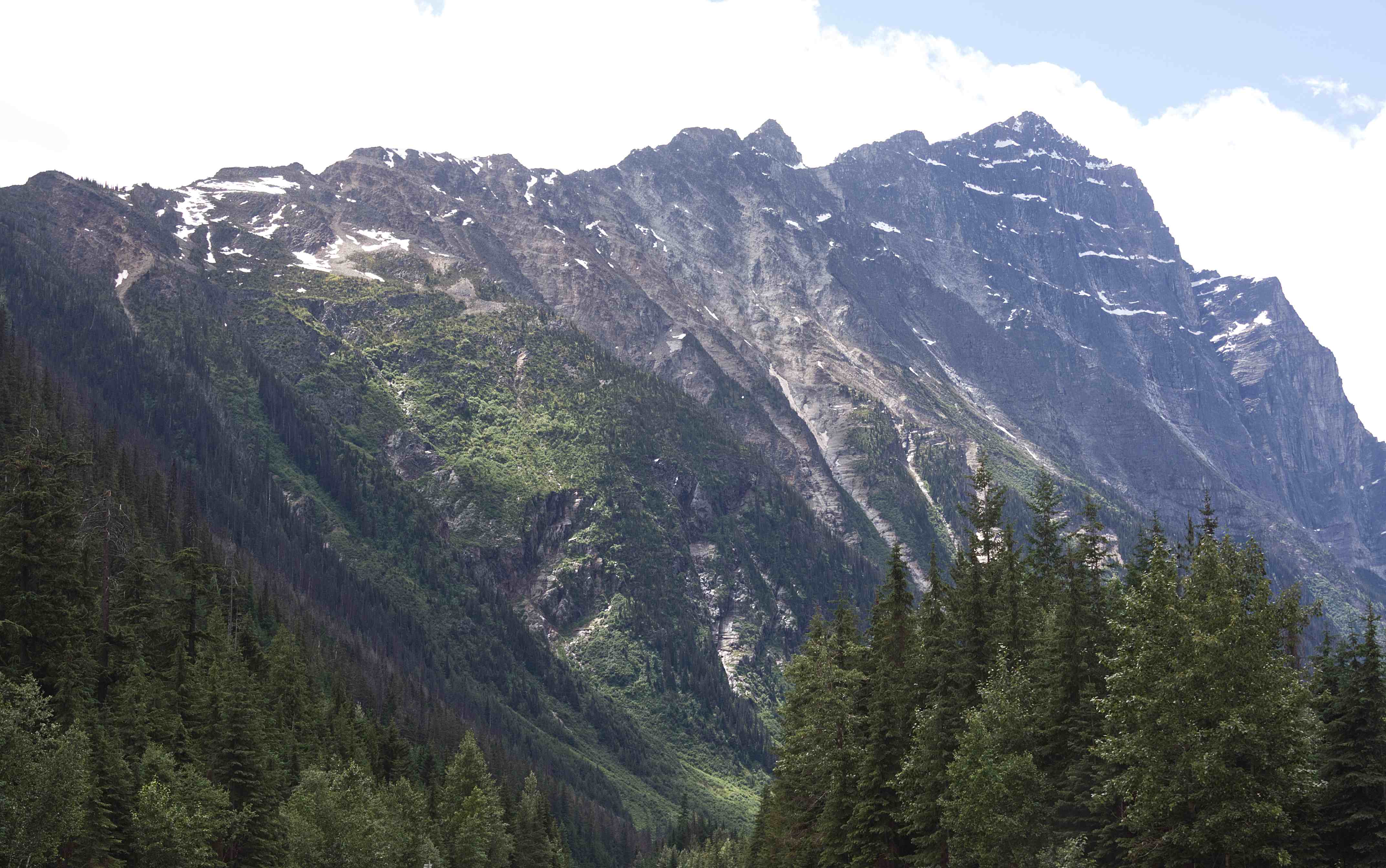
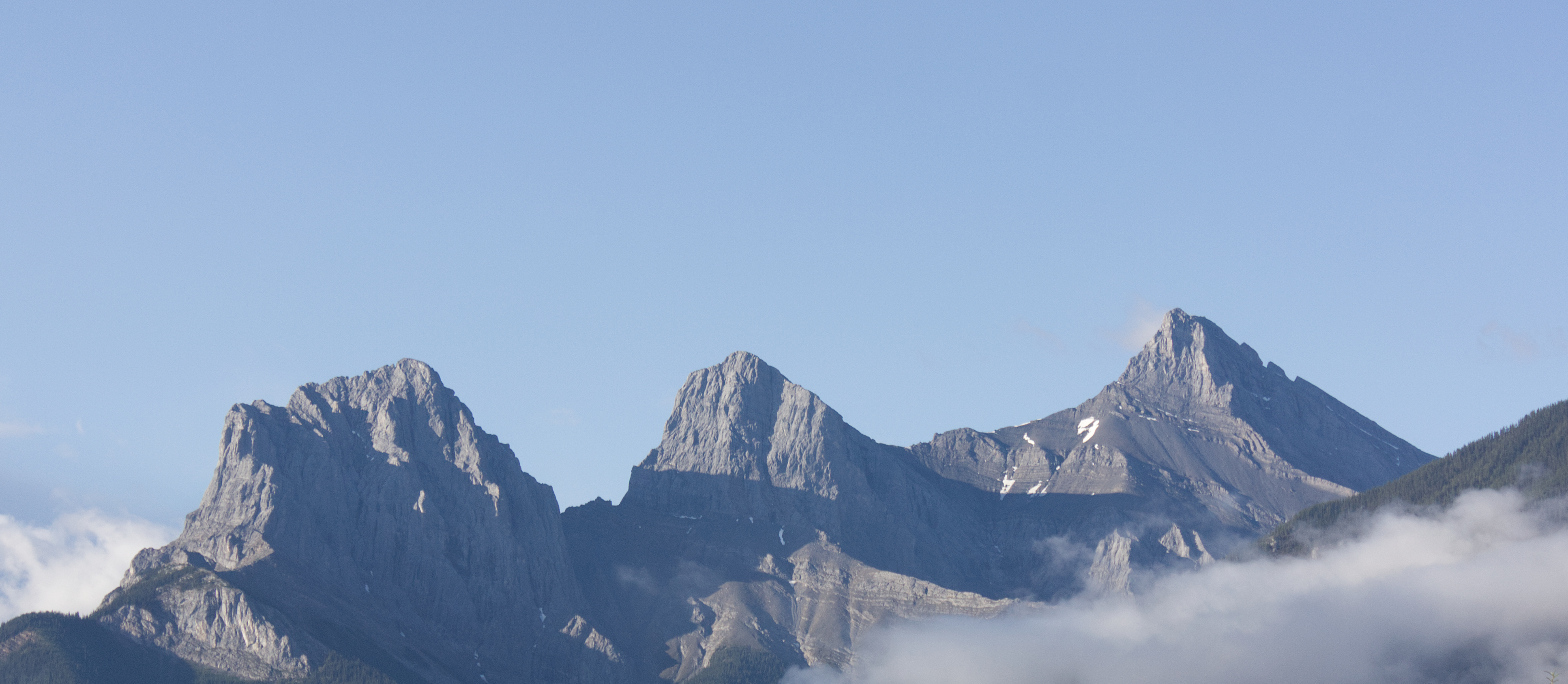
From the rolling Prairies I ascended up the foothills of the Rocky Mountains in Alberta. As I neared the mountains, they seemed to cut the sky with jagged peaks of steely grey. Rugged and unabashedly wild, they teased my spirits into flight.
Rocky Mountains, Alberta (photo by Nina Munteanu)
Canadian Rockies, AB (photo by Nina Munteanu)
.
The Rockies are such a wonder! I found myself thinking—well, wishing—that I had a geologist sitting in the passenger seat (instead of my companions Toulouse, Mouse and a car full of plants), telling me all about these stately mountains and their formations. All that folding, thrusting, scraping and eroding! So fascinating!
.
Rockies west of Banff, AB (photo by Nina Munteanu)
.
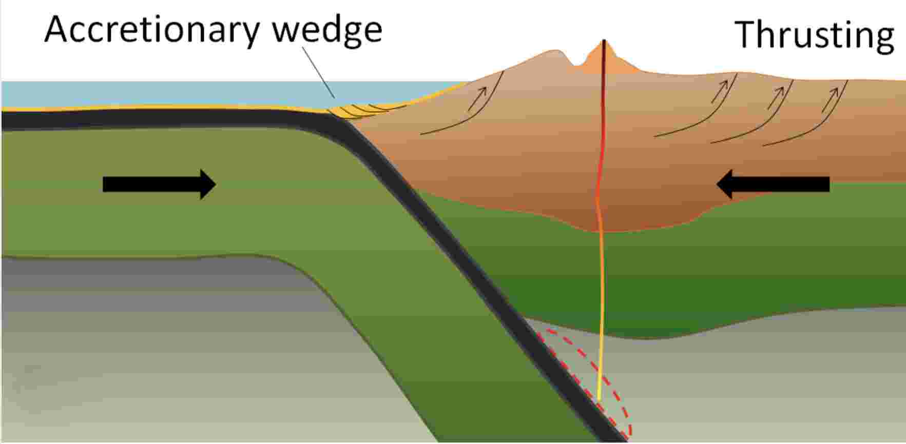
I did some research into The Canadian Rocky Mountains and discovered that they were formed through a combination of subduction and thrust faulting with an oceanic plate subducting beneath the North American plate.
.
Sketch showing subduction of ocean plate beneath the North American plate with accompanying accretionary wedge and thrusting action (image by Earle and Panchuk)
.
The Canadian Rocky Mountains were originally part of an ancient shallow sea half a billion years ago and formed from pieces of continental crust over a billion years old during an intense period of plate tectonic activity. Their jagged peaks of mostly sedimentary limestone (originally part of the continental shelf) and shale (originally part of the deeper ocean waters) belonged to an ancient sea floor; during the Paleozoic Era (~5-2 hundred million years ago), western North America lay beneath a shallow sea, depositing kilometers of limestone and dolomite.
.
Rocky Mountains near Canmore, AB (photo by Nina Munteanu)
.
The current Canadian Rocky Mountains were raised by the Cordilleran Orogeny, a process of mountain-building when tectonic plates started colliding ~ 200 million years ago during much of the Mesozoic Era, which extends over 187 million years from the beginning of the Triassic (252 Ma) to the end of the Cretaceous (65 Ma). This era, I’m told, was a particularly important period for the geology of western Canada. During the plate and land mass collisions, ancient seabed layers were scraped, folded and thrust upwards (through a process called thrust faulting). As plates converged, entire sheets of sedimentary rock were slowly pushed on top of other sheets, creating a situation where older rocks lie on top of younger ones.
.
Castle Mountain overlooks the Bow River, Canadian Rockies, AB (photo by Nina Munteanu)
.
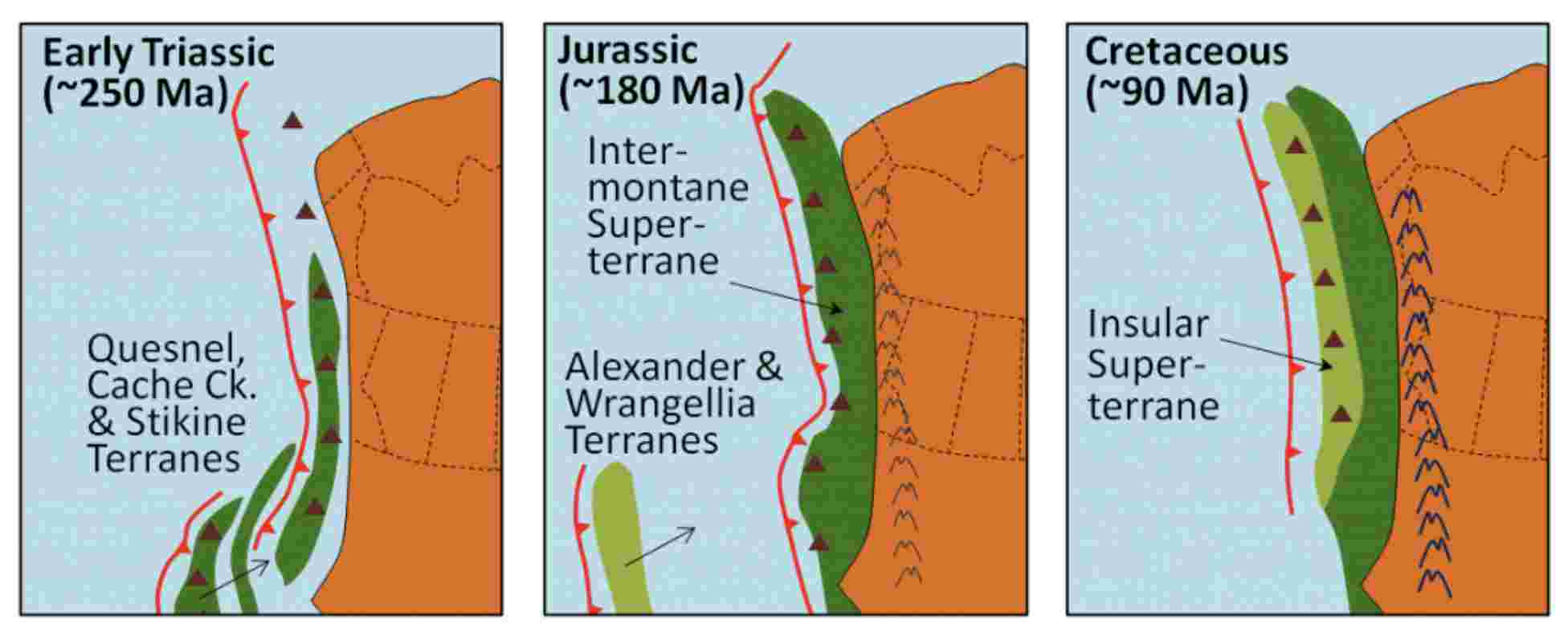
According to Earle and Panchuk, several continental collisions occurred along the west coast over the Mesozoic, resulting in the formation of the Rocky Mountains and the accretion (addition) of much of British Columbia’s land mass. Starting in the early Triassic (~250 Ma) through to the Cretaceous Period (~90 Ma), continued subduction sent several continental terranes (land masses) colliding into and accreting to the western edge of North America. The Quesnel, Cache Creek, and Stikine Terranes formed the Intermontane Superterrane, which now forms BC’s interior plateau between the Rockies and the Coast Range. A hundred million years later, during the Jurassic Period, a pair of terranes—Alexander and Wrangellia—collided with the west coast to form most of Vancouver Island and Haida Gwaii as well as part of Alaska. During the Cenozoic Era, more terranes accreted with the western edge of North America.
.
Model of the accretion of the Superterranes to the west coast of North America during the Mesozoic Era; red toothed lines=subduction zones; dark red triangles=volcanoes (images by Earle and Panchuk, 2019)
.
In the Jurassic Period, the Intermontane Superterrane acted like a giant bulldozer, pushing, folding, and thrusting the existing Proterozoic and Paleozoic west coast sediments eastward and upward to form the Rocky Mountains. The same process continued into the Cretaceous as the Insular Superterrane collided with North America and pushed the Intermontane Superterrane farther east.
.
Cross-section of the accretion of the Intermontane Superterrane to the west coast of North America in Jurassic and early Cretaceous, with resulting compression folding and thrusting of sedimentary rocks. Late Cretaceous Insular Superterrane further pushed against the Intermontane Superterrane to create massive folding and thrusting (image from Earle and Panchuk, 2019)
.
Canadian geologist/author Ben Gadd explains the Canadian Rocky Mountain building through the metaphor of a rug being pushed on a hardwood floor: the rug bunches up and forms wrinkles (mountains). In Canada, the subduction (downward movement) of an oceanic tectonic plate and the terranes (slabs of land) smashing into the continent are the feet pushing the rug, the ancestral rocks are the rug, and the Canadian Shield in the middle of the continent is the hardwood floor. The Rockies, writes Gadd, were like Tibet: a high plateau, 6,000 metres above sea level. Then, in the last 60 million years, glaciers—creeping forward at 50 feet per year—stripped away the high rocks, revealing the ancestral rocks beneath and carving out steep U-shaped valleys to form the current landscape of the Rockies: jagged peaks of soft sedimentary limestone and shale overlooking steep gorges and valleys. You can watch an excellent video of the 200-million-year formation of the Rocky Mountains by Spark.
.
Castle Mountain, Canadian Rockies, AB (photo by Nina Munteanu)
Rockies west of Lake Louise, Alberta (photo by Nina Munteanu)
.
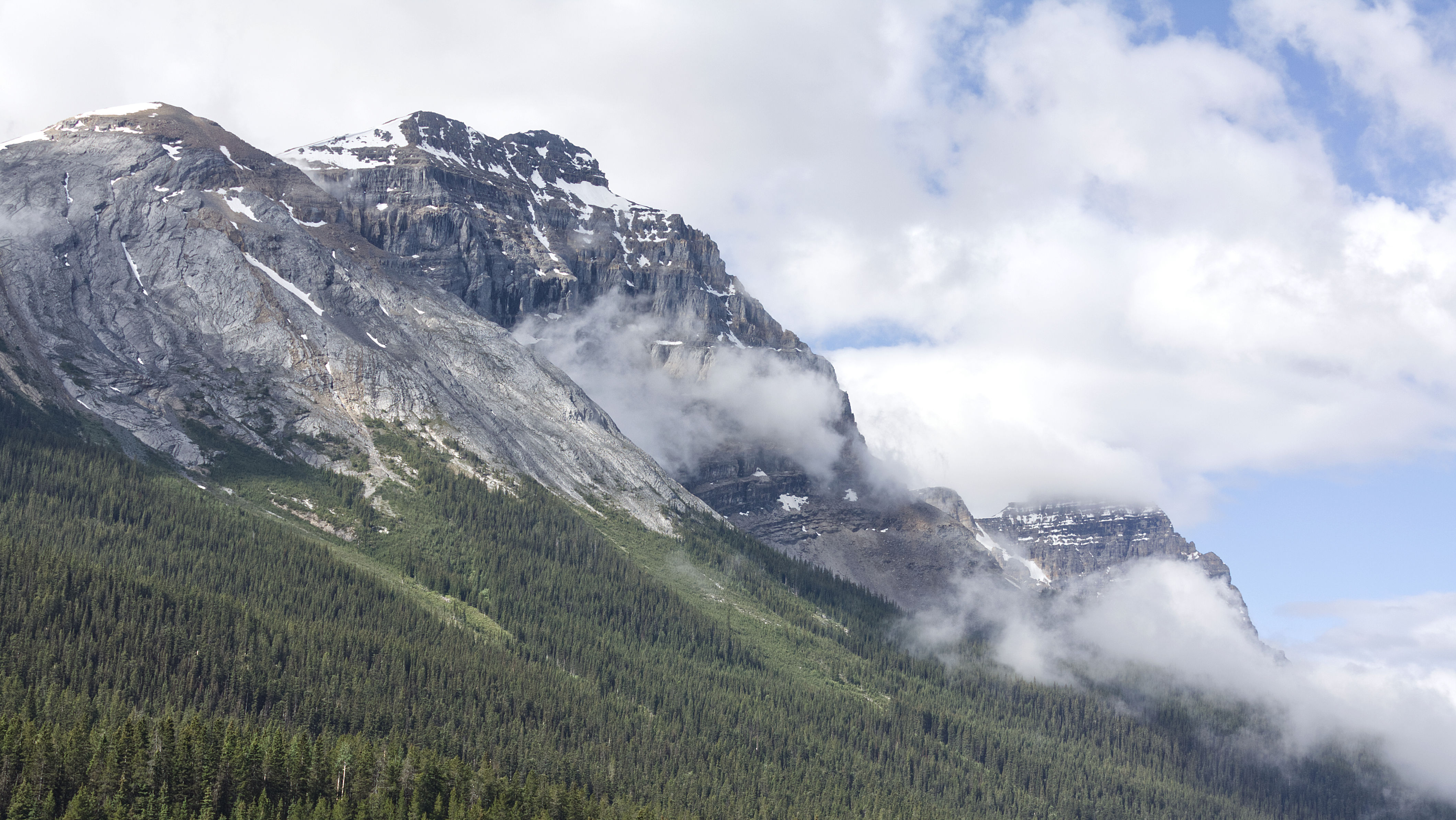
When I stopped in Canmore, Alberta, for the night, I found all the hotels solidly booked, except for a few very expensive rooms in high end hotels. It was the weekend of the Calgary Stampede and the crowds had spilled out this far, I was told. I also acknowledged that I was plum in the middle of tourist season too. But I was dead tired and it would be dark soon; so, I bit the bullet and booked an expensive room in an expensive hotel. I recalled that I was repeating my mother’s trip across Canada to settle in Victoria many years ago; she’d also driven through here in her old Datsun, brim with plants, like my Benny, and stopped in Canmore for the night. Only, she found very reasonable accommodations when she came through over four decades ago. Canmore is located in the front ranges of the Rockies, with a wonderful view of the Three Sisters and Ha Ling Peak from my hotel room.
.
The Three Sisters, Canmore, AB (photo by Nina Munteanu)
.
Temple Mountain, west of Lake Louise, Alberta (photo by NIna Munteanu)
.
I gave Banff and Lake Louise a miss and opted for a breakfast at some remote viewpoint after crossing the border into British Columbia. As I ate my cereal from the tailgate of my car, I felt a strange but lovely warm joy spread through me like a deep soothing balm.
I was home…
.
Faeder Lake, Yoho National Park, BC (photo by Nina Munteanu)
.
I stopped at Faeder Lake, on the western side of Yoho National Park, with a view of the Ottertail Range and Mount Vaux. Faeder Lake’s clear tourquise water—a result of fine particles of rock dust called glacial flour—enticed me for a swim.
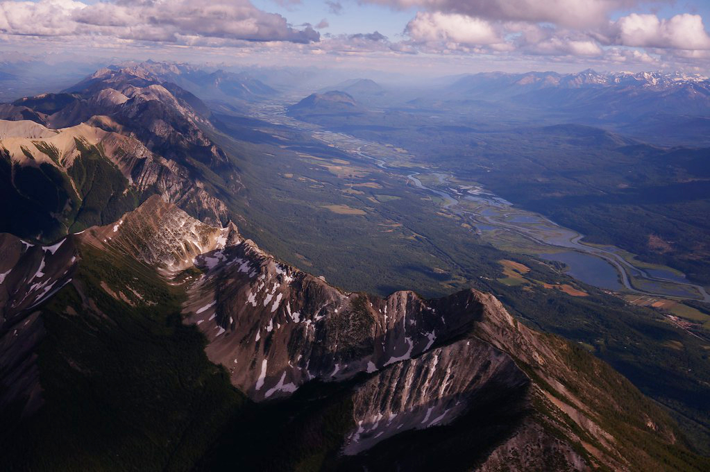
I stopped briefly for lunch in Golden in the Rocky Mountain Trench. The Rocky Mountain Trench is a long and deep valley walled by sedimentary, volcanic and igneous rock that extends some 1,500 km north south, spanning from Montana through British Columbia. The Trench is sometimes referred to as the “Valley of a Thousand Peaks” because of the towering mountain ranges on either side: the Rocky Mountains to the east and the Columbia, Omineca and Cassiar mountains to the west.
.
Rocky Mountain Trench near Golden, BC
.
The Trench is a large fault—a crack in the Earth’s crust—and bordered along much of its length by smaller faults. Major structural features resulted from the shifting and thrusting of tectonic plates of the crust during the early Cenozoic Era (65 million years ago) during mountain formation discussed above. The ridges of fractured crust pulled apart and the land in between dropped, creating the floor of the Trench. Major rivers that flow through the trench include the Fraser, Liard, Peace and Columbia rivers.
.
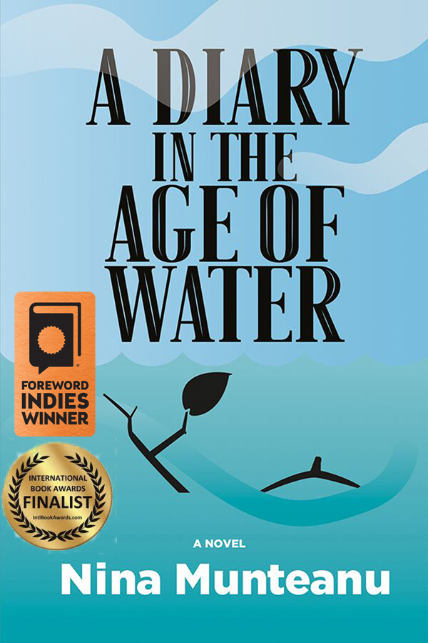
The Rocky Mountain Trench features in two of my books: A Diary in the Age of Water (Inanna Publications) and upcoming novel Thalweg. In both novels, which take place in the near future, the trench has been flooded to create a giant inland sea to serve as water reservoir and hydropower to the USA. You can read an excerpt in my article “A Diary in the Age of Water: The Rocky Mountain Trench Inland Sea.” The article also talks about the original 1960s NAWAPA plan by Parsons Engineering to flood the trench to service dry sections of the US by diverting and storing massive amounts of Canadian water. Proponents are still talking about it!
.
Mount Macdonald, Rogers Pass, BC (photo by Nina Munteanu)
.
I entered Glacier National Park, driving through several snow & avalanche sheds at Rogers Pass, in the heart of the Selkirk Range of the Columbia Mountains. This part of the drive was spectacular as mountains towered close and steep above me like sky scrapers, fanning out as the bright green vegetation crept resolutely up their scree slopes.
.
Selkirk Mountains and Mount Macdonald in Roger’s Pass; Google location (image by Google Maps)
.
Selkirk Range at Rogers Pass, BC (photos by Nina Munteanu)
The highway followed the Illecillewaet River as it wound southwest to Arrow Lake from it’s the glaciers east. I soon reached Revelstoke National Park and stopped at the Giant Cedars Boardwalk Trail, located about 30 km east of Revelstoke, between the Monashee Mountains, west, and the Selkirk Range, east.
.
Boardwalk through ferns, devils club and giant cedars, Giant Cedar Boardwalk, Revelstoke National Park, BC (photo by Nina Munteanu)
.
The Giant Cedars Boardwalk Park is a rare inland temperate rainforest ecosystem, receiving significant precipitation from Pacific weather systems that rise over the Columbia Mountains and dump here. It is a lush and humid old-growth forest with rich diversity of plant and animal life that resembles a coastal rainforest. Dominated by Western Red Cedars and Western Hemlocks—with some Douglas fir, paper birch and Bigleaf maple—the forest floor is a rich understory of salal, devil’s club, several berry shrubs and a diversity of ferns—oak fern, sword fern, and licorice fern. All was covered with a dense carpet of mosses, lichens, liverworts and fungi.
.
Above: moss-covered Red Cedar; Below: Devil’s club; Giant Cedar Boardwalk Trail, Revelstoke National Park, BC (photos by Nina Munteanu)
.
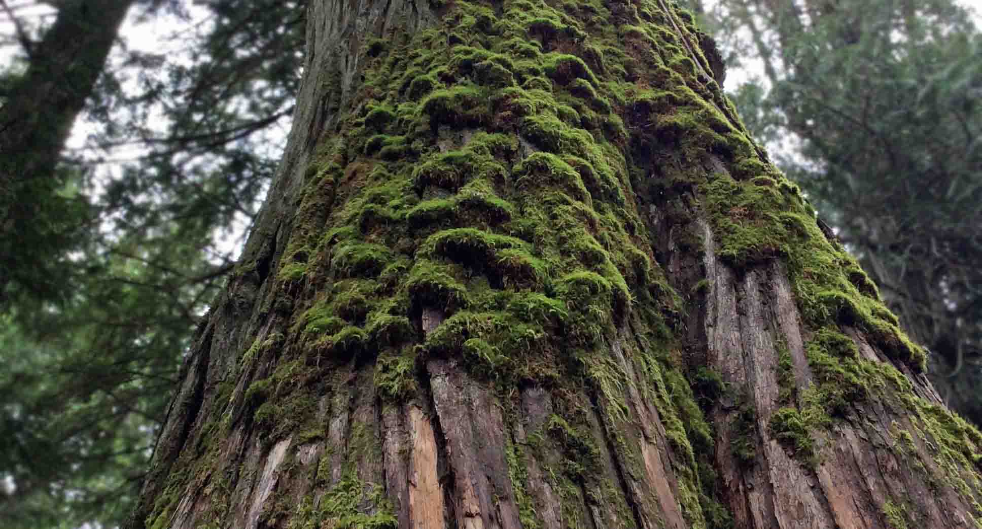
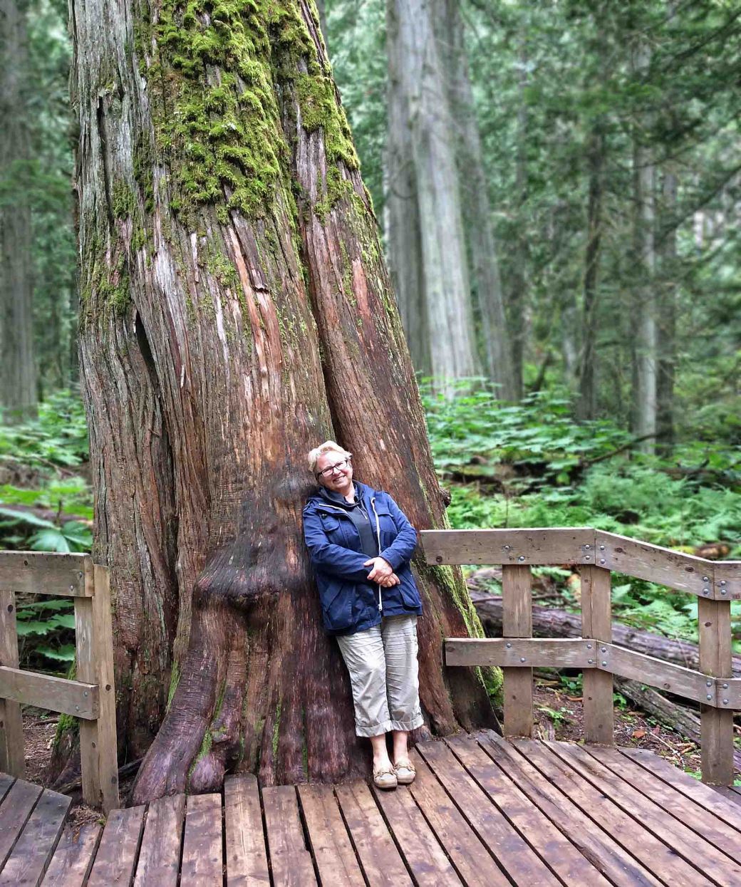
I followed the boardwalk through a cathedral of towering trees, among ancient cedars, whose fibrous, thick trunks loomed high to pierce the sky. Some are over 500 years old. I found that one large cedar trunk beside the boardwalk was ‘smooth from loving’ as I leaned against it and stroked its bark, no longer fibrous but burnished smooth and shiny.
.
Nina leans against a giant red cedar, fibrous bark smoothed from copious stroking of hands, Giant Cedar Boardwalk Park, BC (photo by Anne Voute)
.
I reached Revelstoke just after 6 pm and, to celebrate, I booked a room at the Regent Hotel. After a walk through the ski resort town, alive with young tourists, I returned to the hotel restaurant, I treated myself to a celebratory salmon dinner with garlic mashed potatoes and mixed veggies. I even I had a dessert—Tiramisu with a cup of tea—and went to bed sated, happy and tired. As soon as my head hit the pillow, I was in dreamland.
.
Revelstoke and the Regent Hotel; my celebratory meal there (photos by Nina Munteanu)
.
Chaparral near Merritt, BC (photo by Nina Munteanu)
Two types of sage brush near Merritt, BC (photo by Nina Munteanu)
.
The next day, I descended southwest from the Selkirk Range, passing through Kamloops and then arriving at Merritt, in the heart of the Nicola Valley, an area of dry forests, grasslands, sagebrush, alpine meadows, and wetlands. This was range country, dry, golden and rolling with the peppery scent of sage. The most visible and dominant vegetation included big sage (Artemisia tridentata) and bluebunch wheatgrass (Pseudoroegneria spicata) with the odd Ponderosa Pine (Pinus ponderosa) dotting the dry landscape.
.
Sagebrush country at Merritt, BC (photo by NIna Munteanu)
Sagebrush country near Merritt, BC (photo by Nina Munteanu)
.
From there, I drove south along the Coquihalla Highway in the Cascades Range to Hope, where I treated myself to an ice cream cone and ate it overlooking the mighty Fraser River. I followed the Fraser west to Vancouver, where it empties into the Pacific Ocean.
My last stop before reaching my good friend’s place in Ladner (where I would stay until I found my own place) was the Four Winds Brewery on Tilbury Road, where I bought a case of beer for the pizza we would share once I got there.
Earle, Steven and Karla Panchuk. 2019. “Physical Geology”, 2nd edition: Chapter 21: Geological History of Western Canada, 21.4, Western Canada during the Mesozoic.” BCcampus. OpenTextBC/Physical Geology
Munteanu, Nina. 2020. “A Diary in the Age of Water.” Inanna Publications, Toronto. 328 pp.
.
Nina Munteanu is a Canadian ecologist / limnologist and novelist. She is co-editor of Europa SF and currently teaches writing courses at George Brown College and the University of Toronto. Visit www.ninamunteanu.ca for the latest on her books. Nina’s bilingual “La natura dell’acqua / The Way of Water” was published by Mincione Edizioni in Rome. Her non-fiction book “Water Is…” by Pixl Press (Vancouver) was selected by Margaret Atwood in the New York Times ‘Year in Reading’ and was chosen as the 2017 Summer Read by Water Canada. Her novel “A Diary in the Age of Water” was released by Inanna Publications (Toronto) in June 2020.
I emerged from the Lake of the Woods boreal forest into Manitoba’s true flatlands as I neared Winnipeg. Though, the eastern part of Manitoba was similar to the boreal hills of Ontario, it soon leveled out into flat stretches of prairie grasslands, and expansive fields of various crops including bright yellow fields of blooming canola.
Canola field in Saskatchewan (photo by Nina Munteanu)
.
It was early July and I’d caught it at its peak in flowering. Bright waves of yellow continued from Manitoba into Saskatchewan, where canola seemed to take over the land. At times all I saw was lemon yellow all the way to the horizon in all directions. Canola accounts for the largest area of land dedicated to any single crop in Saskatchewan. I’m told that there are over 22 million acres of canola growing in that province.
.
Train lumbers across a horizon of canola, west of Winnipeg, Manitoba(photo by Nina Munteanu)
.
Canola is a member of the crucifer family; it is a cool season crop that grows particularly well on the prairies, where cool nights and hot days allow it to develop its unique fatty acid profile. The name Canola was registered as a trademark in Canada in 1978. The name is essentially an acronym for CANadian Oil Low Acid. Prior to canola oil, most of the oil Canadians used for food purposes was imported. The canola plant was developed by two Canadian prairie plant scientists, Dr. Baldur Stefansson and Dr. Keith Downey, who bred rapeseed populations to develop a crop that would meet consumer demand for a healthy, edible oil product. Harvested seeds are crushed to produce canola oil, with the remainder used to create a high-protein meal for livestock and human consumption. Canola is kind of cool, given its versatile use from cooking oil pant-based protein, biofuel, animal feed to possibly even clothing!
.
Bridge across the Assiniboine River for the Trans Canada Highway
.
Before reaching Winnipeg, I crossed the Red River at Selkirk. This large river floods almost every spring, covering large areas of flat land with muddy water. I touched on the Red River in an article I wrote about the impact of current agricultural practices on river dynamics and eventual flooding in the Niverville Citizen.
.
Nina Munteanu talks about watersheds in the Niverville Citizen
.
After passing through Winnipeg, near Portage La Prairie, Manitoba, I crossed the iconic Assiniboine River, as it flows from Saskatchewan and parallels the Trans Canada Highway as it flows east to Winnipeg to join the Red River.
.
Train crossing the Trans Canada Highway in Saskatchewan (photo by Nina Munteanu)
.
Driving through the prairies on the Trans Canada Highway, I often had to stop for a train crossing or slow down as a slow farm vehicle cut across my path on the highway. Here, the Trans Canada was just another country road and I was competing with tractors, farm vehicles and, in some cases, horse and wagon.
I made good time, driving the straight roads along flat and gently rolling landscapes sculpted by wind and water. This was big sky country, and I recalled that this was all a giant shallow and warm inland sea in prehistoric times.
Depiction of the prehistoric inland sea in Canada
.
Called the Western Interior Seaway, this Cretaceous inland sea stretched from the Arctic Ocean down to the Gulf of Mexico, connecting the two oceans and separating the continent into eastern (Appalachia) and western (Laramidia) landmasses and covering what is now most of Manitoba, Saskatchewan and part of Alberta. Existing from about 100 to 66 million years ago, this shallow marine sea supported a rich and diverse marine life, including the shell-crushing durophagous Ptychodus mortoni, apparently 10 metres long. I thought all this as I raced across a giant dry ocean of grass waving in the wind. I imagined myself a crab scuttling along the ocean floor beneath 760 m of water as giant sharks, 13-metre long mosasaurs and other exotic creatures swam leisurely above me. Is that why I found myself speeding along the highway and crossing into Saskatchewan before I knew it?
.
Sodium sulphate deposits of salt mine near Chaplin Lake, Saskatchewan (photo by NIna Munteanu)
.
Near the village of Chaplin, Saskatchewan, I stumbled on a moonscape of white chalk-like hills. This was the sodium sulphate mine on the northern shore of Chaplin Lake, a salt lake that is a major stop over for migratory birds that feed on its brine shrimp. I discovered that the lake formed in the late Pleistocene when glaciers shaped the landscape and deposited salts and other minerals into the soil and bedrock. As the glaciers receded in the late Pleistocene, meltwater channels dried and left isolated depressions filled with meltwater and groundwater rich in dissolved salts from underlying glacial deposits. Hot, dry summers and persistent winds common in the Saskatchewan prairies increased evaporation and concentrated salts, leading to crystalline sodium sulphate deposits, which created the salt lake. The salt mine started in 1947 and today is one of the largest producers of anhydrous sodium sulphate in North America with production capability of 285,000 tons per year.
.
Map showing Chaplin Lake
Salt deposits on the side of the road, near Chaplin, Sask (photo by NIna Munteanu)
Flat sage-grasslands plain under a darkening sky, near Piapot, Saskatchewan (photo by NIna Munteanu)
.
I continued through the Great Plains, west toward Alberta, across a rolling grassland mingled with sage. Along the stretch from Chaplin Lake past Swift Current through Piapot, the terrain grew distinctly dry and chaparral-like. I spotted various types of sage everywhere.
.
I saw two types of native sage: left is Artemisia frigida; right is Artemisia ludoviciana (photos by NIna Munteanu)
.
Three types of native sage live in the grasslands of Saskatchewan: Pasture Sage or Prairie Sagewort (Artemisia frigida), Prairie Sage (Artemisia ludoviciana), and Silver Sagebrush (Artemisia cana). Pasture sage is an ‘increaser’ species; its population grows as rangeland condition deteriorates. It is a good indicator of overgrazing.
I also found ‘frothy’ clusters of pretty tiny white 5-petaled flowers that I finally identified as Prairie Baby’s Breath (Gypsophila paniculata), growing by the roadside and in the grasslands of Saskatchewan. The pretty tiny white 5-petaled flowers It’s a much branched perennial, the inflorescence often giving the plant a dome shape. Foliage is glaucous and plants are glabrous except for small hairs on the calyx. This plant has been designated a noxious weed in Saskatchewan.
.
Bunches of Gypsophila paniculata in a Saskatchewan grassland (photo by Nina Munteanu)
Close up of Gypsophila paniculata, Sask (photo by Nina Munteanu)
Then, in no time, I crossed the border and was approaching Medicine Hat in Alberta. But that’s Part 4 of this journey.
Rolling prairie hills near Medicine Hat, AB (photo by Nina Munteanu)
.
Nina Munteanu is a Canadian ecologist / limnologist and novelist. She is co-editor of Europa SF and currently teaches writing courses at George Brown College and the University of Toronto. Visit www.ninamunteanu.ca for the latest on her books. Nina’s bilingual “La natura dell’acqua / The Way of Water” was published by Mincione Edizioni in Rome. Her non-fiction book “Water Is…” by Pixl Press (Vancouver) was selected by Margaret Atwood in the New York Times ‘Year in Reading’ and was chosen as the 2017 Summer Read by Water Canada. Her novel “A Diary in the Age of Water” was released by Inanna Publications (Toronto) in June 2020.
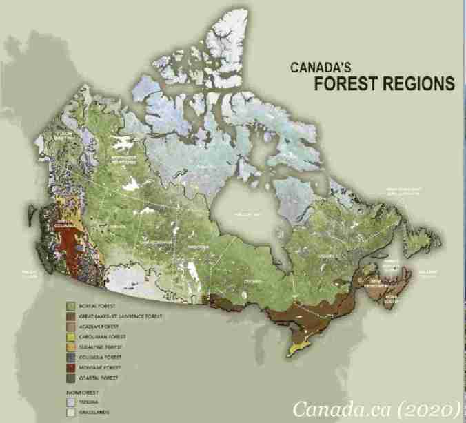
The second leg of my drive west from Peterborough, took me past Thunder Bay, northwest from Lake Superior and into the heart of the boreal forest. Named after Boreas, the Greek god of the Northwind, the boreal forest is also called taiga (a Russian word from Yakut origin that means “untraversable forest”). Canada’s boreal forest is considered the largest intact forest on Earth, with around three million square kilometres still undisturbed by roads, cities and industrial development.
.
Canaada’s Boreal Forest
The boreal forest is the largest forest region in Ontario, covering two thirds of the province—some 50 million hectares—from the Great Lakes-St. Lawrence forest to the Hudson Bay Lowlands.
I drove the Trans-Canada Highway (Hwy 17) through mixed coniferous forest, wetlands and marsh. The highway generally marks the boundary or transition zone between true Boreal Forest and the Great Lakes-St. Lawrence Forest, both dominated by coniferous trees.
.
Marshy river and spruce forest, north of Wawa, ON (photo by Nina Munteanu)
.
I stopped at English River overnight and the following morning woke to the echoing calls of two loons on the lake. I left at dawn with a peach sky behind me and a dark charcoal sky ahead of me. Soon the dark clouds unburdened themselves and the rain fell in a deluge as I continued west, barely making out the dense forest through flapping windshield wipers. The forest here was a mix of balsam fir, white and black spruce, white pine, aspen and white birch.
.
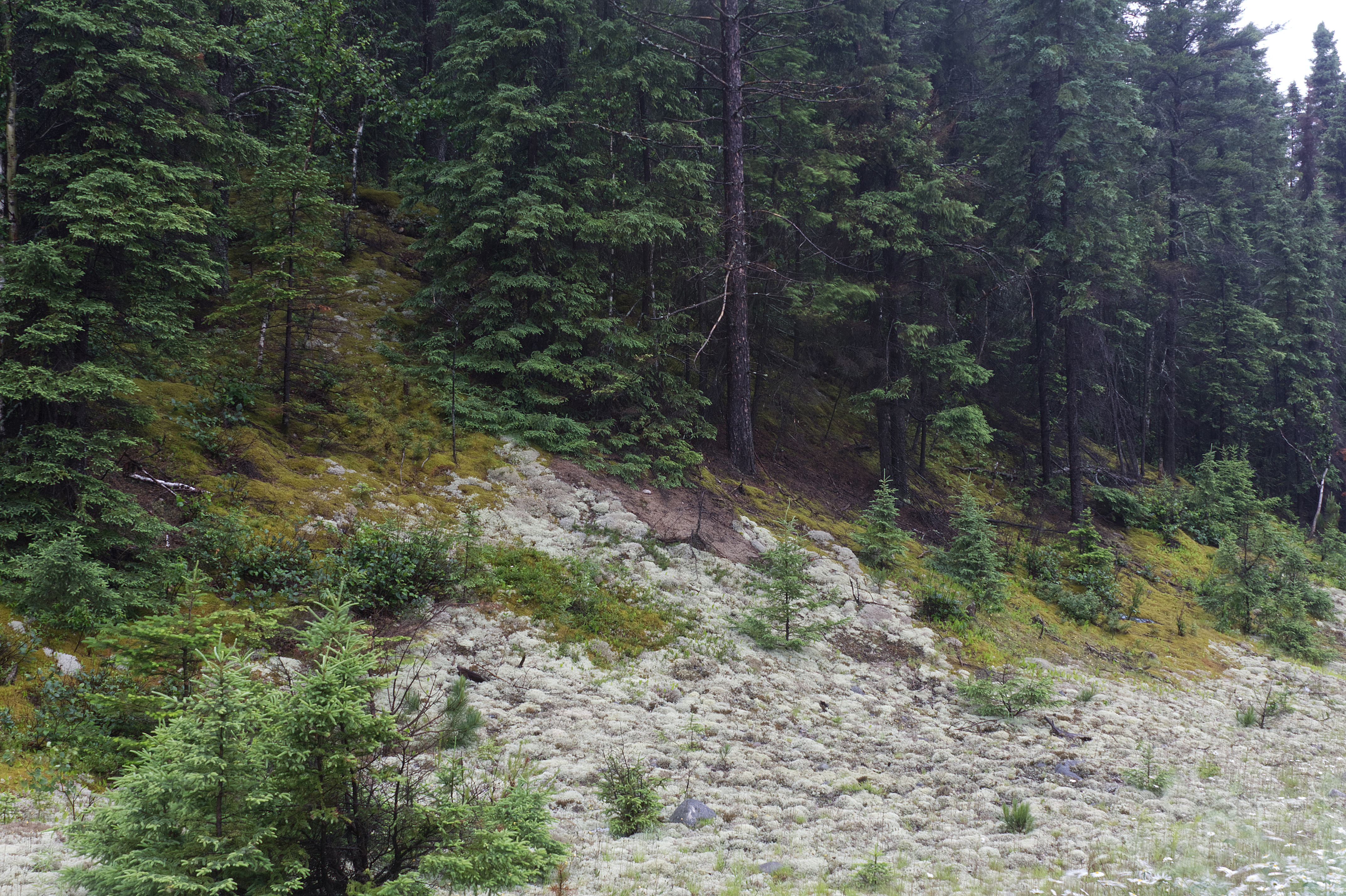
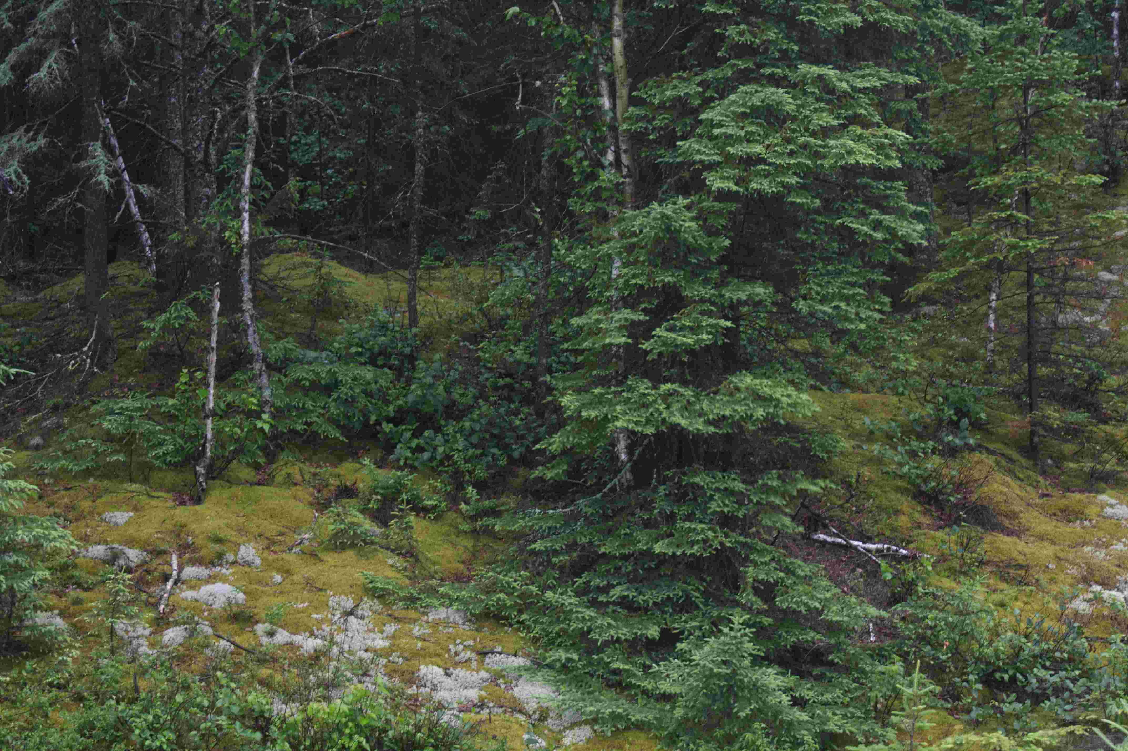
Spruce forest with birch and ground cover of moss and lichen, off Trans-Canada Highway, ON (photo by Nina Munteanu)
.
When the rain abated to a steady sprinkle, I ventured out to photograph the spruce-moss-lichen forest by the side of the road. I stood in the drizzle and set up my tripod and camera to take my shots, careful not to tread on the reindeer lichen. Reindeer lichen is highly susceptible to trampling. Branches break off easily and they take decades to recover. This foliose lichen is a key food source for reindeer and caribou during the winter; it also helps stabilize soil and recycles nutrients.
.
Spruce-moss-lichen forest off Trans-Canada Highway, ON (photo by Nina Munteanu)
Spruce-moss-lichen forest by Trans-Canada Highway, ON (photo by Nina Munteanu)
.
I drove into the tiny community of Vermillion Bay on Highway 17, looking forward to stopping in Quacker’s Diner for a hearty breakfast as advertised by a fetchy sign on the road. Alas, the place had closed long ago, according to the lady at the Moose Creek Trading Co., and hadn’t been replaced. And she couldn’t suggest anything else in the village. Disappointed, I felt I was truly in the middle of nowhere…
.
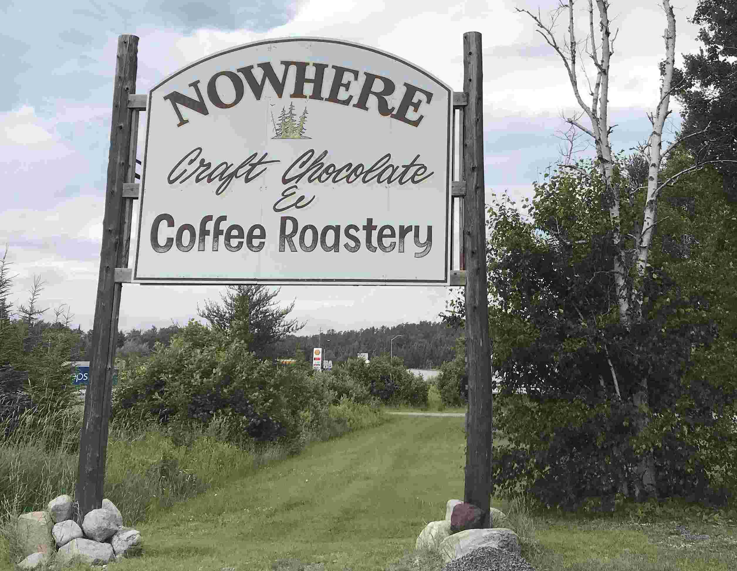
Sign for Nowhere, ON (photo by Nina Munteanu)
Then, a ways down the main road, I spotted the sign: “Nowhere Craft Chocolate & Coffee Roastery” and felt like I’d entered a dream-state where the north was run by hipsters.
Benny reaches Nowhere in Ontario, Vermillion Bay (photo by Nina Munteanu)
.
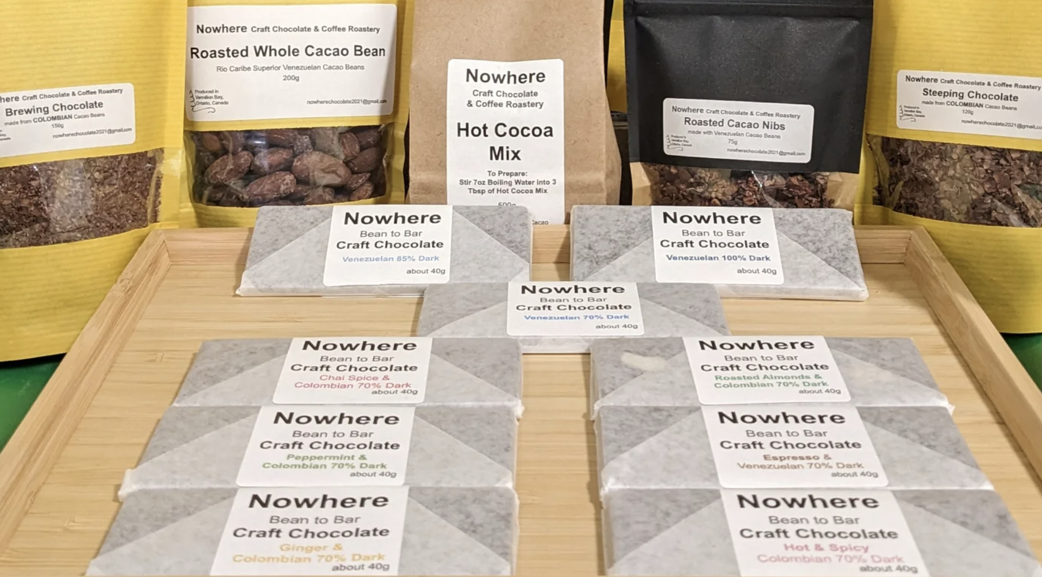
It was a husband and wife team who ran this wonderful craft bean-to-bar chocolate making and coffee roasting enterprise.
Filling my dark roast coffee order (photo by Nina Munteanu)
.
No sooner had I started to feel like I was back in trendy southern Ontario, when I met one of the locals, Simon, who worked in the bush and was patiently waiting for some dark roasts to take back to his buddies. We got to chatting and he shared some colourful stories about ‘the bush’ and folks who live in it, reminding me where I really was.
Coffee in hand, Simon stands next to his ATV with cooler, ready to return to ‘the bush’ with coffee (photo by Nina Munteanu)
When I mentioned the experience to a friend, she made the astute comment: “It is somehow satisfying to think of loggers and trappers and campers emerging out of the forests to go have a great cup of coffee and a hunk of chocolate. Why does that seem totally normal for Canada?”
Coffees from Nowhere
Chocolates from Nowhere
.
The Nowhere craft chocolate I bought—dark chocolate infused with ginger and Colombian coffee—was the best chocolate I’ve tasted this side of Switzerland. I bought some dark blends of Nowhere Coffee and continued my journey, happy despite no breakfast.
.
Black Spruce Forest
The black spruce (Picea mariana) dominates much of Canada’s boreal forests, frequently occurring in the Canadian Shield ecoregion where it forms extensive stands with groundcover of various mosses and reindeer lichen. Which of the two groundcover types depends on soil conditions and gaps in the forest from disturbance or fire.
Black spruce forest with moss and lichen ground cover, east of Dryden, ON (photo by Nina Munteanu)
.
The black spruce tree thrives in acidic peatlands, bogs and poorly drained mineral soils in wet, cold environments, but also grows in drier soils. It is particularly common on histosols (soils with peat and muck) on the Canadian Shield. Fires play a significant role in its regeneration as it replaces pioneer species such as white birch and tamarack after a fire, and grows with lichen and moss.
.
Marshland with black spruce, boreal forest north of Wawa, ON (photo by Nina Munteanu)
.
Mosses & Lichen Groundcover of Spruce-Dominated Forest
Both mosses and lichen (particularly reindeer lichen) help cool the forest by regulating evaporation and soil temperature; they can also fix nitrogen from the air, providing this key nutrient to an often nitrogen-limited ecosystem.
Spruce-Moss Woodland
Spruce forest with feathermoss ground cover, ON (photo by Nina Munteanu)
.
This spruce-moss woodland is typified by fairly dense closed canopy of black spruce (Picea mariana), along with white spruce (Picea glauca), balsam fir (Abies balsamea), paper birch (Betula papyrifera) and trembling aspen (Populus tremuloides); this association creates a fairly shaded environment on the forest floor, inviting groundcover of various mosses such as feathermosses and Sphagnum that thrive in stable moist, shaded conditions.
.
Various mosses that typify the spruce-moss woodland in the boreal forest: A. Ostrich Plume Moss (photo by iNaturist); B. Red-Stemmed Feathermoss (photo by Ohio Moss and Lichen Association); C. Glittering Feathermoss; and D. Haircap moss with sundew (photographs by Nina Munteanu)
.
Common mosses in the spruce-dominated forest include Knight’s Plume Moss (Ptilium crista-castrensis), Red-Stemmed Feathermoss (Pleurozium schreberi), Glittering Feathermoss (Hylocomium splendens), and various species of Sphagnum. Knight’s Plume Moss and Sphagnum are key carbon cyclers in the poorly drained acidic boreal forest, contributing significantly to net primary productivity. They decompose slowly, leading to substantial organic matter accumulation. Sphagnum in particular influences soil organic matter and carbon consumption during wildfires. Due to their ability to retain water, their acidity and resistance to decay, Sphagnum plays a crucial role in both the development and long-term persistence of peatlands where black spruce likes to live.
.
Various species of Sphagnum: A. Sphagnum squarrosum; B.Sphagnum papillosum; C. Sphagnum magellanicum; and D. Sphagnum papillosum (photos by Nina Munteanu)
.
Spruce-Lichen Woodland
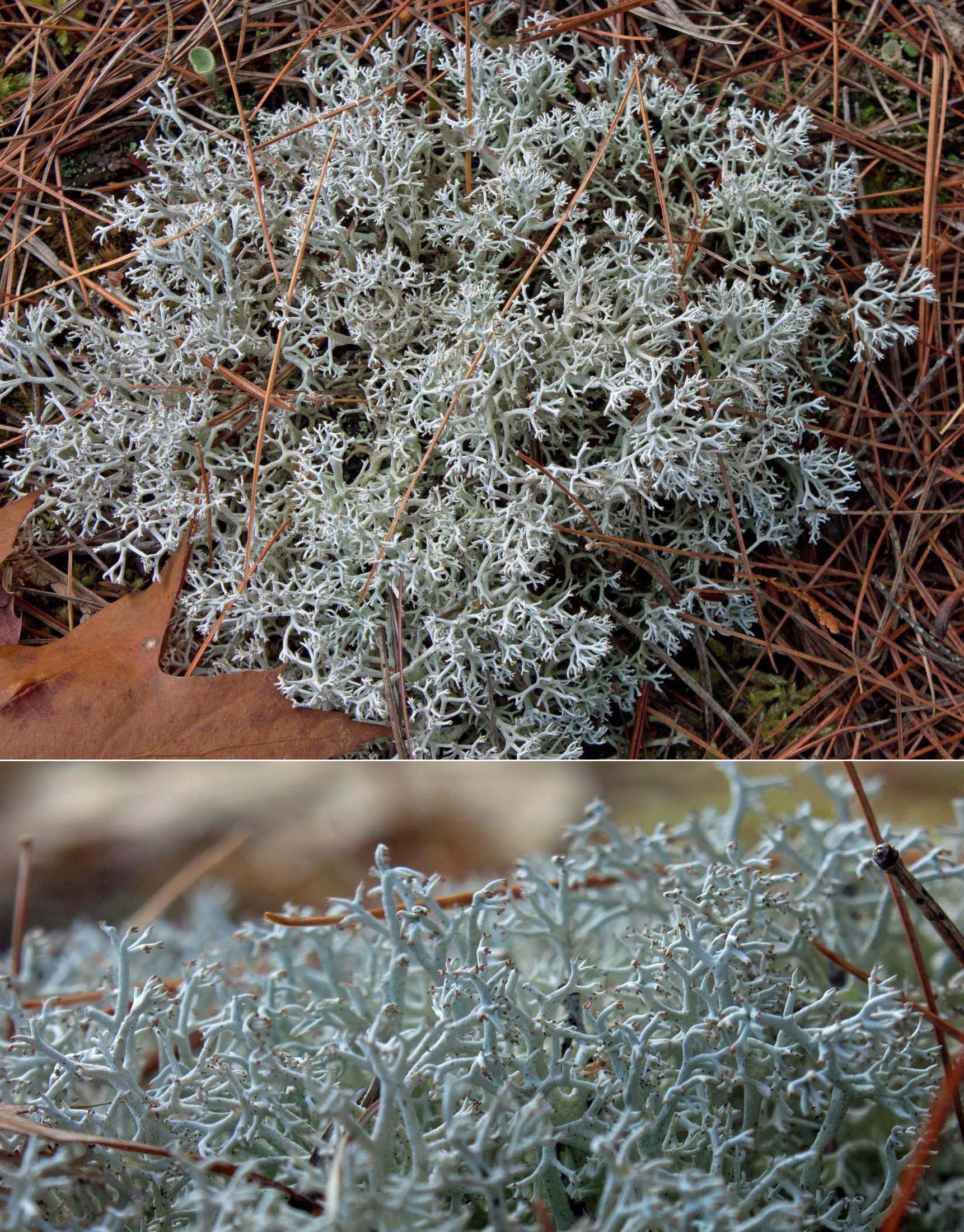
Gray Reindeer Lichen (Cladonia rangiferina) colonizing granite outcrop in Catchacoma Forest, ON (photo by Nina Munteanu)
.
Spruce-lichen woodlands are characterized by an open canopy of black spruce trees, often with jack pine (Pinus banksiana) and white birch (Betula papyrifera) and a ground layer of mostly lichens, particularly fruticose species such as Cladonia rangiferina, C. mitis and C.stellaris. This association is typically found on well-drained, often drier soils and may experience more extreme temperature fluctuations than spruce-moss associations. Through their release of acids that break down rock and organic matter, fruticose lichens contribute to soil formation.
.
Close up of a similar reindeer lichen species, Cladonia uncialis with Bristly Haircap Moss, on Catch Rock, ON (photo by Nina Munteanu)
.
A dense Cladonia mat also creates a microclimate that helps retain moisture. Lichen may also inhibit spruce regeneration, maintaining the open, park-like nature of lichen woodlands through the release of allelochemicals, such as usnic acid, that inhibit growth of plants and other lichen. Spruce-lichen woodlands may represent a stage in forest succession moving toward a closed-crown forest and may result from fire and insect disturbances that create openings in the forest canopy.
.
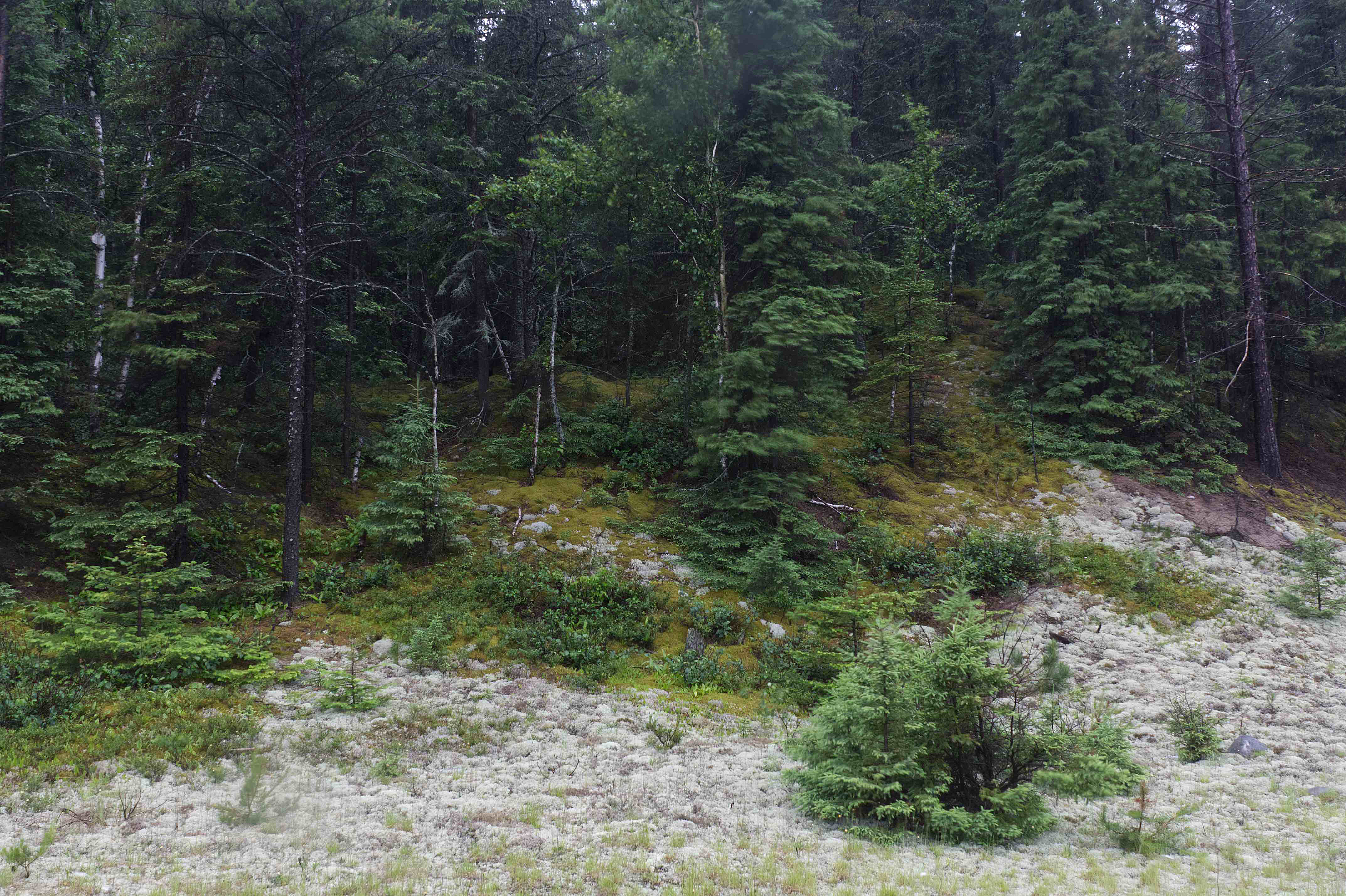
Spruce forest, showing reindeer lichen ground cover in foreground closest to the highway and moss ground cover upslope, ON (photo by Nina Munteanu)
.
This is what I observed where I’d stopped the car by the side of the road; closer to the disturbance of the open road, reindeer lichens—likely Cladonia rangiferina, C. mitis and C. stellaris—formed a thick continuous mat on the ground, which was fairly open with young spruce growing here and there. Further up the slope, where the canopy became more closed with mature trees, the mosses dominated the ground.
.
Boreal Wetlands & Kabenung Lake
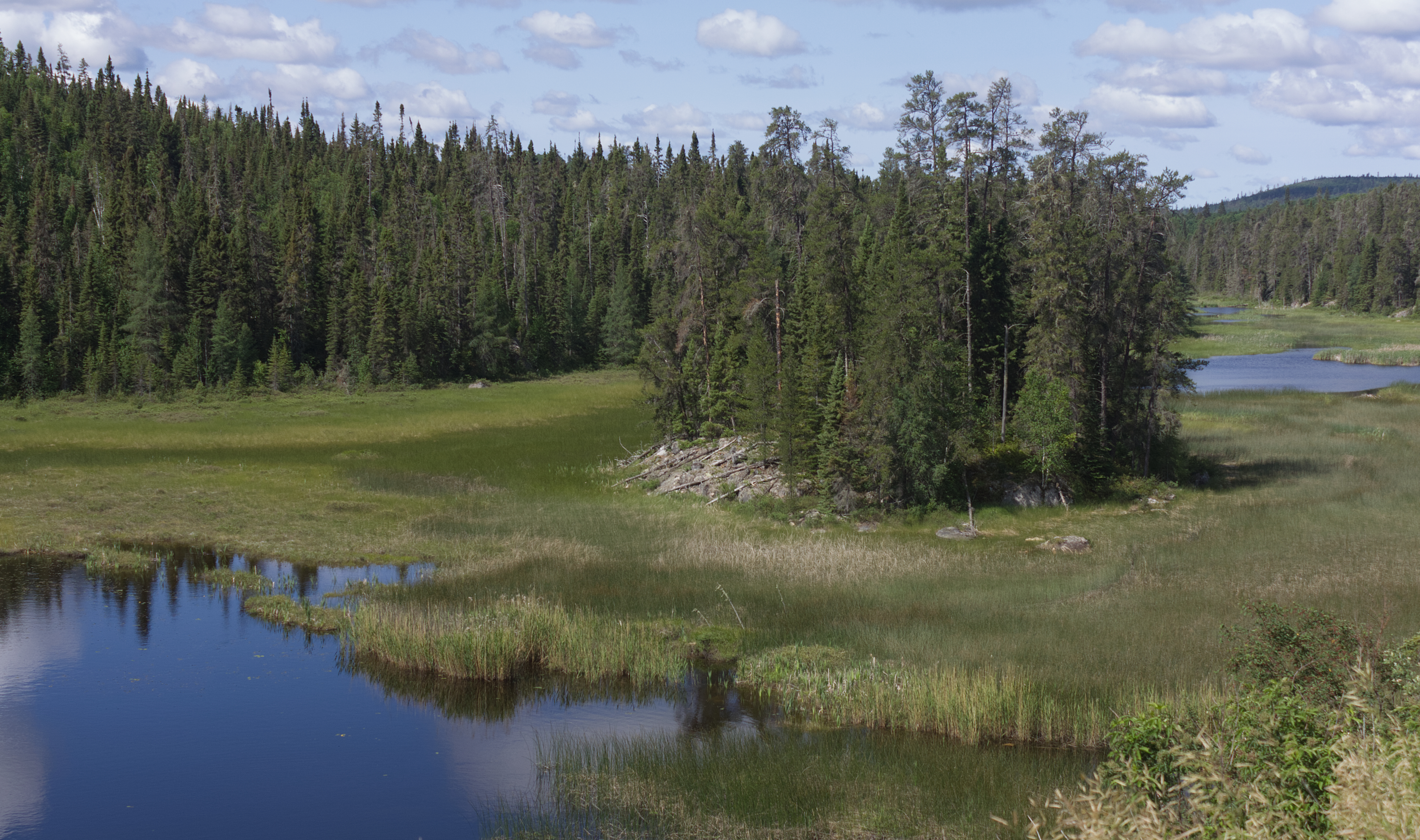
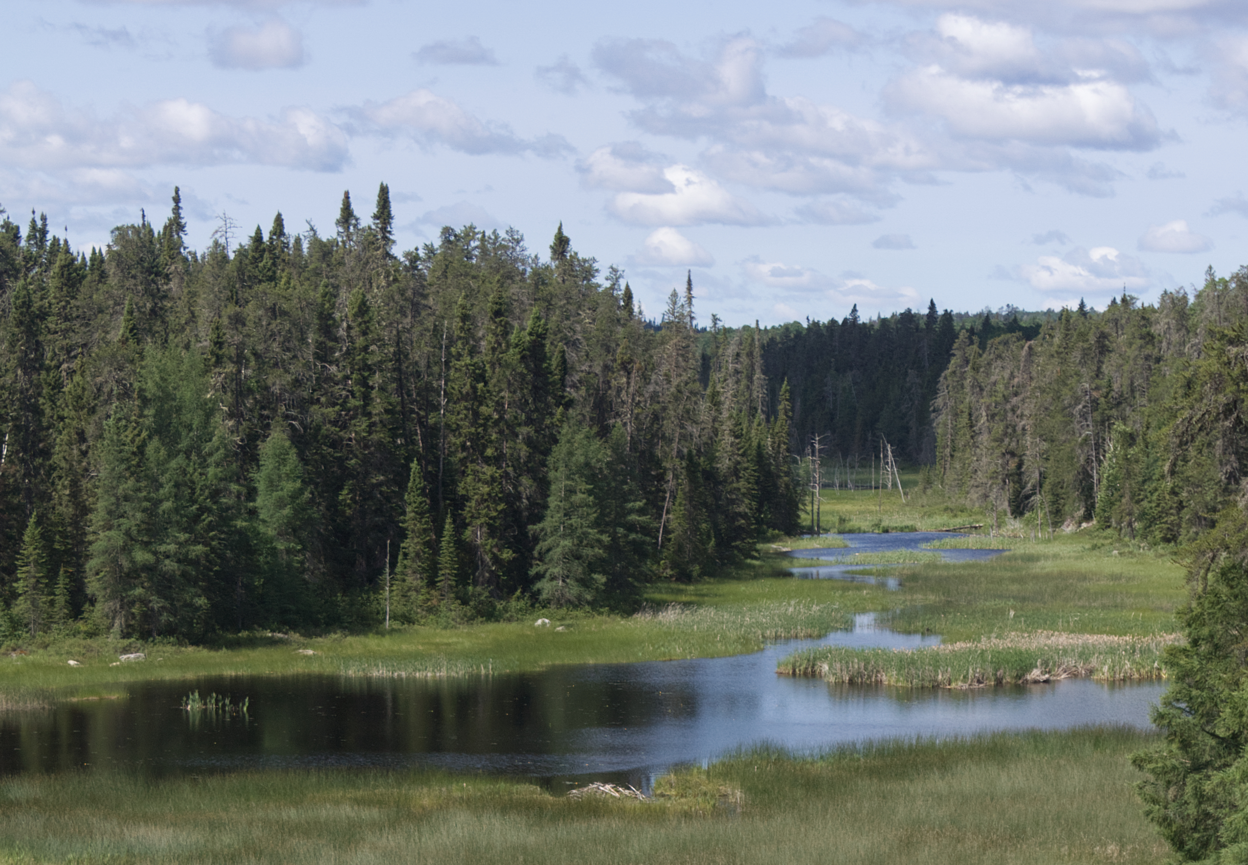
Wetland north of Wawa, ON (photo by Nina Munteanu)
.
On my drive through the boreal forest north of Wawa, I encountered extensive wetlands—mostly marshes, bogs and fens, forming winding networks of water habitats. These water features are key to the environment’s water regulation, excellent carbon stores and provide habitat for many species. Boreal wetlands are seasonally or permanently waterlogged (up to 2 metres deep) with plant life adapted to wet conditions, including trees, shrubs, grasses, moss and lichen. Organic wetlands (peatlands or muskegs) such as bogs and fens accrue deep organic deposits. Mineral wetlands (marshes, swamps and open water) have shallow organic deposits; these open water systems have nutrient-rich soils.
.
Kabenung Lake, ON (photo by Nina Munteanu)
.
I stopped at Kabenung Lake, considered a prime fishing lake, supporting diverse populations that include Northern Pike, Whitefish, Bass, Walleye, Brook Trout, Lake Trout, and Perch. Judging by the map, I had only a small view of the large convoluted 16 km long lake from the highway. The angler’s bathymetric map suggests a maximum depth of fifteen metres near the lake’s centre.
.
Kabenung Lake, north of Wawa, ON (photo by Nina Munteanu)
.
Before my journey west took me out of Ontario (and the boreal forest) into Manitoba’s flat prairie, I continued on the Canadian Shield across rugged terrain dominated by conifer trees with ancient Archean rock outcrops of granite and gneiss revealed in rock cuts on the highway. I reached Kenora, a charming old town with character architecture and a vibrant downtown. The town is located in the Lake of the Woods area, near the transition to the Great Lakes-St. Lawrence Forest to the south and the Aspen Parkland to the west. I saw lots of spruce, fir and pine alongside birch, maple and poplar. Lake of the Woods is a huge lake about 4349 km2 with over 14,000 islands with a highly convoluted shoreline and serves as an active hub for fishing, recreation and sightseeing.
.
Lake of the Woods Brewing Company, Kenora, ON (photo by Nina Munteanu)
.
In Kenora, I made a short stop at the craft brewery Lake of the Woods Brewing Company, bought some Sneaky Peach Pale Ale to take with me, and continued west to the Manitoba border.
.
Nina with her Sneaky Peach Ale, Kenora, ON
On my way, I had to stop the car to let a red fox cross the road. It looked like it owned the road, just sashaying across in a confident trot and smiling at me…Yes, smiling!
Benny on a road in the boreal forest, east of Kenora, ON (photo by Nina Munteanu)
.
References:
Houle, Gilles and Louise Fillon. 2003. “The effects of lichens on white spruce seedling establishment and juvenile growth in a spruce-lichen woodland of subarctic Québec.” Ecoscience 10(1): 80-84.
Payette, Serge, Najat Bhiry, Ann Delwaide and Martin Simard. 2000. “Origin of the lichen woodland at its southern range limit in eastern Canada: the catastrophic impact of insect defoliators and fire on the spruce-moss forest.” Canadian J. of Forest Res. 20(2).
Rydin, Håkan, Urban Gunnarsson, and Sebastian Sunberg. 2006. “The Role of Sphagnum in Peatland Development and Persistence.” In: Boreal Peatland Ecology, Ecological Studies 188, R. K. Wieder and D. H. Vitt (eds) Springer-Verlag Berlin Heidelberg, pp 47-65.
.
Nina Munteanu is a Canadian ecologist / limnologist and novelist. She is co-editor of Europa SF and currently teaches writing courses at George Brown College and the University of Toronto. Visit www.ninamunteanu.ca for the latest on her books. Nina’s bilingual “La natura dell’acqua / The Way of Water” was published by Mincione Edizioni in Rome. Her non-fiction book “Water Is…” by Pixl Press(Vancouver) was selected by Margaret Atwood in the New York Times ‘Year in Reading’ and was chosen as the 2017 Summer Read by Water Canada. Her novel “A Diary in the Age of Water” was released by Inanna Publications (Toronto) in June 2020.
It was time to go back out west for me. So, I packed up my car Benny with my precious treasures—including all my plants—and drove west from Peterborough, Ontario (where I’d been living for a decade). My destination was Vancouver, BC, where my son and sister and good friends live.
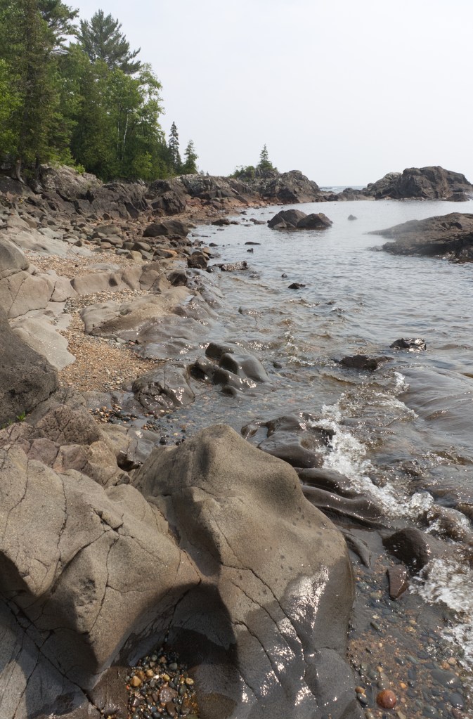
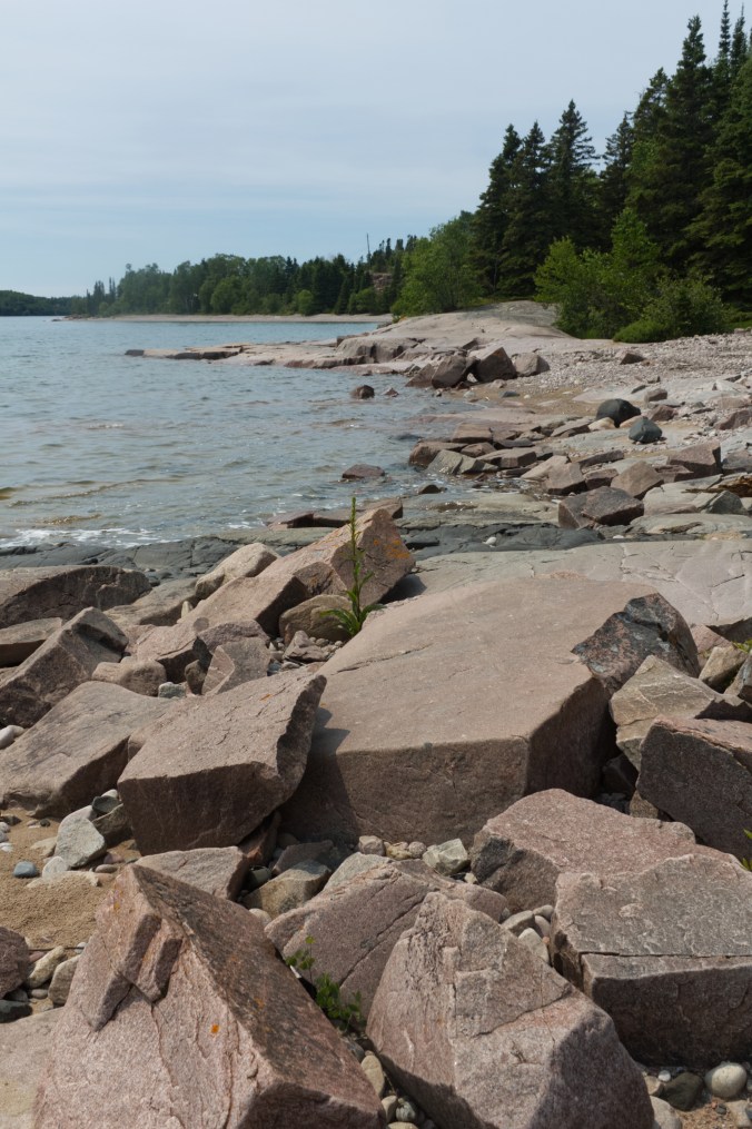
Stone Beach, Lake Superior, ON (photo by Nina Munteanu)
I looked forward to the drive through the boreal forest of the Canadian Shield—spectacular country of mostly black spruce forest, rugged billion-year old rocks and ancient inland seas. Because I’m a limnologist and ecologist, I particularly looked forward to driving along the northern shores of Lake Superior. Distinguished by iconic terraced cobble shores, vast sand beaches, steep gnarly cliffs and brooding headlands, Lake Superior was certain to be a highlight of my trip. I anticipated experiencing this Great Lake with the giddy excitement of a child.
Water-carved sandstone and granite / rhyolite boulders form shore of Stone Beach, ON (photo by Nina Munteanu)
.
Sandy Katherine Bay, Lake Superior, ON (photo by Nina Munteanu)
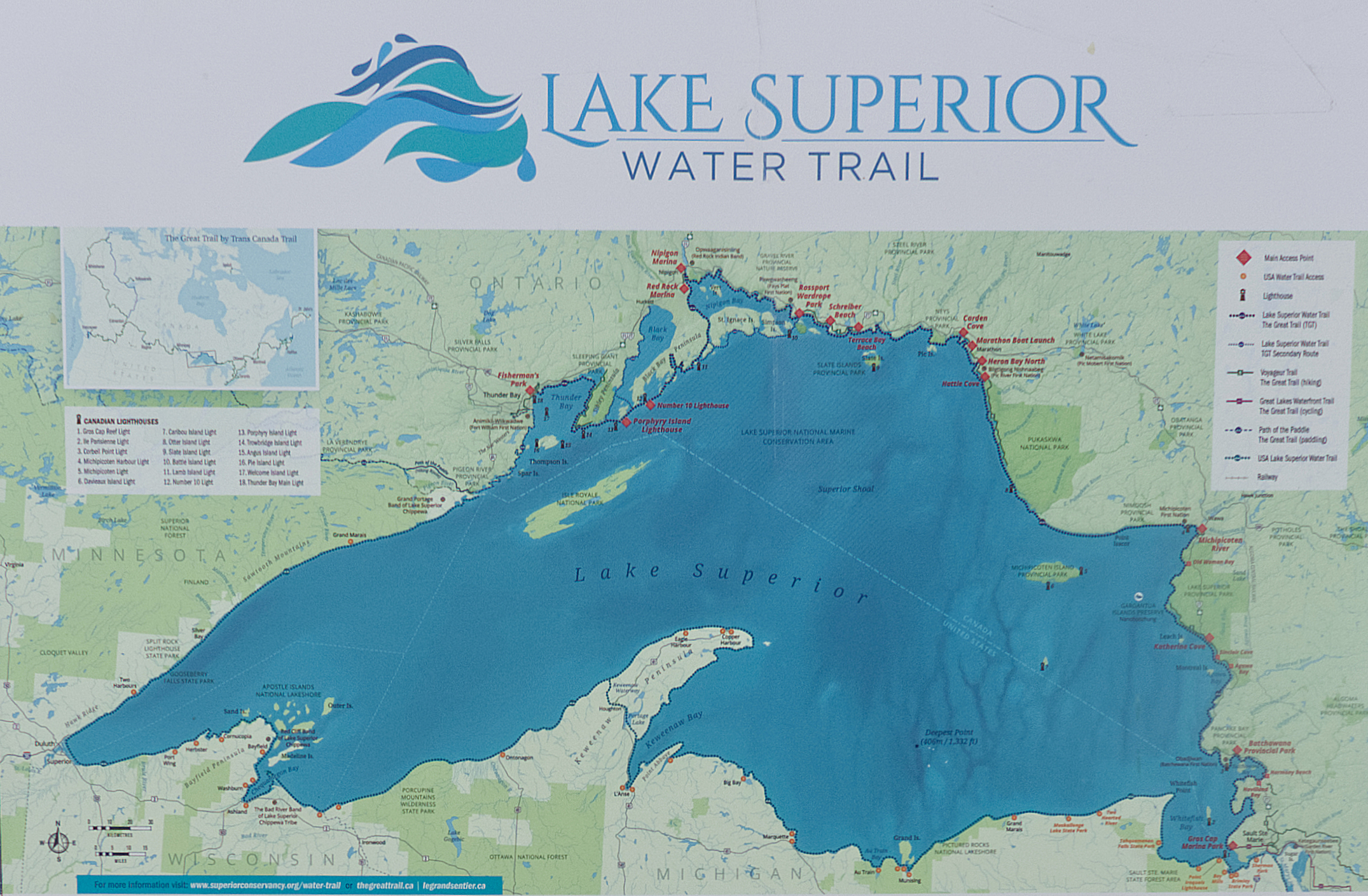
Contour and trail map of Lake Superior
.
I got my first glimpses of this massive lake at Sault Saint Marie, a charming town on the southeastern shore of Lake Superior and the location of the lake’s outlet, St. Marys River. My first stop for a more immersive experience of the lake was Batchawana Bay, part of Pancake Bay Provincial Park, where I explored the mostly sand coast and shore forest. I’m told that the name Batchawana comes from the Ojibwe word Badjiwanung that means “water that bubbles up”, referring to the bubbling current at Sand Point.
.
Benny, laden with my plants, parks beside Batchawana Beach of Lake Superior, ON (photo by Nina Munteanu)
.
Batchewana Bay is not only a main access point to several trails of the Lake Superior Water Trail; it also serves as a popular place for boaters and kayak paddlers to launch their craft for water adventure. The cold water and high wind fetch often make for treacherous boating. The Lake Superior Watershed Conservancy put up a sign at Batchewana Bay warning paddlers about dangerous and wily currents, including rip currents and channel currents and effects of offshore winds, accompanied by sudden surges.
.
Chippewa Falls, ON (photo by Nina Munteanu)
.
From Batchawana Bay, I continued north along the lake’s eastern shore, past Chippewa Falls, formed on 2.7 billion year old pink granite bedrock, covered by a later basalt flow; here, the Harmony River tumbles some 6 metres before emptying into Lake Superior.
I found access points including Stone Beach, Alona Bay, Agawa Bay, and Katherine Bay, variously dominated by pebbled shores with rocky granite outcrops and finely sculpted sandstone—all overseen by windswept pine, cedar and spruce. This part of the lake lies in the Great Lakes-St. Lawrence Forest area, dominated by mixed forest of fir, spruce, cedar and paper birch.
.
Sorted cobble shore with scupted rocky bluffs of granite / rhyolite and black spruce, Alona Bay, Lake Superior, ON (photo by Nina Munteanu)
Rugged coastline of Alona Bay showing terraces of water-worn cobbles and granite / rhyolite bluffs, Lake Superior, ON (photo by Nina Munteanu)
.
Along the cobble shores of Alona Bay, I met a trio of rock hounds, looking for distinct Lake Superior agate, quite fetchy with its rich red, orange and yellow colours. I was told that the colours are caused by the oxidation of iron that leached from rocks. Fascinated by their varied colours and rounded shapes, I fell into a hypnotic meditation, picking up pebbles, rubbing them wet to reveal their bright colours and examining them close up.
Local rock hounds collecting choice pebbles at Alona Bay, Lake Superior (photo by Nina Munteanu)
.
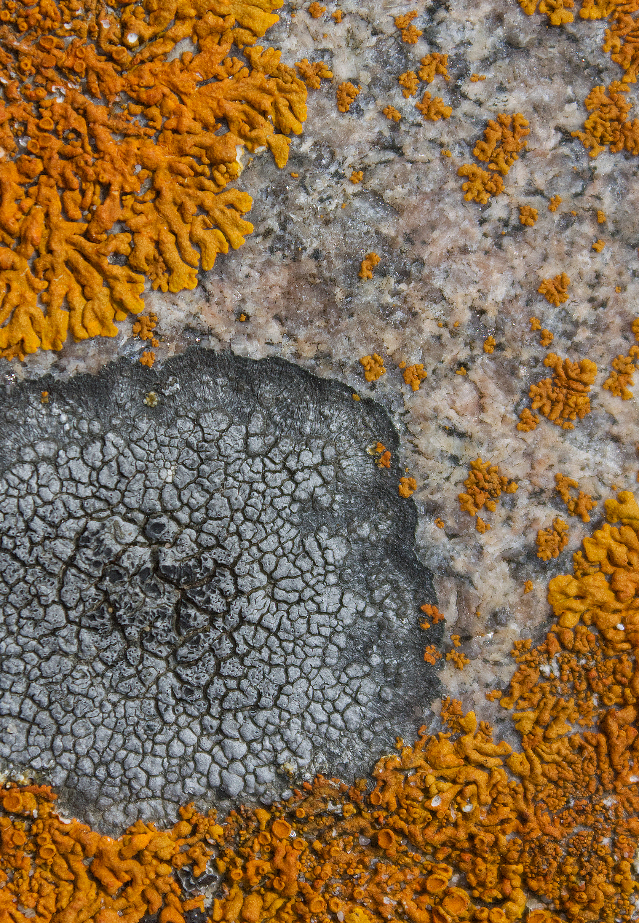
Rusavskia elegans along with Aspicillia cinerea and Lecidea sp. cover granite boulder, Alona Bay, Lake Superior, ON (photo by Nina Munteanu)
.
On the pink granite in Alona Bay, I found some brilliant lichen, which I confirmed was Elegant Starburst Lichen (Rusavskia elegans formerly Xanthoria elagans)—documented by other lichenologists as common on Lake Superior’s granite shores. I also saw patches of Rock Disk Lichen (Lecidella stigmatea).
.
Lake Superior northern shore near Rossport; top left: Encrusted Saxifrage tucked into granite crack; top right: Sunburst Lichen carpets granite boulder; bottom cobbled beach (photos by Nina Munteanu)
Shoreline of terraced cobbles in Alona Bay, Lake Superior, ON (photo by Nina Munteanu)
Boulder-strewn shore of Lake Superior at Agawa Bay, ON (photo by Nina Munteanu)
.
Agawa Bay and surrounding high points provide magnificent views of the Lake Superior shoreline and surrounding country. The high rising hills are easily one of the most rugged and beautiful in Ontario. The area is underlain mostly by over two billion year old granitic rocks of igneous origin that form part of a large batholitic mass formed in the Algoman period of Precambrian time.
.
Trail to Agawa Rock, Lake Superior, ON
.
It’s a short hike (0.8 km) through the woods on a trail that leads to the Agawa Rock Pictographs, an amazing collection of Aboriginal pictographs that sends one’s senses soaring with imagination. Beautiful representations of real and mythical animals fill the granite canvas;, one is Mishipeshu, the Great Lynx. This mythical creature is a water dwelling dragon-like animal that also resembles a lynx with horns and a back tail covered in scales. Mishipeshu is believed to cause rough and dangerous water conditions claiming numerous victims.
.
Great Lynx pictograph, Agawa Rock, Lake Superior
.
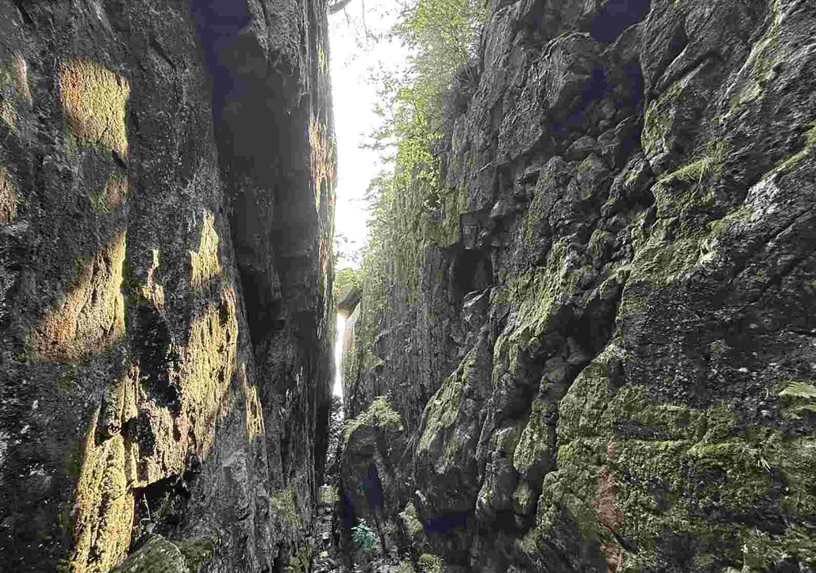
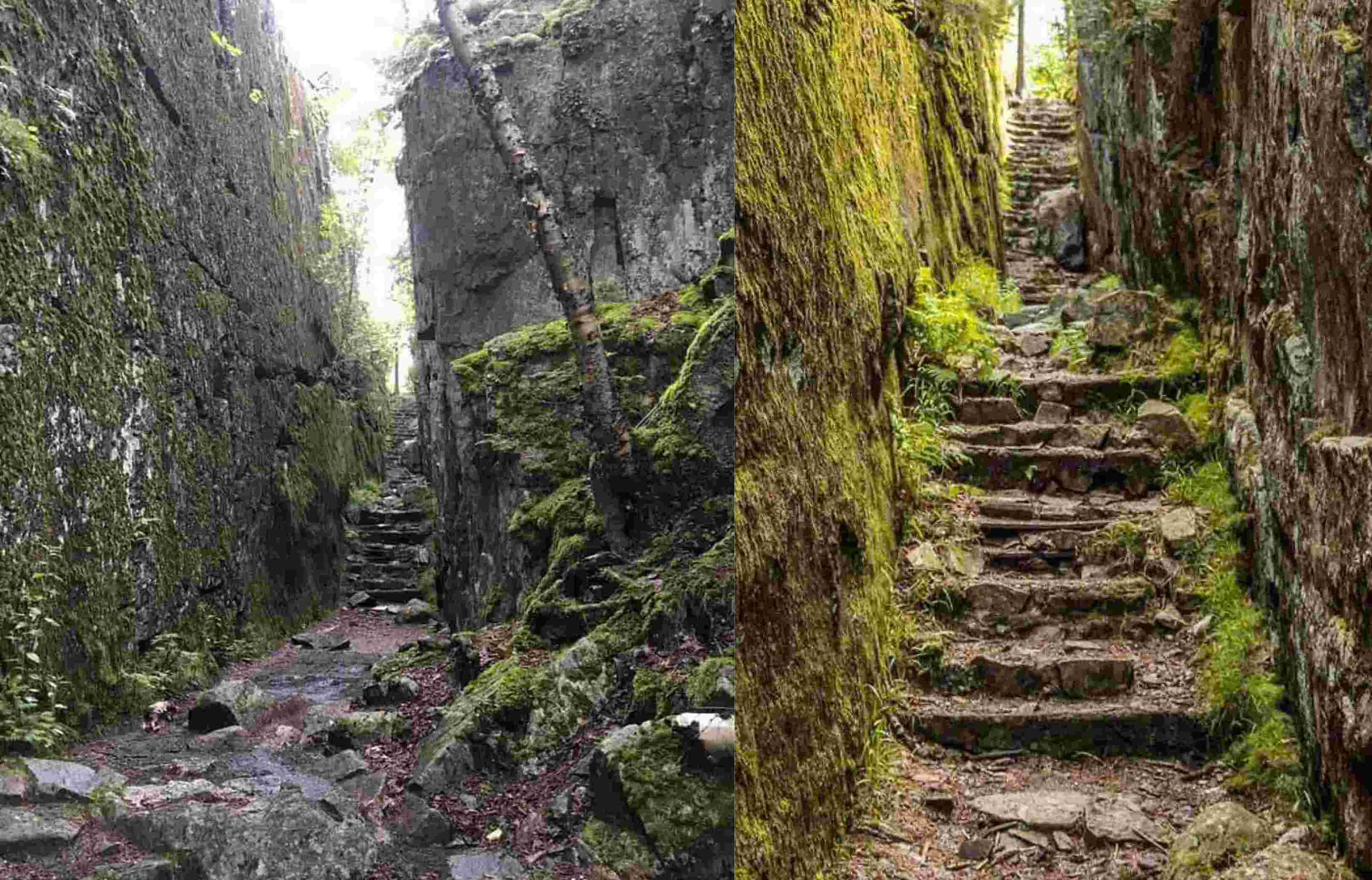
The trail it itself a highlight, takes you up a steep rock-hewn staircase, with steep cliff faces looming overhead, and along rocky pathways. The pictographs are viewed from a rock ledge below the 15-story high cliff that faces Lake Superior.
.
Two views of the rock-hewn staircase of the Agawa Rock trail, Lake Superior, ON
Rugged shoreline of Agawa Bay with birchleaf spirea in foreground, Lake Superior, ON (photo by Nina Munteanu)
.
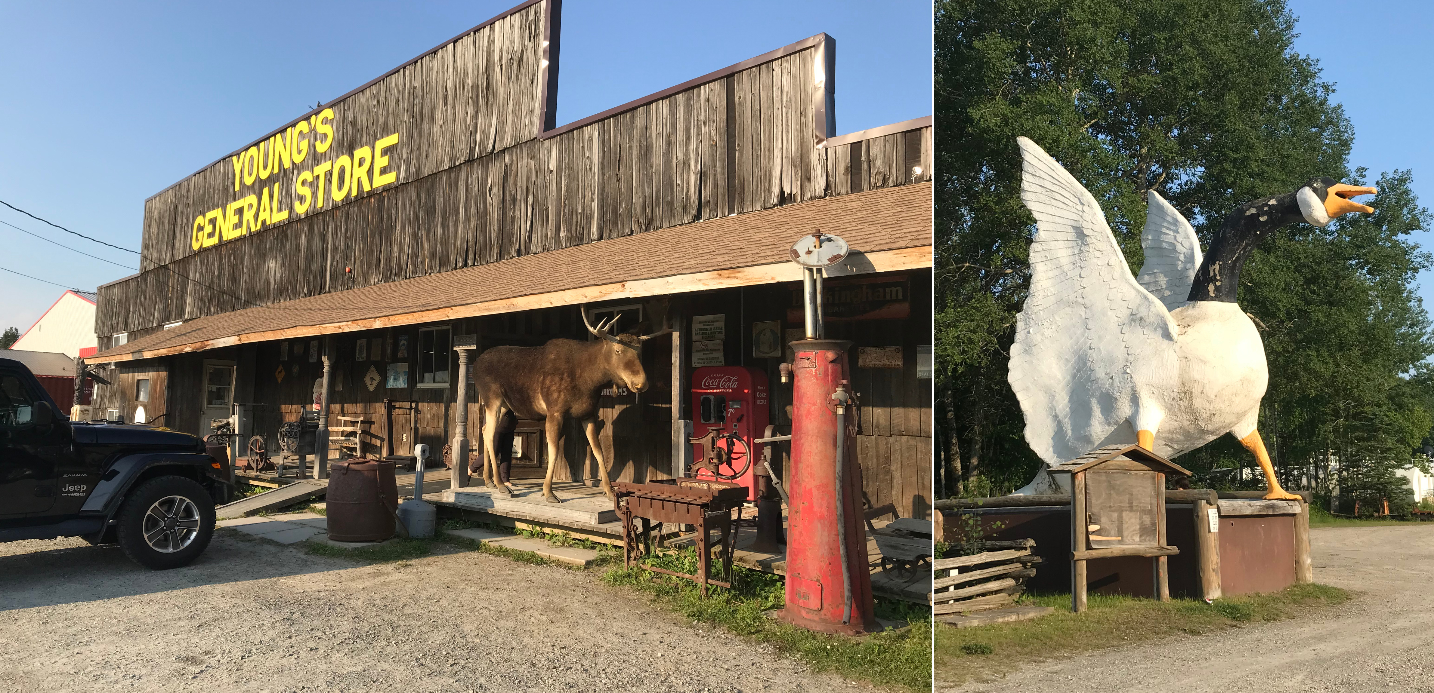
My second night stop was Wawa, on the edge of the boreal forest of the Canadian Shield, known for its giant ugly goose sculptures. The name Wawa comes from the Ojibwe word wewe for “wild goose.” The town, which resembles a modern-day version of an old pioneer town included the colourful Young’s General Store, where you could purchase anything from moccasins and fishing tackle to homemade fudge and ice cream.
.
Left: Young’s General Store in Wawa; Right: (in)famous goose statue(photos by Nina Munteanu)
.
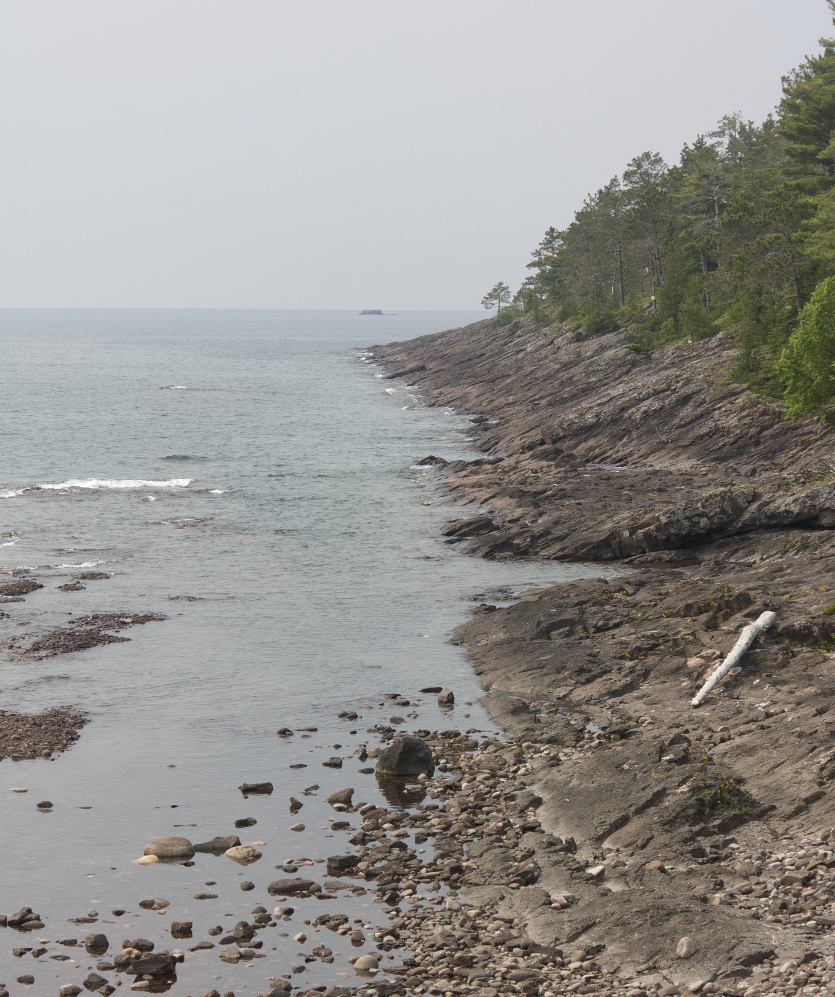
From Wawa, I drove west along the most northerly shores of Lake Superior, stopping at access points including Schreiber Beach, Cavers and Rossport. I found this stretch of Lake Superior’s northern coast from Terrace Bay to Nipigon particularly enchanting. Here I found several access points off the road that drew me like Alice into wondrous boreal landscapes, offering windows to an ancient time before humans walked the earth.
Near Schreiber, I stopped on the road to explore deep pink smooth granite outcrops covered in foliose Cumberland Rock Shield Lichen (Xanthoparmelia cumberlandia) and cushions of fruticose Reindeer Lichen (Cladonia spp.) where shallow soil pockets had grown.
Granite outcrop with Xanthoparmelia cumberlandia and Cladonia spp. off Trans Canada Highway on shore of Lake Superior, near Schreiber, ON. (photo by Nina Munteanu)
.
The Lake Superior shoreline at Rossport consists mostly of exposed primordial granite, worn smooth by wave action. The granite here is mostly pink feldspar, quartz, and black mica. According to E.G. Pye, this rock is called porphyritic granite, an igneous rock that crystalized from a natural melt, or magma.
.
Transition Zone & the Disjunct Plants of Lake Superior’s Northern Coastline
.
Though it lies in the boreal forest (typified by black spruce), the northern shoreline of Lake Superior in fact also supports species more characteristic of the Great Lakes-St. Lawrence Forest (e.g. white spruce, white cedar, red maple, paper birch). The northern shoreline of Lake Superior is therefore considered a transition zone between these two types of forest ecosystems.
.
Saxifrage flowers bloom in the cracks and corners of granite / gneiss rock, Lake Superior near Rossport, ON (photo by Nina Munteanu)
.
Nestled in the rocky cracks and crevices of Lake Superior’s wild rocky shores, I discovered several cold-loving plants that normally grow in high alpine areas of the Arctic. Botanists refer to them as “Arctic-alpine disjunct plants,” separated from their usual arctic-alpine habitat and regarded as possible relicts of the last glaciation. Typically, such plants grow much farther north; but these plants have adapted to the unique cold micro-environment of Lake Superior’s northern shores. Examples include encrusted saxifrage (Saxifraga paniculata), black crowberry (Empetrum nigrum), bilberry (Vaccinium uliginosum), arctic fir clubmoss (Huperzia selago), elegant groundsel (Packera indecora), and the carnivorous English sundew (Drosera anglica).
.
Lichens of Lake Superior’s Northern Coastline
Rhizocarpon geographicum and Lecidea sp. on granite rocks at Katherine Bay, Lake Superior, ON (photo by Nina Munteanu)
Lecidella stigmata on granite rock, Lake Superior, ON (photo by Nina Munteanu)
.
I met old friends on the lake’s wild shores, lichens that made their homes on the water-smoothed rock surfaces and gnarly rock cliffs and boulders. Random patches of the crustose Yellow Map Lichen (Rhizocarpon geographicum), rosettes of the foliose Cumberland Rock Shield Lichen (Xanthoparmelia cumberlandia) and Tile Lichen(Lecidea sp.)—all lichens I’d encountered on my studied Catch Rock, a granite outcrop in the Catchacoma old-growth hemlock forest near Gooderham.
.
Rhizocarpon geographicum and Xanthoparmelia cumberlandia on granite outcrop, near Schrieber off Lake Superior, ON (photo by Nina Munteanu)
.
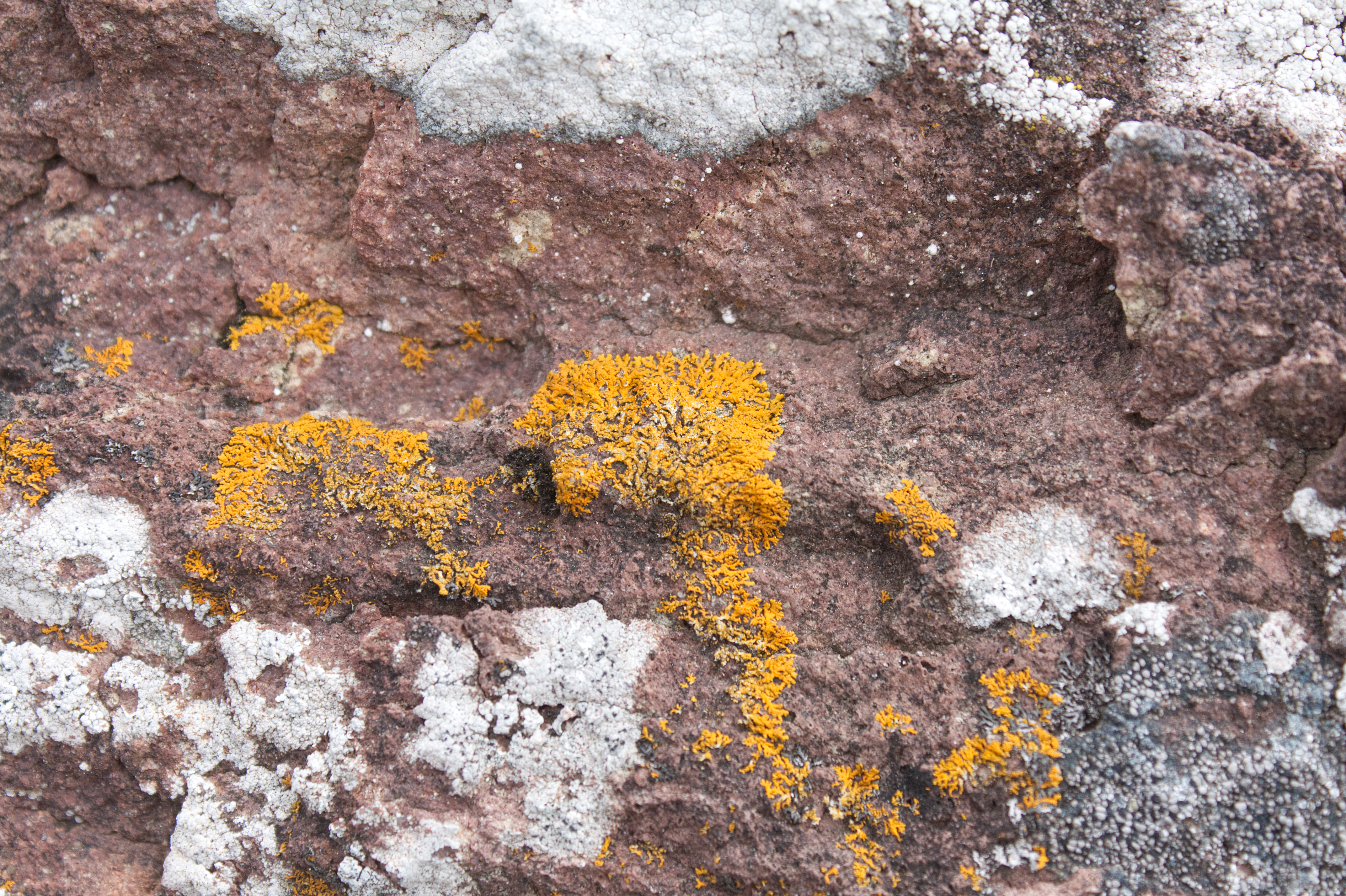
Circular patches of bright tangerine-orange Elegant Starburst Lichen (Rusavskia elegans formerly Xanthoria elegans) graced many of the rocky surfaces. I particularly noted them on the exposed granite slabs of Schreiber Beach and Rossport, often accompanied by Peppered Rock-Shield Lichen (Xanthoparmelia conspersa) and grey Cinder Lichen (Aspicillia cinerea).
.
Rusavskia elegans and Aspicillia cinerea, Lichen colonizing granite near Rossport on Lake Superior, ON(photo by Nina Munteanu)
Rusavskia elegans colonizes granite boulders on shore of Lake Superior near Rossport, ON (photo by Nina Munteanu)
.
William Purvis writes that R. elegans is a nitrophile (nitrogen lover) and is common at sites that are regularly fertilized by birds. In other words, they like bird poop. Inuit hunters knew that orange lichen meant small mammals like marmots probably lived nearby (the poop connection again). The orange colour comes from the carotenoid pigment, which acts like sunscreen to protect the lichen from UV radiation. This was the lichen that made it into space in 2005, exposed to the extremes of space (e.g. temperature, radiation and vacuum) for 1.5 years. Most of the samples continued to photosynthesize when they returned to Earth.
.
Lichen colonizing granite near Rossport on Lake Superior, ON. A. Rusavskia elegans and Xanthoparmelia conspersa; B. Rusavskia elegans and Aspicillia cinerea (photo by Nina Munteanu)
.
Limnology & Geology of Lake Superior & Watershed
Morphometric map of Lake Superior (image by World Lake Database)
.
Lake History
Lake Superior was formed 10,000 years ago when glacial melt-water filled a billion-year-old volcanic basin. The lake is the size of Austria, covering an area of about 82,100 km3 and making it the largest lake in the world by surface area. Lake Superior holds 10% of the Earth’s surface freshwater—enough to fill the other Great Lakes plus three more Lake Eries, making it the third largest lake in the world by volume. The Ojibwe call the lake gichi-gami (great sea), which so aptly describes this inland sea.
Slabs of granite rocks scatter along the shore of Lake Superior near Rossport, ON (photo by Nina Munteanu)
Lake Superior is considered an oligotrophic lake of low productivity, characterized by cold, deep, nutrient-poor nutrients (particularly phosphorus and nitrogen). Its mean depth is 147 meters with a maximum depth of 406 meters. Fed by 200 rivers, Lake Superior holds 12,100 km3 of freshwater—enough to cover the entire North and South American continents with 30 cm of water. The lake’s volume is sufficiently large that it takes almost two centuries for a drop of water to circulate the lake before leaving through St. Marys River—its only natural outflow at Sault Ste. Marie—which flows into Lake Huron. Lake Superior also experiences seasonal circulation; the lake stratifies into two major temperature layers in summer and winter and undergoes mixing (turnover) twice in spring and fall, making it a dimictic lake.
.
Because of lack of plankton and turbidity from silt (due to cold waters low in nutrients), the lake is super clear with Secchi disk depths of 20-23 meters observed. Samuel Eddy at the University of Minnesota provided a summary of zooplankton and phytoplankton in the lake.
.
Macrophytes appeared nonexistent on the wave-washed shallows, though some boulders were covered in periphyton (e.g. attached algae, mostly diatoms). I also noticed some filamentous algae on the shore rocks near Rossport, likely Cladophora and Spirogyra, known to occur in the sheltered waters of the lake.
Granite shore near Rossport with green filamentous algae (photo by Nina Munteanu)
.
Lake Fetch & Seiches
Seiches in lakes (image from University of Michigan)
.
Because of its size, Lake Superior provides long distances for wind to push water from one end to the other; these distances, called fetches, can exceed 500 km on Lake Superior. As a result, the lake experiences ‘tides’ called seiches—essentially oscillations in water level caused by strong winds and changes in atmospheric pressure. This causes a sloshing effect across the lake (of about a metre), much like a cup of coffee as it’s being carried, and exposes shorelines to dramatic fluctuations in shoreline levels with large waves, which can be as high as 6 m during storms.
.
Lake Geology
Rocky shore off Agawa Bay, Lake Superior, ON (photo by Nina Munteanu)
.
The rocks of the lake’s northern shore date back to the early history of the earth, during the Precambrian Era (4.5 billion to 540 million years ago) when magma forcing its way to the surface created the intrusive granites of the Canadian Shield. With a watershed rich in minerals such as copper, iron, silver, gold and nickel, the lake lies in long-extinct Mesoproterozoic rift valley (Midcontinent Rift). Over time eroding mountains deposited layers of sediments that compacted to become limestone, dolomite, taconite and shale. As magma injected between layers of sedimentary rock, forming diabase sills, flat-topped mesa formed (particularly in the Thunder Bay area), where amethyst formed in some cavities of the rift. Lava eruptions also formed black basalt, near Michipichoten Island.
.
During the Wisconsin glaciation 10,000 years ago, ice as high as 2 km covered the region; the ice sheet advance and retreat left gravel, sand, clay and boulder deposits as glacial meltwater gathered in the Superior basin
Although the lake currently freezes over completely every two decades, scientists speculate that by 2040 Lake Superior may remain ice-free due to climate change. Warmer temperatures may also lead to more snow along the shores of the lake.
Rock-strewn Katherine Bay, Lake Superior, ON (photo by Nina Munteanu)
.
Lake Superior & Watershed Characteristics
Parameter
Value
Age
10,000 years
Trophic Status
Oligotrophic
Visibility (Secchi Depth)
8-30 m
Thermal Stratification
dimictic
Length
563 km
Breadth
257 km
Mean Depth
147 m
Maximum Depth
406 m
Volume
12,100 km3
Lake Surface Area
82,100 km2
Watershed Area
127,700 km2
Shoreline Length
4,385 km
Water Residence / Flushing Rate
191 years
Fetch
500 km
Outlet
St Marys River
.
Viking cruise ship from Minnesota off sandy shore of Terrace Bay, Lake Superior, ON (photo by Nina Munteanu)
.
References:
Brandt et. al. 2015. “Viability of the lichen Xanthoria elegans and its symbionts after 18 months of space exposure and simulated Mars conditions on the ISS.” International Journal of Astrobiology.
Stone Beach, Lake Superior, ON (photo by Nina Munteanu)
.
Nina Munteanu is a Canadian ecologist / limnologist and novelist. She is co-editor of Europa SF and currently teaches writing courses at George Brown College and the University of Toronto. Visit www.ninamunteanu.ca for the latest on her books. Nina’s bilingual “La natura dell’acqua / The Way of Water” was published by Mincione Edizioni in Rome. Her non-fiction book “Water Is…” by Pixl Press (Vancouver) was selected by Margaret Atwood in the New York Times ‘Year in Reading’ and was chosen as the 2017 Summer Read by Water Canada. Her novel “A Diary in the Age of Water” was released by Inanna Publications (Toronto) in June 2020.
Nina stands next to a giant redcedar, BC (photo by Anne Voute)
.
It’s been a few months since I moved back to British Columbia from Ontario.
I don’t have a place to live yet (currently crashing at a friend’s place, thanks to her kindness), but it feels right. And, more importantly, it feels like home.
.
Nina, early days in BC (photo H. Klassen)
.
I first came to BC over five decades ago, shortly after I graduated from Concordia University in Montreal. I started my first teaching job at the University of Victoria on Vancouver Island, first worked as an environmental consultant in Richmond, met my husband-to-be in Vancouver, wrote and published my first novel in Delta and raised my son in the village of Ladner, overlooking the Fraser River Estuary. I have deep nurturing roots here with family and friends. And wonderful memories.
.
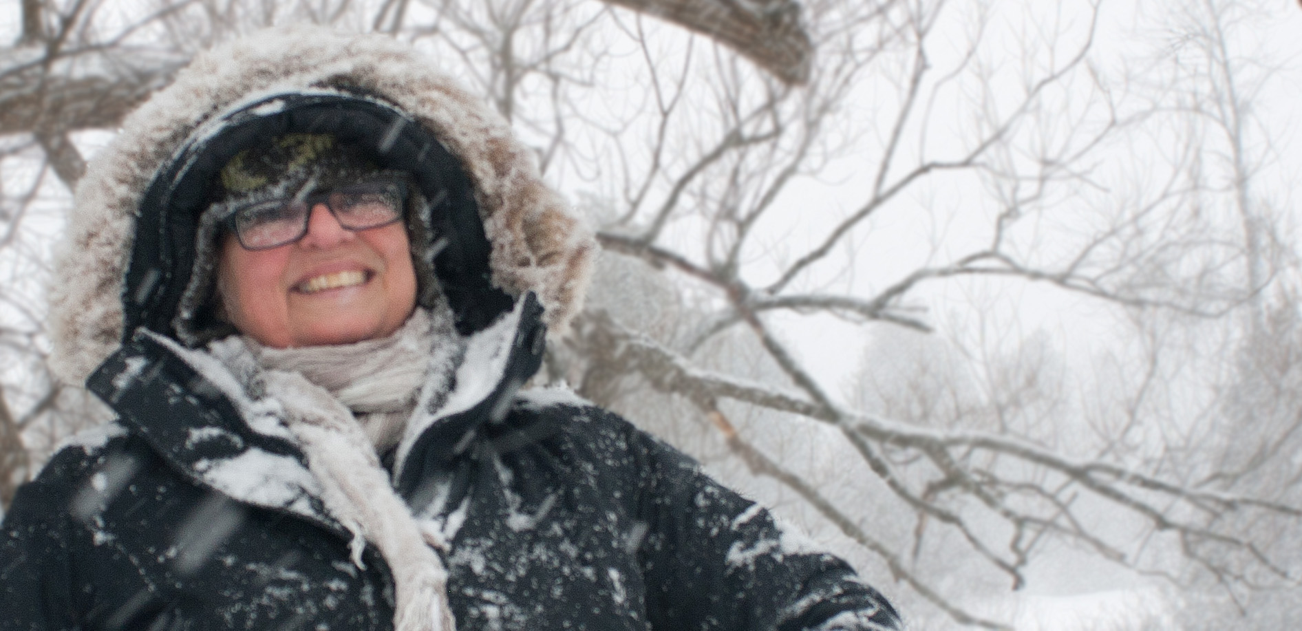
Various winter scenes in Ontario (photos by Nina Munteanu)
Nina ‘snowbear’ enjoys a winter storm, ON (photo by M. Cox)
Hayes Line Road in the colours of autumn, ON (photo by NIna Munteanu)
.
As the seasons progress, I find that I do miss aspects of Ontario. I left behind a rich environment that closely reflected where I’d grown up as a kid, in the Eastern Townships of Quebec: the cold crisp snowy winters and colourful windy autumns of maple-beech forests. These feel like home too. I spent many days driving the country roads of the Kawarthas without a map, looking for adventure and a cup of good coffee at the end of it. In winter, I daily walked through knee-deep snow in magical forests, snow glinting under the moonlight. I frequented several favourite forests over the seasons, some old-growth like the Catchacoma old-growth hemlock forest, the Mark S. Burnham Maple-Beech-Hemlock-Cedar forest, the pine-cedar mixed forest of Jackson Creek, the Trent Nature Sanctuary cedar-pine mixed forest and the South Drumlin Maple-Beech forest. These, I will miss. They were a life-line to a sacred and holy part of my existence.
.
Nina studies a lilac bush, ON (photo by Nina Munteanu)
.
I am building new memories of this new-old home, with more mature eyes and mind. When I left BC 15 years ago after my divorce, and son studying at university, to seek adventure across Canada (I spent several years on the east coast in Nova Scotia), I finally settled in Ontario, where I found fulfillment teaching at the University of Toronto. It was there, in Ontario, where I honed my ecological knowledge and rekindled my love for lichen and fungi. I immersed myself in their study and rediscovered a fascinating miniature world. I studied trees with more diligence, identifying virtually all the key species in the Carolinian forests I visited—and the fungi and lichens that grew on them and around them. I’ve become something of an expert in lichenology, able to identify many of the species I encounter, and also to understand their complex and fascinating ecology.
.
Various lichens, from top left: Punctellia reducta, Xanthoria elegans, Rizocarpon geographicum, Cladonia uncialis, and Cladonia pyxidata (photos by Nina Munteanu)
.
I now bring that new knowledge and appreciation back to coastal BC—my old and new home— with an excitement for more adventure in its magnificent rainforests, its small rural communities and coastal villages—and the cup of coffee at the end of it.
Port Renfrew, BC (photo by Nina Munteanu)
.
Nina checks her camera, Highland Creek, ON (photo by M. Cox)
.
p.s. When you know what to look for, you will see it; not before. That’s likely a tautology; but I found that it has applied to me over the years. And nowhere has it been more obvious to me than in my travels across Canada. My first trip across Canada was five decades ago, as a young sprite, heading west to do my PhD. I went by train and, though I saw much beauty, it passed me at speed. When I drove east to the coast, I recall lots and lots of trees, little else. But, my recent trip west from Ontario was landmarked with a new knowledge and appreciation for so many more layers of my environment; it became eye-opening. What I’d only remembered in the past as “so many trees”, became a fractal journey through boreal layers. I saw so much! I discovered so many ‘friends’: lichens, trees, rock formations, environments that I’d identified in my previous adventures. I became excited by it all. I was in a constant state of wonder. This was how I needed to see Canada. With a wide-open mind and the spirit of adventure.
I look forward to re-immersing myself in these coastal BC ecosystems with that same new understanding, and better informed eyes and mind.
Let it be.
.
Heron oversees activities in Ladner Marsh, BC (photo by NIna Munteanu)
.
Nina walks Highland Creek, ON (photos by M. Cox)
Nina Munteanu is a Canadian ecologist / limnologist and novelist. She is co-editor of Europa SF and currently teaches writing courses at George Brown College and the University of Toronto. Visit www.ninamunteanu.ca for the latest on her books. Nina’s bilingual “La natura dell’acqua / The Way of Water” was published by Mincione Edizioni in Rome. Her non-fiction book “Water Is…” by Pixl Press(Vancouver) was selected by Margaret Atwood in the New York Times ‘Year in Reading’ and was chosen as the 2017 Summer Read by Water Canada. Her latest novel “A Diary in the Age of Water” was released by Inanna Publications (Toronto) in June 2020.
Some years ago now, when the Dalai Lama was attending the 2009 Vancouver Peace Summit, he was quoted as saying, “The world will be saved by the western woman.”
This set the media buzzing on what His Holiness meant and—perhaps more importantly—how his statement resonates with us, and how his “call” affects the western woman.
Marianne Hughes, executive director of the Interaction Institute for Social Change (IISC), pondered the idea of the aging woman as hag (originally a representation of feminine power) and how it relates to the Dalai Lama’s statement on her blog. “I’m not entirely sure what [the Dalai Lama] meant,” said Hughes, “But I am wondering if when he travels across the globe and sees so many of our sisters impoverished and repressed he sees western women of all ages in a position to speak out for justice and to take on the responsibilities of “the hag”… to take loving care of the planet and its people.”
The original meaning of the word “hag” in Gaelic originally referred to a saint with great powers who was responsible for the land, the waters and the people. The term has since been distorted through patriarchal propaganda into something far less flattering and powerful. The “Hag” is currently being redefined as a strong, beautiful and ageless woman and has its similarities with “the Crone”, the third stage of a woman’s life and evolution from maiden to mother to crone. Postmenopausal women currently comprise the largest demographic group in America. With our increased lifespan, the ancient tripartite divisions of Maiden, Mother, and Crone are more meaningful in women’s lives as the Crone stage occupies one third of our lifespan. Moreover, our current Crone generation (those born in the forties and fifties) is the first in the history of humankind that can claim (and has already claimed) economic autonomy and power.
According to Dr. Linda E. Savage (author of “Reclaiming Goddess Sexuality”) “Each stage of a woman’s life is organized around what Goddess Cultures called the blood mysteries: menarche, (the first monthly flow of blood); childbirth, which is accompanied by blood from birthing; and menopause, when a woman’s “wise blood” remains inside her to give her wisdom. These are still powerful landmarks, which profoundly influence women’s lives. They function as psychological gateways to the change in consciousness required by each new stage.”
Savage describes the Crone as a powerful shamanic figure in society: “The developmental task of the Crone Stage is sharing wisdom. In Neolithic times, Crone women were the tribal matriarchs. Their heightened awareness of human nature yielded great insight and they were the source of wise counsel for important decisions. Spiritually, this is the Mastery phase. The Wise Woman teaches knowledge gained from her skills and life experience. It is a time of reaching into her spiritual depths, utilizing her powers of intuition, and finding meaning in her visions from the dream world. Some Crone women are masters of healing at the highest level. The Crone Stage of life, more than any other, is a time of giving back to society the cumulative wisdom of the years. Many women have an urge to speak out, to organize others, to take action. They have the energy to get more involved in the world-at-large. It is often Crone energy that leads to changes being made in society. As the Crone woman moves further into her life path she feels the urge to teach others and to cultivate her passions. It can be the most productive time in womens’ lives.”
Crone energy isn’t necessarily limited to Crones. It is an energy that may be carried by anyone at any age. Ariane de Bonvoisin, writing for the Huffington Post, made the following observation:
“Most people I meet have a new fear—the fear of not being relevant, the fear of not making a difference, the fear of working on things that don’t really matter in the important times of transition we live in. We’re hungry to be part of making things better. We want to create, we want to do what we love again and find our voice. We sense intuitively that we have a critical role to play in shaping the future of our world. And yet, so many of us give in to excuses of not being good enough, young enough, smart enough, wealthy enough, creative enough. We still play small, still give in to the ‘victim’ archetype. We still buy into what society’s beliefs are and put them right above our own. But we don’t really have time for these fears. If I could create a vaccine, instead of the flu one, I’d create one against fear. It’s what holds us back, every one of us, in every area of our life. And, while we’re holding back, time just moves on faster than ever. We are at a critical time in the evolution of our planet, a time where each one of us is waking up. We feel it.
Our intuition is growing more acute. Our inner microphone, as I like to call it, is getting harder and harder to turn off, so that we can’t just go along with our normal day. There’s a rise in consciousness where we feel more connected to others, a part of something bigger going on, where we each have a role to play. The most important thing isn’t to get the promotion, or stay in the marriage, or lose those 10 pounds. The most important thing is for us to remember who we are—why we are here—to do the inner work and find what are our ‘spiritual’ reasons for being on the planet. Yes we do have something great to accomplish. Now. At any age. Wherever we are.”
I found yet another revealing comment on her blog post that reminded me of another statement by His Holiness: that the next Dalai Lama might be a woman. The commentator told the story of the Buddhist Goddess Tara, who is highly revered in Tibet and was a most promising student of Buddhism. The monks told her she should come back as a man so that she could reincarnate and finish her spiritual journey and become a Buddha. She responded that male/female has no meaning since spiritual beings have perfectly balance aspects of both and in reality can incarnate as either gender. She made a resolution to always come back as a woman. I see this proclamation as a metaphor for choosing “feminine wisdom” or “Goddess Wisdom”, represented by the depth of forgiveness, kindness, tenderness, openness, vulnerability, tolerance, honor, integrity, sacred courage, humility, trust and faith.
So, why “the Western Woman”? We are not particularly known on the globe for these traits, nor does the western philosophy we espouse typically embrace these ideal traits. The western woman has more often been stereotyped (and vilified) with the following characteristics: vanity, pride, shallowness, self-centeredness, self-serving ambition, competitiveness, and pettiness.
While we can, in fact, accept these as our stereotypic weaknesses (it is part of our shallow consumer culture and capitalist model, after all), it is for this very reason that the western woman represents the salvation of the world. Not only do we have the means, as Marianne Hughes pointed out, but we are in the best position to convince.
We are the necessary paradox that spawns evolution. The darkness that sparks light. The chaos that creates stability. The inertia that initiates change.
Viburnam berries, ON (photo by Nina Munteanu)
.
Nina Munteanu is a Canadian ecologist / limnologist and novelist. She is co-editor of Europa SF and currently teaches writing courses at George Brown College and the University of Toronto. Visit www.ninamunteanu.ca for the latest on her books. Nina’s bilingual “La natura dell’acqua / The Way of Water” was published by Mincione Edizioni in Rome. Her non-fiction book “Water Is…” by Pixl Press(Vancouver) was selected by Margaret Atwood in the New York Times ‘Year in Reading’ and was chosen as the 2017 Summer Read by Water Canada. Her novel “A Diary in the Age of Water” was released by Inanna Publications (Toronto) in June 2020.
When I was little, I wanted to be a storyteller, a cartoonist specifically. I was reading graphic novels before I could read. That didn’t stop me from understanding what was going on. Being a virtual learner and an artist, I understood context: expressions, body language…
Nina, age three, pretending to read (photo by Martha Munteanu)
.
.
I wrote and drew wild adventure thriller detective stories and stories about exploring other planets. While my first love was telling stories, I was called by the needs of the environment. This percolated through me as I grew up and wouldn’t let go. When I could read and write, I still read graphic novels; I wrote and illustrated short stories about the environment, dystopian tales that focussed on how we were destroying our planet.
.
At school, I loitered in the hallways, pasting subversive posters on the walls. They were a call to action: Restrain … Reuse … Repurpose … Recycle … Remain true to the environment. I wrote in the school paper. I quoted global statistics, mentioned global warming (yes, people knew about it back in the ‘60s and ‘70s), and submitted cheesy emotional drawings of pollution and toxic waste.
By the time I was ready to go to university (I’d been accepted early into the fine arts program at Concordia University in Montreal), I switched my major on registration day. Like a horse bolting from a fire, I charged out of the arts and into the sciences. I’d heard environment’s call for help and had notions of becoming an environmental lawyer. I kept a few arts courses as electives but focused on a biology degree in the environmental sciences. I understood that the tools I needed to wield as an eco-warrior in law were rooted in science.
.
A twenty-some old Nina exploring the forest
.
I learned something about ecology, botany, animal, plant, and cell physiology, genetics and biochemistry, and limnology (the study of water systems). The sciences fascinated me and I became entranced in the study of how the natural world worked. I was particularly attracted by lichens, plant-like organisms called cryptogams that grow like miniature forests on substrates—trees,fence posts, rock, cement. My attraction was partly because these often overlooked organisms were actually more of a symbiotic community or mini-ecosystem: an intriguing community of fungi, algae, cyanobacteria, bacteria and yeast growing together. I felt that on some level, lichen had much to teach us on lifestyle and approach to living on this planet. They’d been around for millennia, a lot longer than we’ve been.
Having long abandoned law (I convinced myself that I wasn’t cut out for it; maybe I was but that’s another universe), I decided to pursue lichen ecology for my masters degree. But fate had another path in mind for me. The botany professor who I wished to study under was retiring and no one was taking her place. She referred me to the limnology professor and he got me interested in another microscopic community: periphyton (the algae and associated organisms that colonize plants, rock and cement in water).
Nina and son Kevin explore nature (photo by Herb Klassen)
.
I’d come somewhat full circle to be an eco-warrior, pursuing environmental problems (and corporate mischief) through biology rather than law. I designed and conducted environmental impact assessments and recommended mitigation, restoration, and remediation procedures to various clients from lakefront communities and city planners to mining companies dealing with leaky tailings ponds and pulp mills discharging effluent into the ocean.
.
Various reports, scientific papers and articles I’ve written or been interviewed for
.
It worked for me. I consulted for twenty-some years. It was for the most part both satisfying and encouraging. I felt as though I was making a difference: mostly through educating my clients. But that became less and less the case as the consulting firms I worked for, and the corporations they worked for, seemed to have less and less integrity. They also seemed to care less about the environment and more about profit.
So, just as I’d done on the day of registration at university, I bolted like a horse in a fire and quit my job as a consultant. I never returned to consulting.
Nina photographing pollution of a small creek entering a drinking water source (photo by Matthew Barker, Peterborough Examiner)
My sights went back to storytelling, journalism, and reporting/interviews. Mostly eco-fiction. Creating narratives that would hopefully move people, nudge them to act for the environment. Change their worldview somewhat into eco-friendly territory. Make them care. I’m still an eco-warrior, but my pen and my storytelling is my tool.
The word is a powerful tool. And the stories that carry them are vehicles of change.
Nina Munteanu wandering the Emily Tract forest, ON (photo by Merridy Cox)
.
Nina Munteanu is a Canadian ecologist / limnologist and novelist. She is co-editor of Europa SF and currently teaches writing courses at George Brown College and the University of Toronto. Visit www.ninamunteanu.ca for the latest on her books. Nina’s bilingual “La natura dell’acqua / The Way of Water” was published by Mincione Edizioni in Rome. Her non-fiction book “Water Is…” by Pixl Press (Vancouver) was selected by Margaret Atwood in the New York Times ‘Year in Reading’ and was chosen as the 2017 Summer Read by Water Canada. Her novel “A Diary in the Age of Water” was released by Inanna Publications (Toronto) in June 2020.
I recently received my copies of the 2025 Wild Canada calendar put out by WildernessCommittee.ca. The calendar has 12 months of gorgeous images of wild and sacred places throughout Canada; heartfelt and informative stories accompany each image.
2025 Wild Canada calendar featuring January spread
My own photo of an old-growth hemlock in Catchacoma Forest, Ontario, is featured for January! Go check out the Wilderness Committee site then go to their store to see the whole calendar. It’s worth buying for its beauty and its meaningful narratives. And it is an excellent way to support a worthwhile cause.
Nina Munteanu is a Canadian ecologist / limnologist and novelist. She is co-editor of Europa SF and currently teaches writing courses at George Brown College and the University of Toronto. Visit www.ninamunteanu.ca for the latest on her books. Nina’s bilingual “La natura dell’acqua / The Way of Water” was published by Mincione Edizioni in Rome. Her non-fiction book “Water Is…” by Pixl Press (Vancouver) was selected by Margaret Atwood in the New York Times ‘Year in Reading’ and was chosen as the 2017 Summer Read by Water Canada. Her novel “A Diary in the Age of Water” was released by Inanna Publications (Toronto) in June 2020.