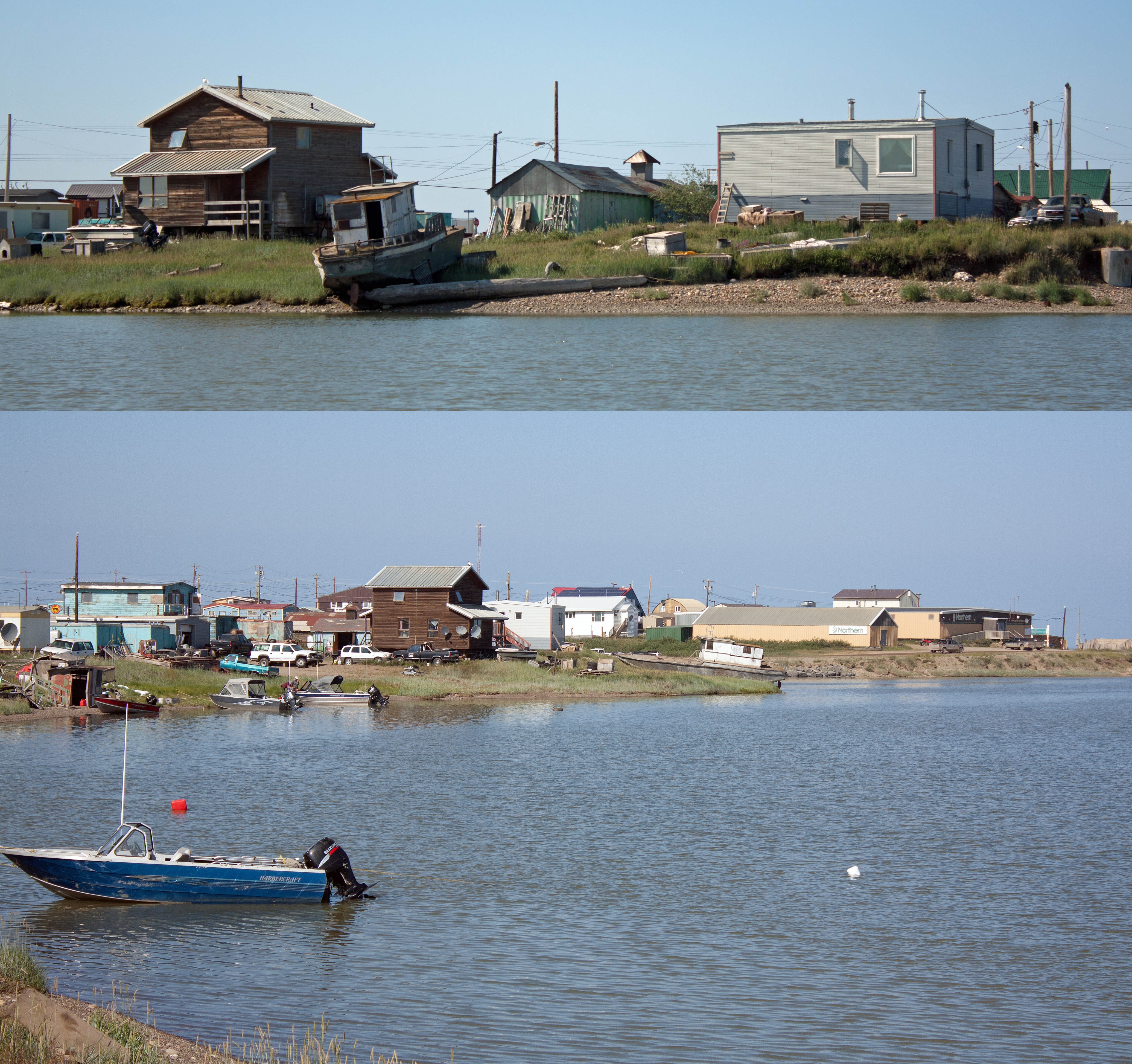
The sleepy village of Tuktoyaktuk on the Arctic Ocean, NWT (photos by Nina Munteanu)
.
A few years ago, I travelled to the village Tuktoyaktuk in the Northwest Territories on the Arctic Ocean. I was researching my upcoming eco-fiction book Thalweg with Inanna Publications (scheduled for release in early 2027). I drove with my friend Anne Voute; we rented a Dodge Dakota truck and drove the Dempster Highway north from Inuvik and the recently completed NWT Highway 10 (completed in 2017), which provides the remaining 140 km stretch to the Arctic Ocean.
.
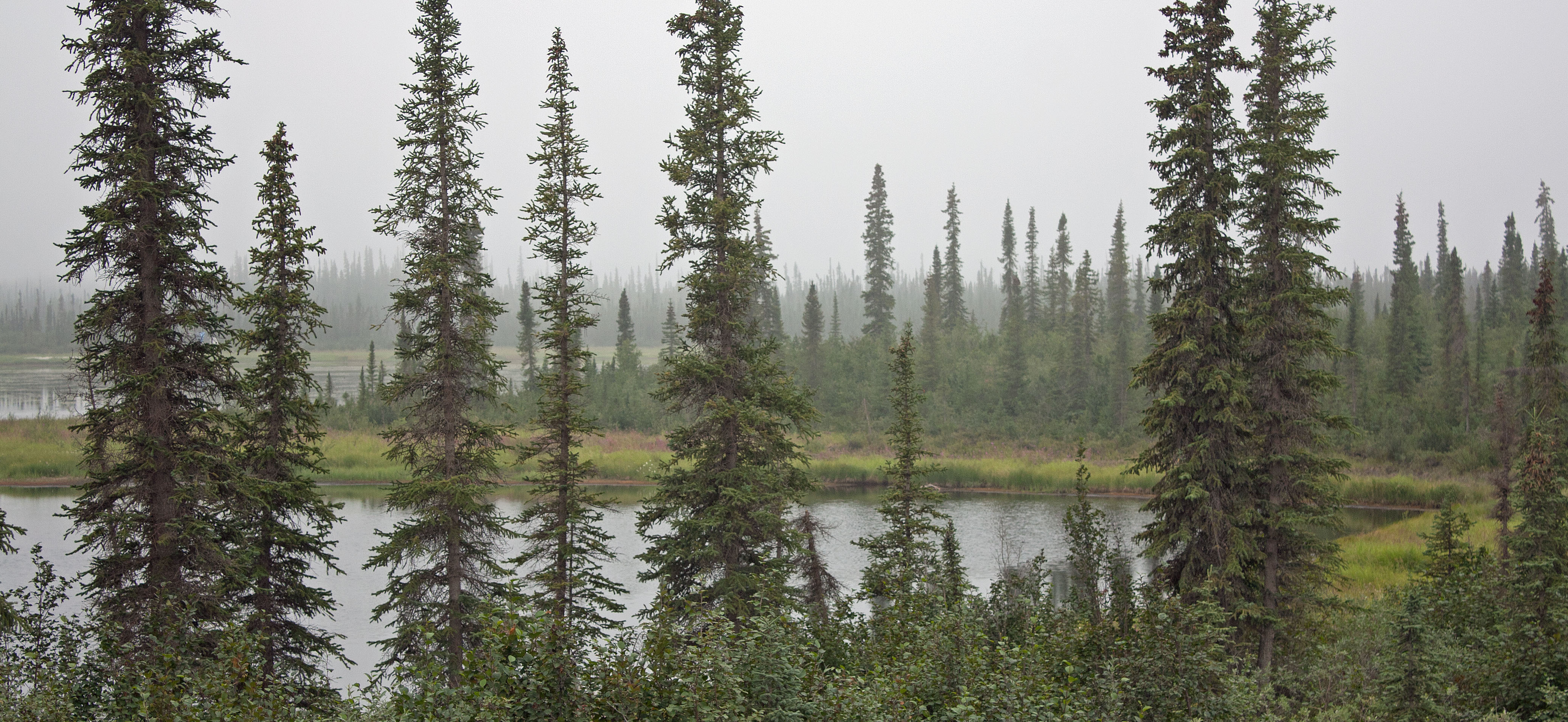
Black spruce forest along the Dempster Highway north of Fort McPherson, NWT (photo by Nina Munteanu)
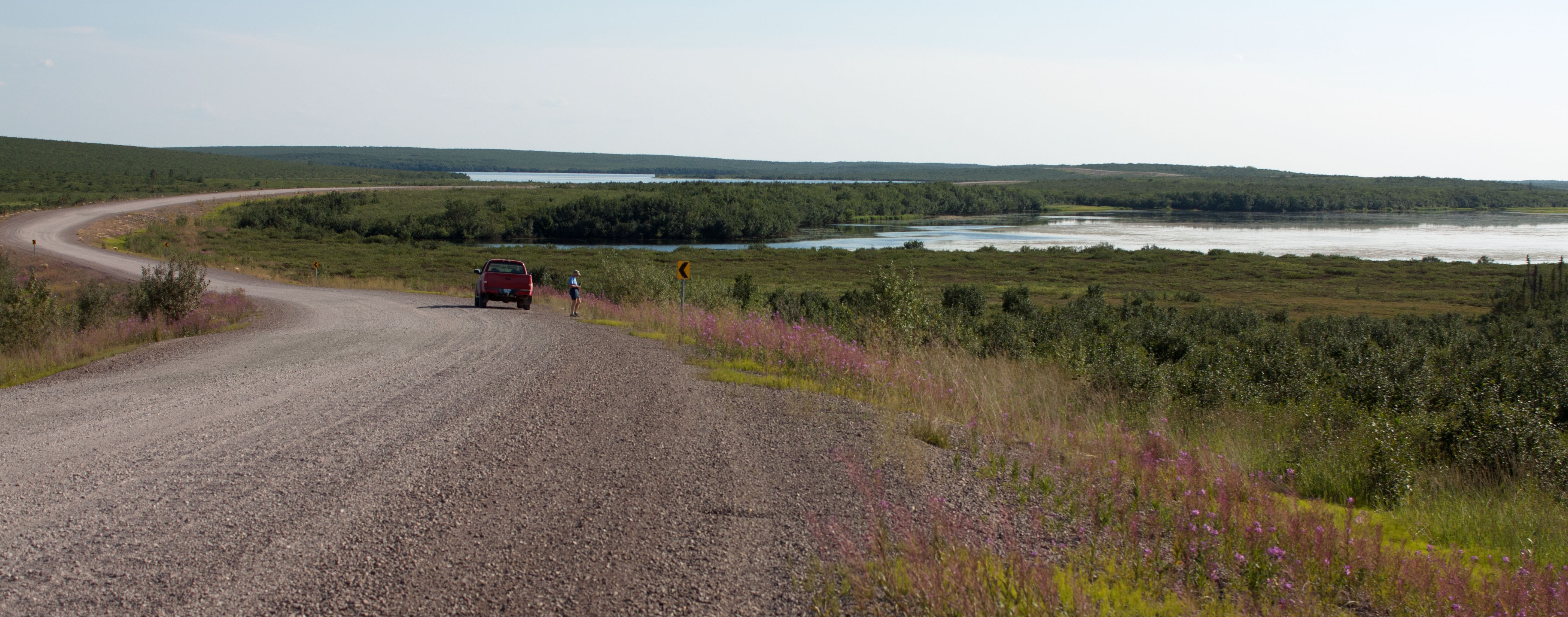
Highway 10 to Tuk winds through the tundra and Husky Lakes, NWT (photo by Nina Munteanu)
.
In Thalweg, main character Bobby-Jo is a Gwich’in limnologist who grew up in Fort McPherson in the Arctic Circle, land of permafrost.
.
Poster Child of Permafrost
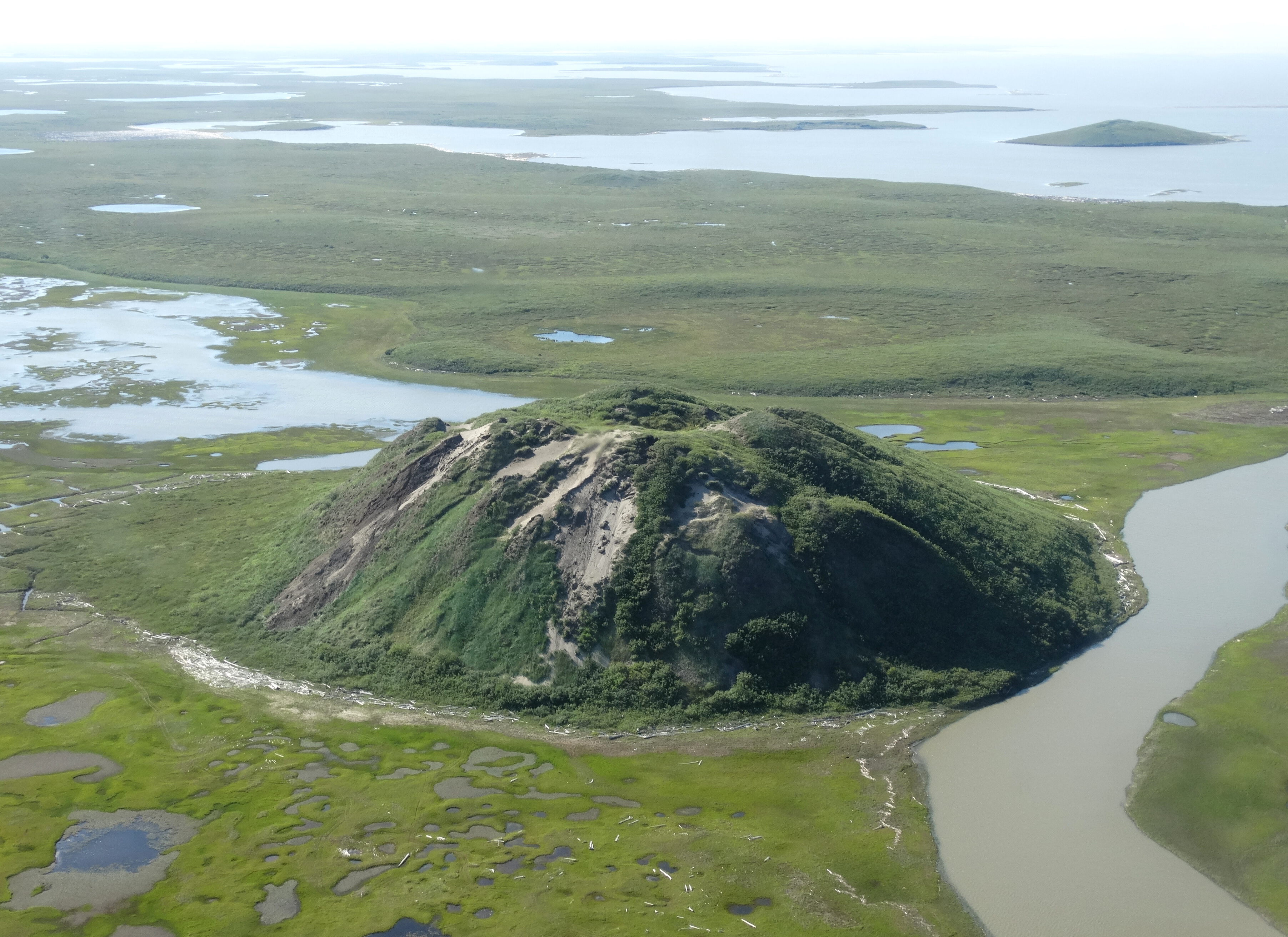
Ibyuk Pingo, near Tuk, NWT (photo shot from Cessna 172 by Adam Jones, 2013; Wikipedia Commons)
.
The poster child of permafrost is the conical ice-cored pingo, common in the Pleistocene Coastal Plain. Pingo is an Inuit word that means conical hill.
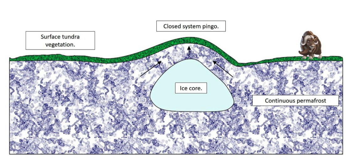
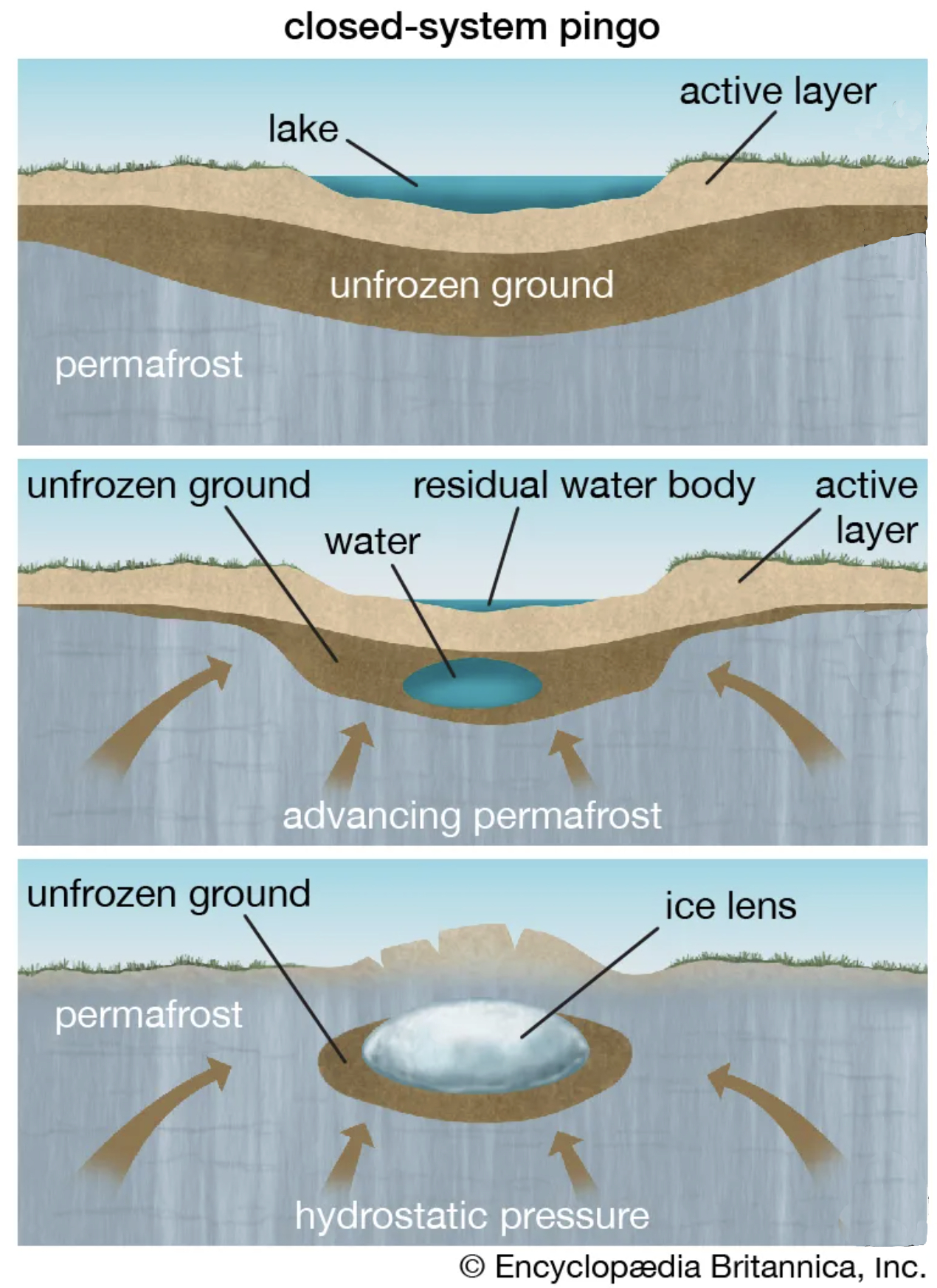
Pingos form when a mass of water is trapped beneath permafrost under pressure. Also called hydrolaccoliths, these huge mounds of earth with ice cores can reach up to 70 meters in height and 600 meters in diameter. Pingos usually grow a few centimeters a year, with the largest having taken decades or even centuries to form. Pingos eventually break down and collapse. They collapse when the ice core melts. This may happen when cracks form on the sides of the pingo that may reach down as far as the ice core, exposing the ice to warm air and sunlight. Once the core completely thaws, what remains is a doughnut-shaped ring of raised tundra enclosing a small round lake. Evidence of collapsed pingos in an area suggests that there was once permafrost there.
Hydrostatic (closed-system) Pingo (illustration by E. Ginn, 2021)
Development of closed-system pingo (illustration by Encyclopedia Brittanica)
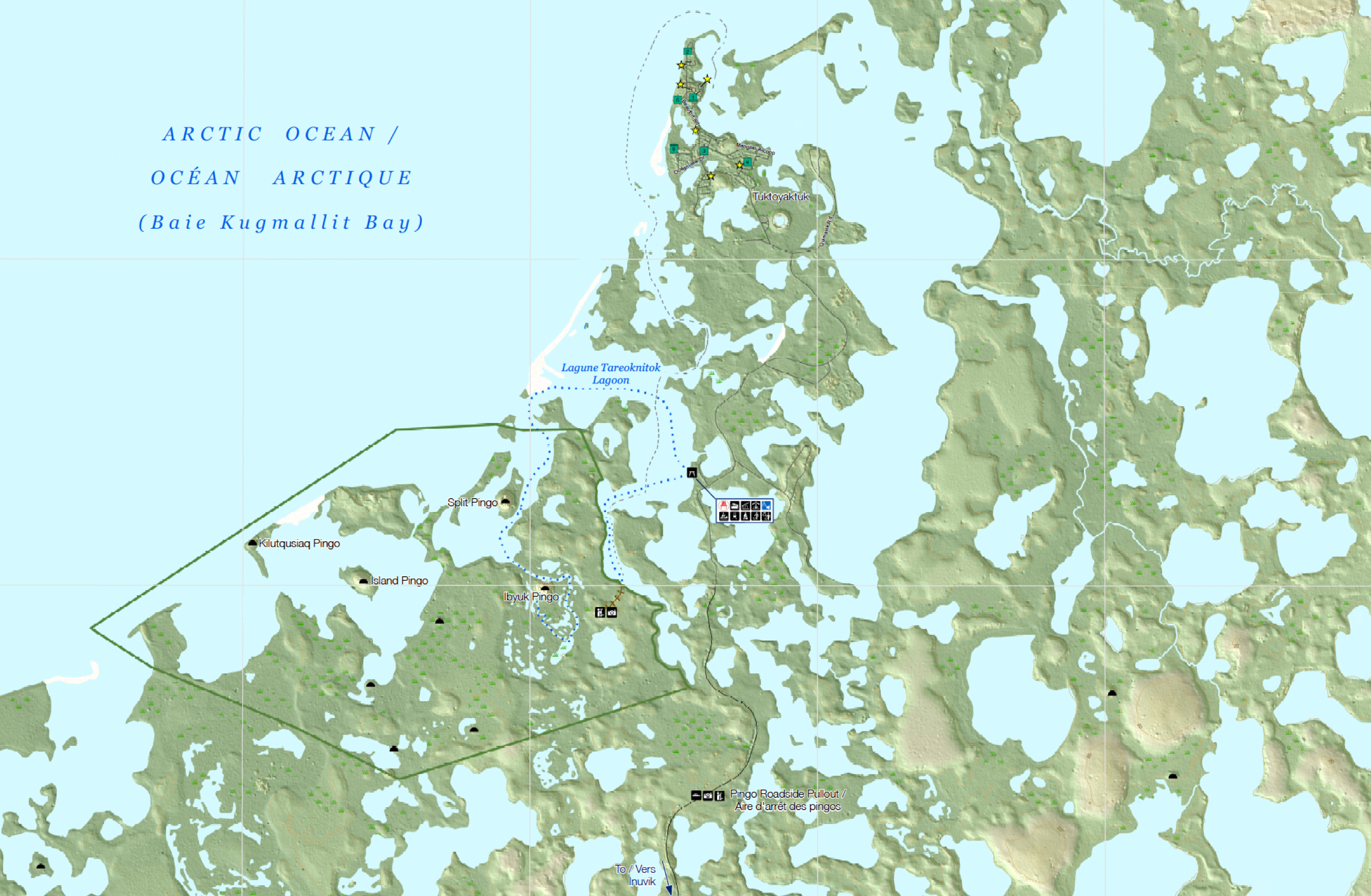
Map of major pingos in the Tuk area, NWT (pingos marked with black semi-circle)
.
One quarter of the world’s pingos, more than fourteen hundred of them, are in the Tuktoyaktuk Peninsula, part of the Mackenzie Delta of the Northwest Territories of Canada. The Inuvialuit and their Thule ancestors used these cone-like hills as navigational landmarks or lookouts when looking for caribou or whales. Hunters also used hollow pingos to freeze meat.
.
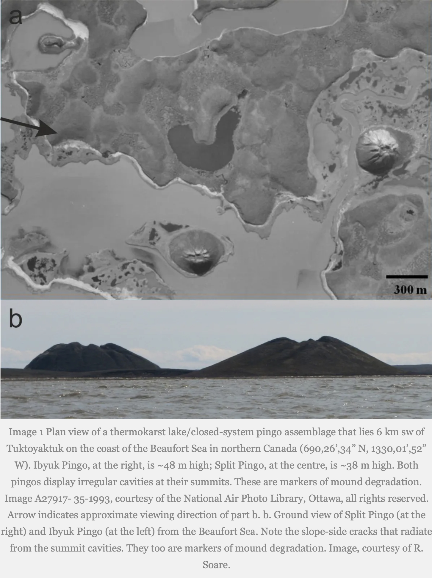
Ibyuk and Split Pingos (photos by National Air Photo Library, Ottawa)
.
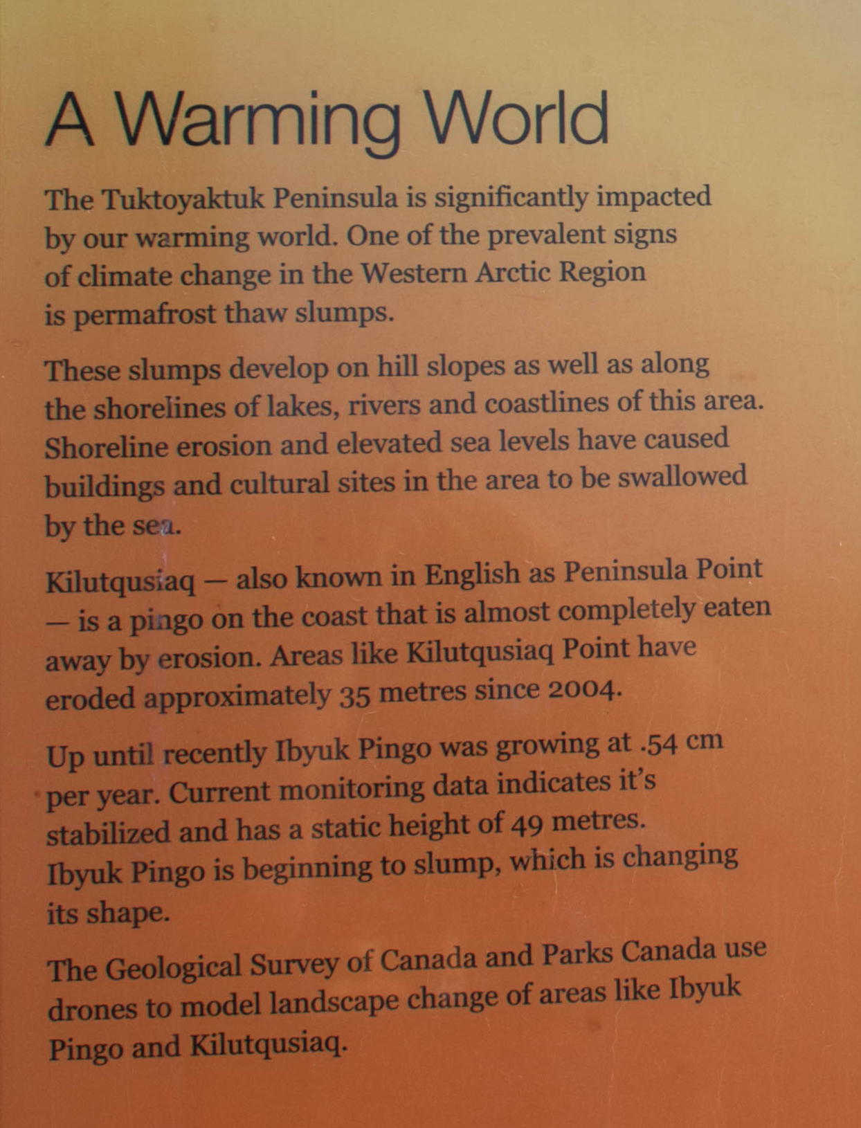
Pingo National Landmark protects eight pingos with the most famous being Ibyuk and Split. Ibyuk is about 50 meters high; it is the tallest pingo in Canada and the second tallest in the world and estimated to be more than 1,000 years old. It is also the world’s largest growing pingo, up to recently growing at a rate of about half a centimeter per year. With ongoing climate change, this is also changing. A local information sign in Tuk mentioned that Ibyuk Pingo has stopped growing and is beginning to slump, which is changing its shape. Kilutqusiaq—Peninsula Point—is a pingo on the coast that is almost completely eaten away by erosion: having eroded about 35 metres since 2004.
.
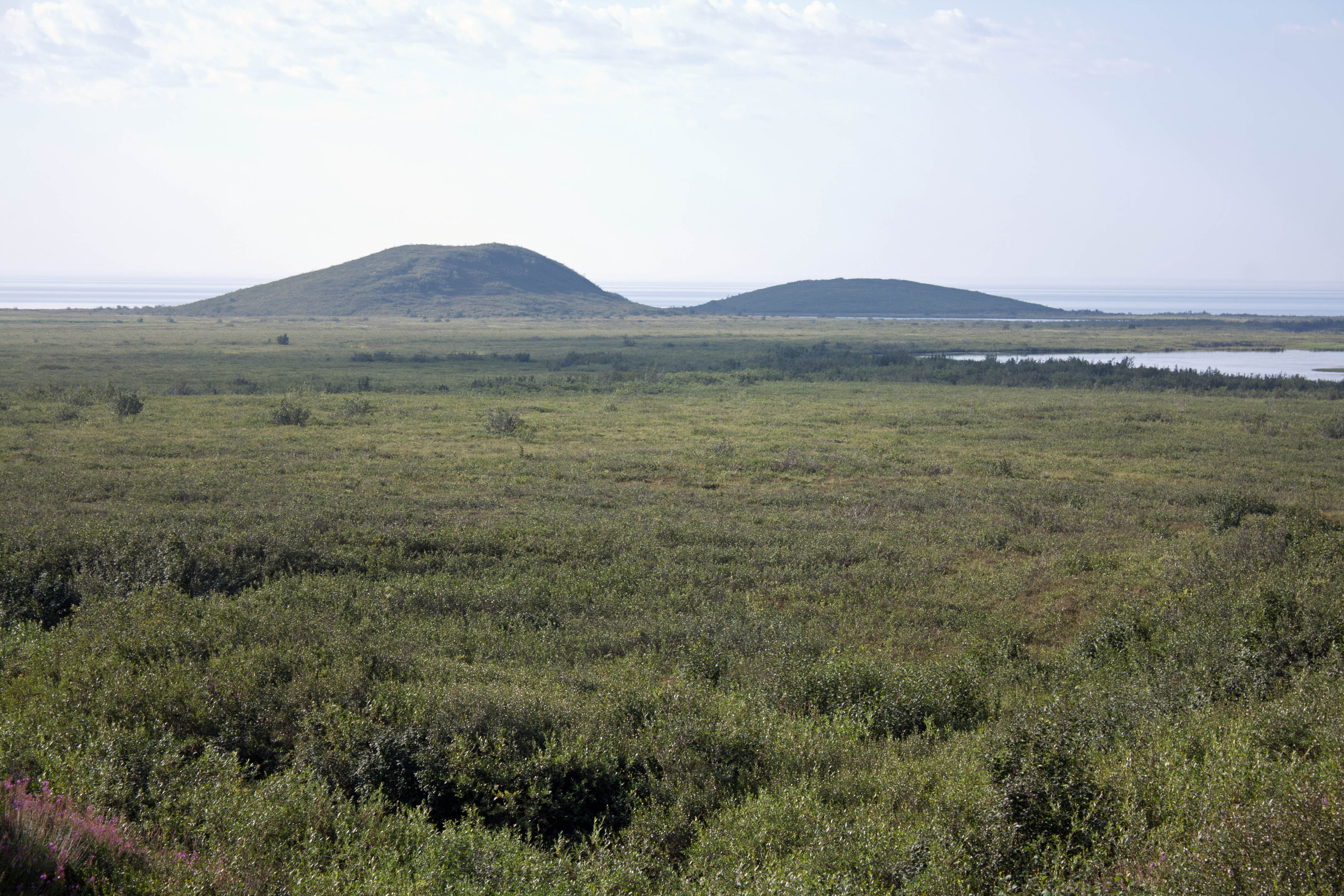
Pingos viewed across tundra near Tuk, NWT (photo by Nina Munteanu)
.
Climate change in the Arctic has caused some permafrost thaw slumps on lake shores, rivers and coastlines; shoreline erosion and sea level rise has swallowed buildings and cultural sites in the Tuk area. Kilutqusiaq—Peninsula Point—is a pingo on the coast that is almost completely eaten away by erosion: having eroded about 35 metres since 2004.
.
Tuk sign on warming climate impact on pingos
.
In the time of my novel Thalweg—2050s—hundreds of pingos near Tuktoyaktuk are caving in and forming circular ponds due to climate change. Giant ice-pimples are exploding as methane-rich gas hydrates decompose and form pressure bombs of combustible methane. The subsidence creates huge sink holes as wide as a house and deeper than hell.
.
Thalweg
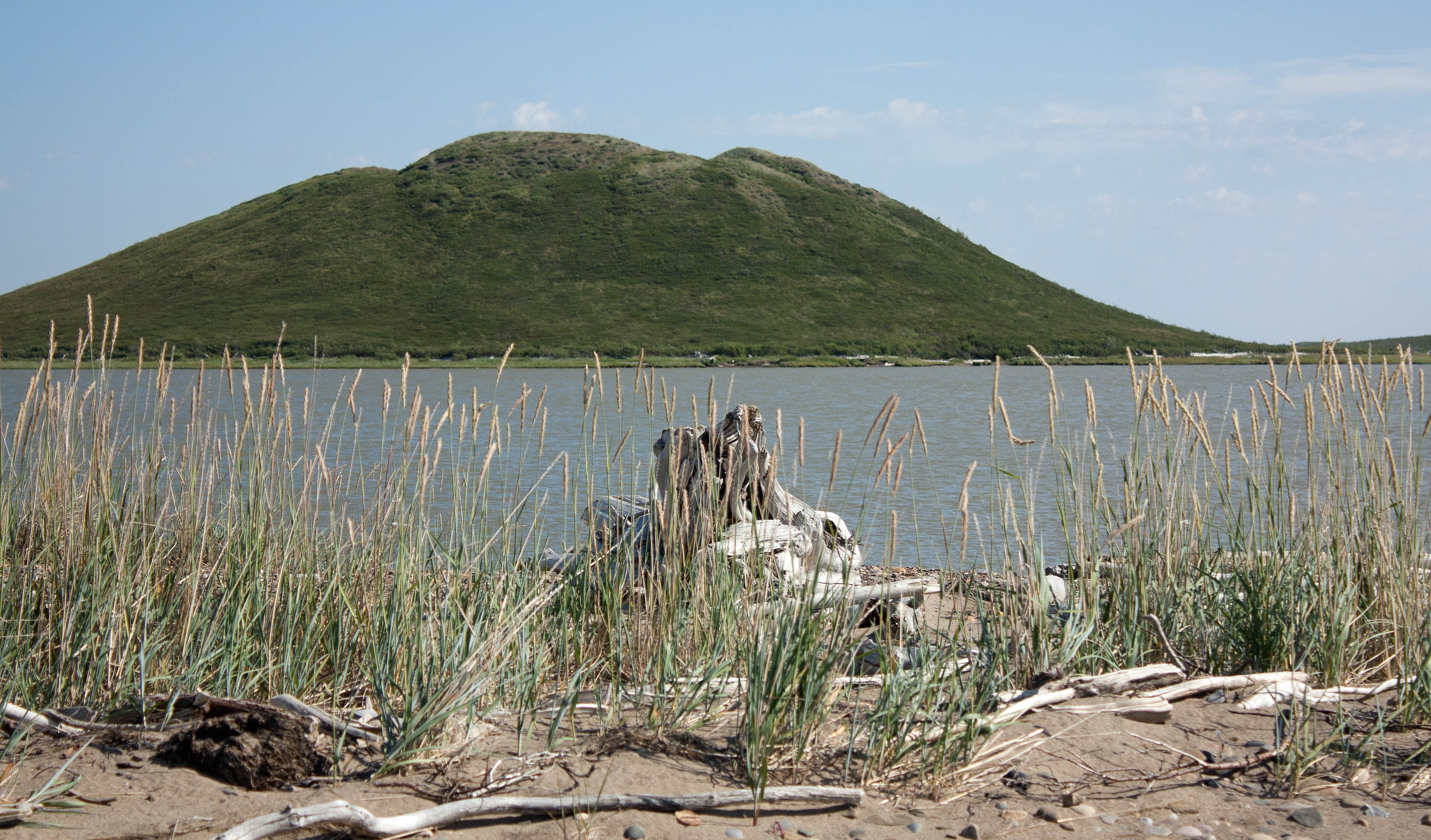
Ibyuk Pingo seen from nearby sandspit, NWT (photo by Nina Munteanu)
.
During her travels, Bobby-Jo thinks of her Inuvialuit friend Mary Steen in Tuk where giant pingos are thawing and exploding—thanks to climate change and permafrost thaw.
When we were kids, Mary took me up the Ibyuk Pingo, the giant cone mountain over a thousand years old. It’s the second highest in the world at forty-nine metres high and three hundred metres across and was still growing a few centimeters a year at its centre—despite the warming climate. Ibyuk is a hydrostatic pingo, which means it formed in an area of continuous permafrost and grew up from a large thermokarst lake. Expelled pore water from permafrost aggradation pushed up the old lake silts and sands from below, and the ice-mountain rose up like a giant frozen pimple above the ancient drained lake flats.
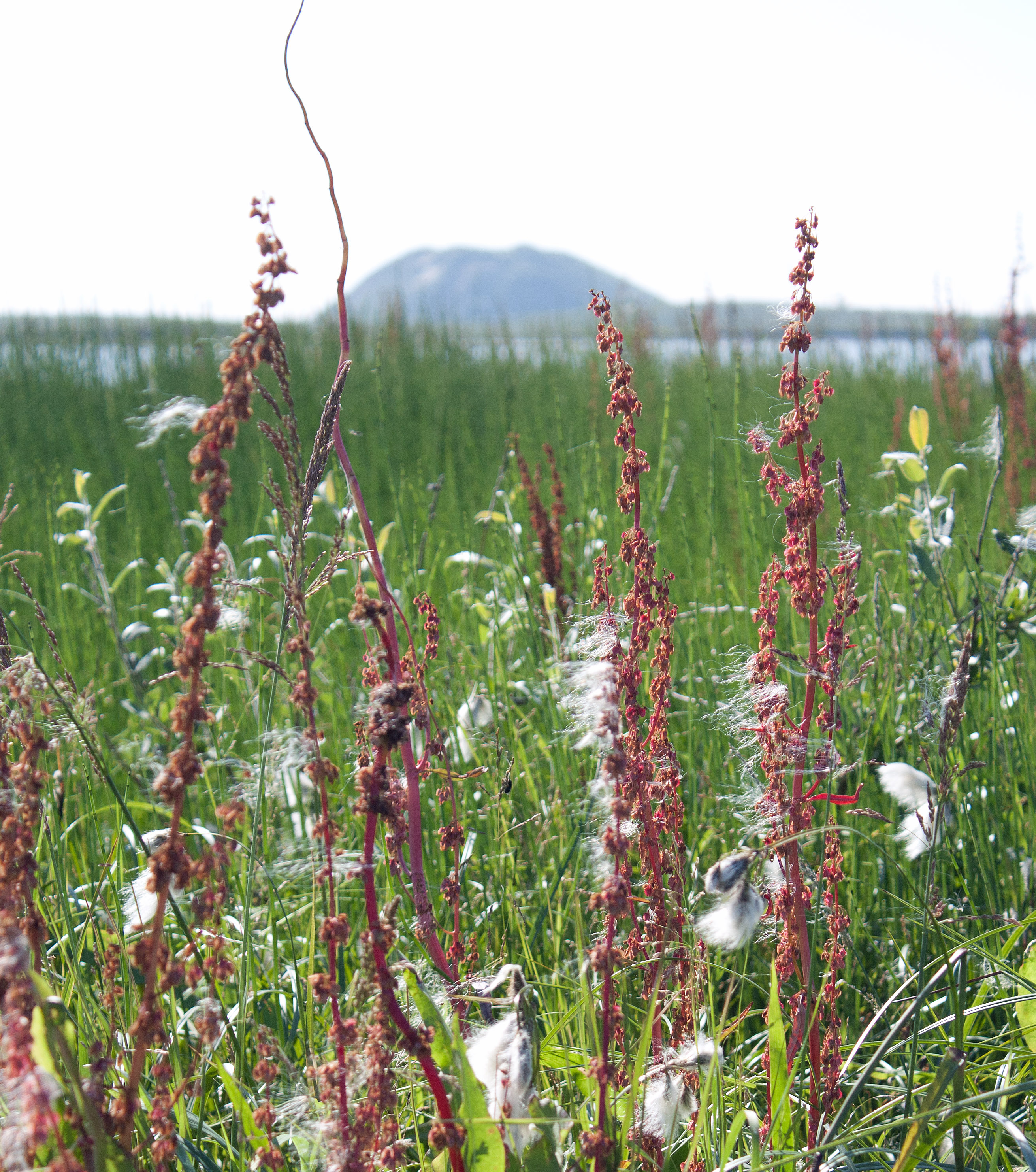
Ibyuk Pingo from a nearby spit of cottongrass and marsh grass, NWT (photo by Nina Munteanu)
.
We shouldn’t have been there; regrowth from trampling is extremely slow, often taking over half a century. The tundra moss, lichen, shrubs and krummholtz help insulate the pingo against ice core melting. When the ice core of the ice-cone is exposed, particularly if the vegetation blanket has broken open by dilation cracks or through erosion, the ice thaws and the mountain eventually collapses. During our climb, Mary and I noticed deep furrows in the vegetated soil layer. They cut down the slope as if a giant bear had clawed it and revealed the pingo’s icy sores.
When Mary and I returned to Tuk from our adventure, she got into trouble with her parents; someone had spotted us climbing the ice mountain and told them. I got a lecture and Mary was grounded for a week.
Because I was visiting, I was grounded alongside her. Pingos are living things, her parents told us sternly. They breathe, they grow, they shrink, they ebb and flow like water; they pulsate vertically. And we’d been in great danger. The Ibyuk Pingo was unstable—not just from a warming climate but from yahoos sliding down its steep sandy slopes and kids climbing where they shouldn’t. Did we know that the depth to its ice crust under the crater pond was shallow and fragile? When we were at the summit, the crater could have collapsed with sudden drainage of the pond and we would have disappeared in a roiling black sink hole!
When I last spoke with Mary five months ago, she told me that the area was starting to look like a moonscape, with craters everywhere. I thought of our little adventure on Ibyuk and decided that my analogy of a pimple or boil was appropriate given that pingos ruptured and flung their icy guts outward with explosive force. Mary admitted in a voice trembling with emotion that Ibyuk, the giant pingo we’d hiked up, had finally collapsed from massive coastal erosion and sea level rise. But not before it exploded.
.
.
Thalweg releases with Inanna Publications in Spring 2027.
.
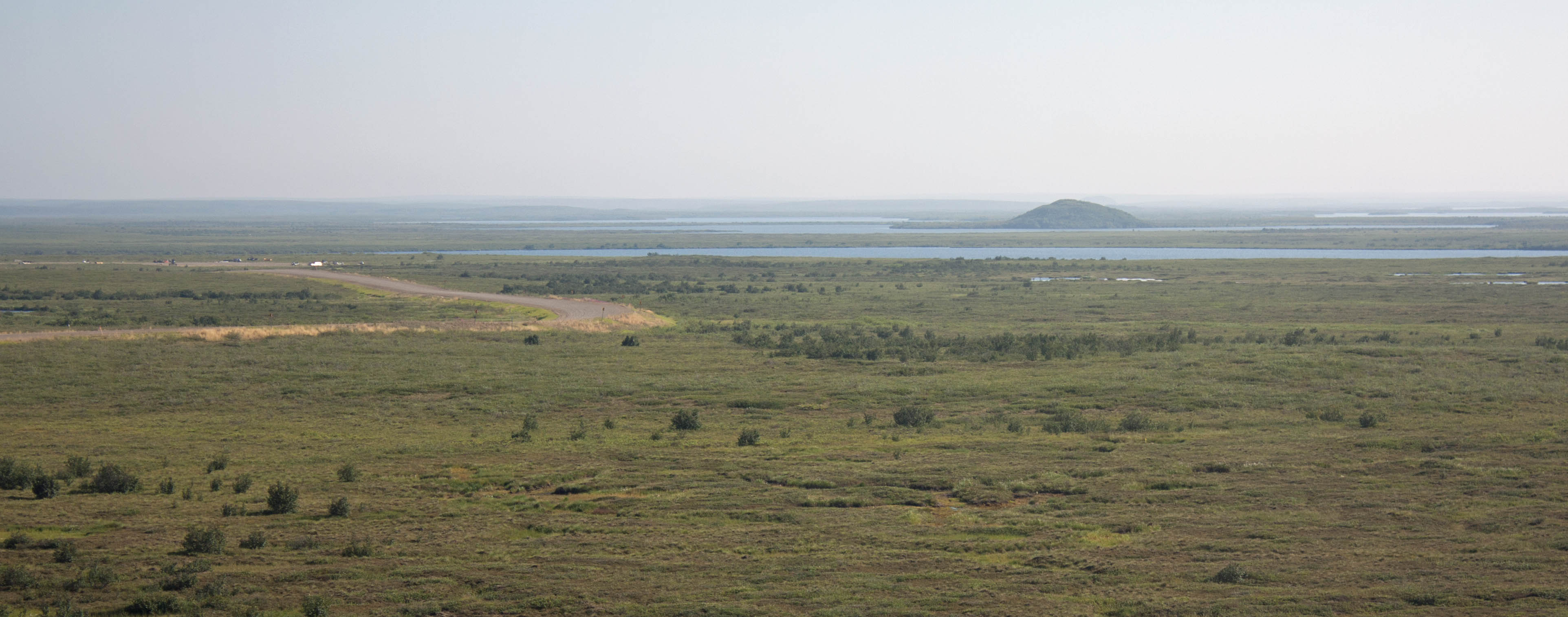
Road through tundra to Tuk with pingo in background, NWT (photo by Nina Munteanu)
.
Glossary:
Pingo: A dome-shaped mound consisting of a layer of soil over a large core of ice in a permafrost area. Pingos form when a mass of water is trapped beneath permafrost (ground that is frozen for at least two years) under cryostatic or hydraulic pressure. One quarter of the world’s pingos are in the Tuktoyaktuk peninsula, more than fourteen hundred. Most are closed-system hydrostatic pingos, pingos formed in an area of continuous permafrost from pore water expulsion caused by permafrost aggradation at the bottom of a drained lake.
Permafrost Degradation: A naturally or artificially caused decrease in the thickness and areal extent of permafrost (Jorgenson, 2013). Widespread degradation of near-surface permafrost (40-80%) is projected by 2100 (Abbott & Jones, 2015). Release of greenhouse gases from thawing permafrost is likely the largest terrestrial feedback to climate change and one of the most likely to occur (Abbott & Jones, 2015). Degradation of permafrost soils can lead to the collapse, drainage and disappearance of water bodies (Vincent et. al., 2011). Jorgenson categorized twenty-three types of permafrost degradation based on dominant ice type, hydrologic regime, heat source and mass transfer.
.
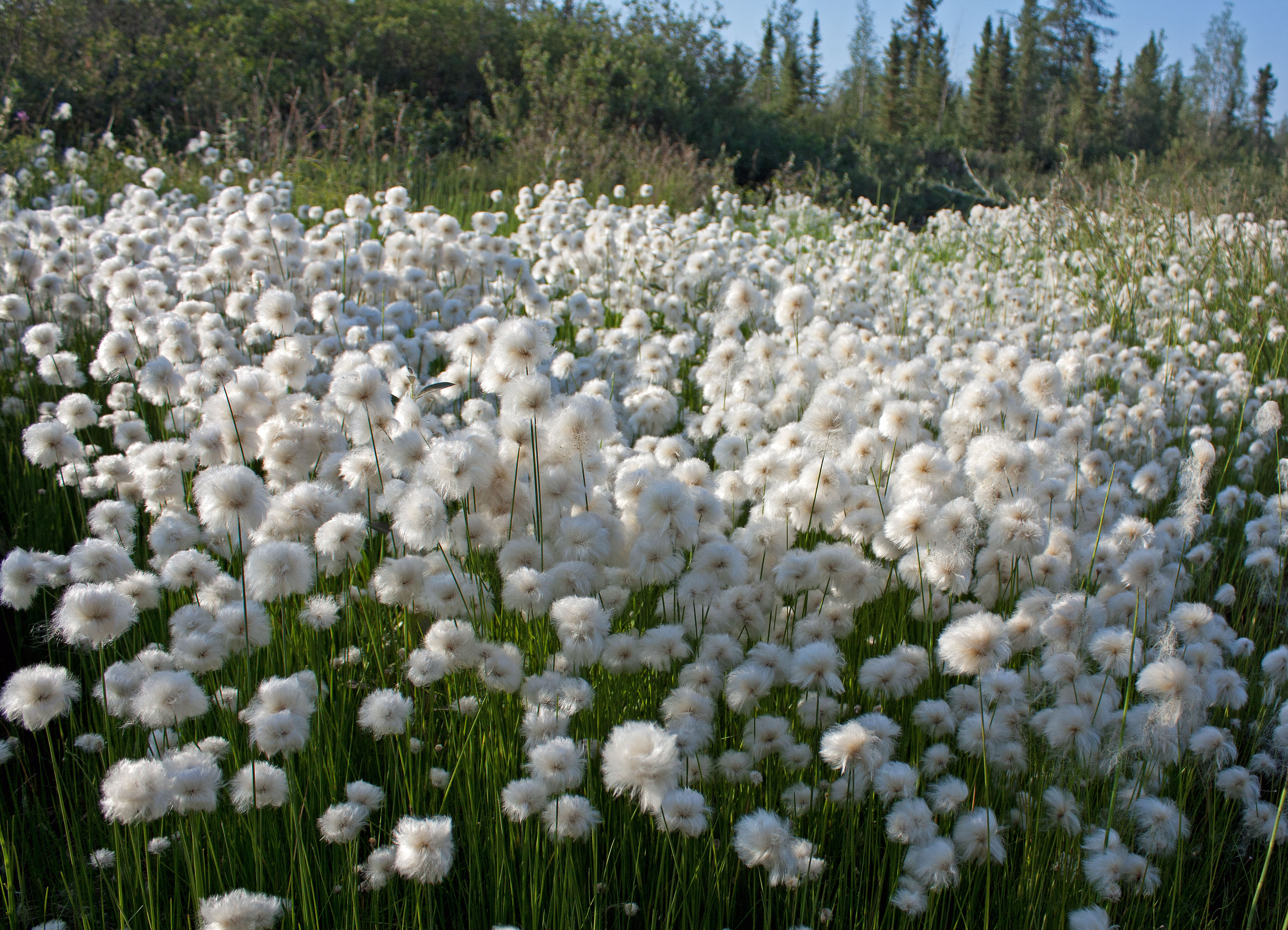
Cottongrass field with black spruce behind, off the Tuk highway, NWT (photo by Nina Munteanu)
.
References:
Abbot, Benjamin W. and Jeremy B. Jones. 2015. “Permafrost collapse alters soil carbon stocks, respiration, CH4, and N2O in upland tundra.” Global Change Biology 21: 4570-4587.
Jorgenson, M.T. and T.F. Osterkamp. 2005. “Response of boreal ecosystems to varying modes of permafrost degradation.” Can. J. For. Res. 35: 2100-2111.
Jorgenson, M.T. 2013. “Thermokarst Terrains.” In: John F. Shroder (Editor-in-chief), Giardino, R., and Harbor, J. (Volume Editors). Treatise on Geomorphology, Vol 8, Glacial and Periglacial Geomorphology, San Diego. Academic Press. pp. 313-324.
Harris, S.A.., French, H.M., Heginbottom, J.A.., Johnston, G.H., Ladanyi, B., Sego, D.C., van Everdingen, R.O., (eds.). 1988. “Glossary of permafrost and related ground-ice terms.” Technical Memorandum 142, Permafrost Subcommittee, National Research Council of Canada.
Mackay, J.R. 1998. “Pingo growth and collapse, Tuktoyaktuk peninsula area, western Arctic coast, Canada: a long-term field study.” Geographie Physique Quaternaire 52(3): 1-53.
Munteanu, Nina. 2027 (upcoming release; in press). “Thalweg.” Inanna Publications, Toronto, ON.
Vincent, Warwick F., et.al. 2011. “Ecological Implications of Changes in the Arctic Cryosphere.” Ambio 30: 87-99.
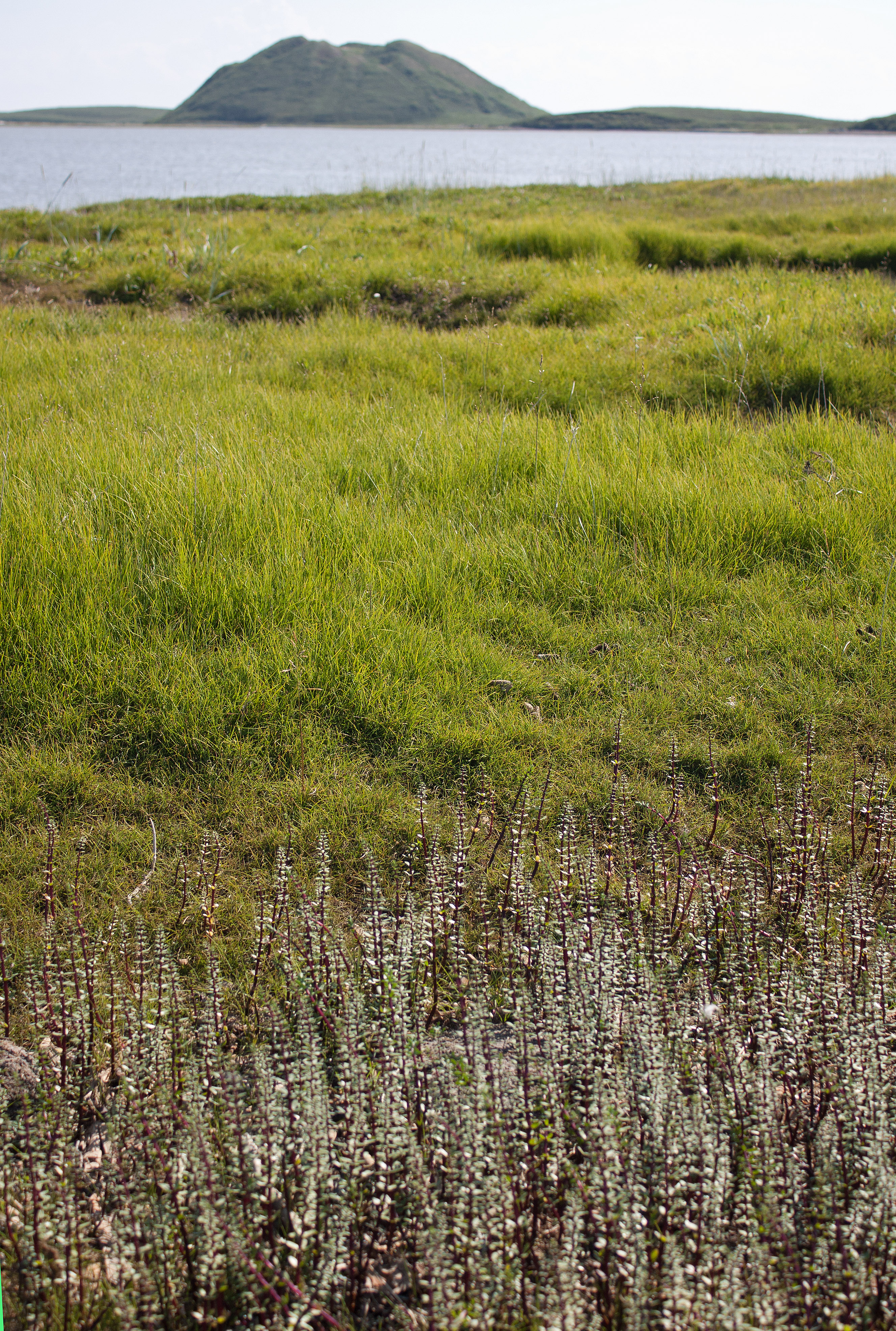
Ibyuk Pingo seen from nearby grass-covered sandspit, NWT (photo by Nina Munteanu
.
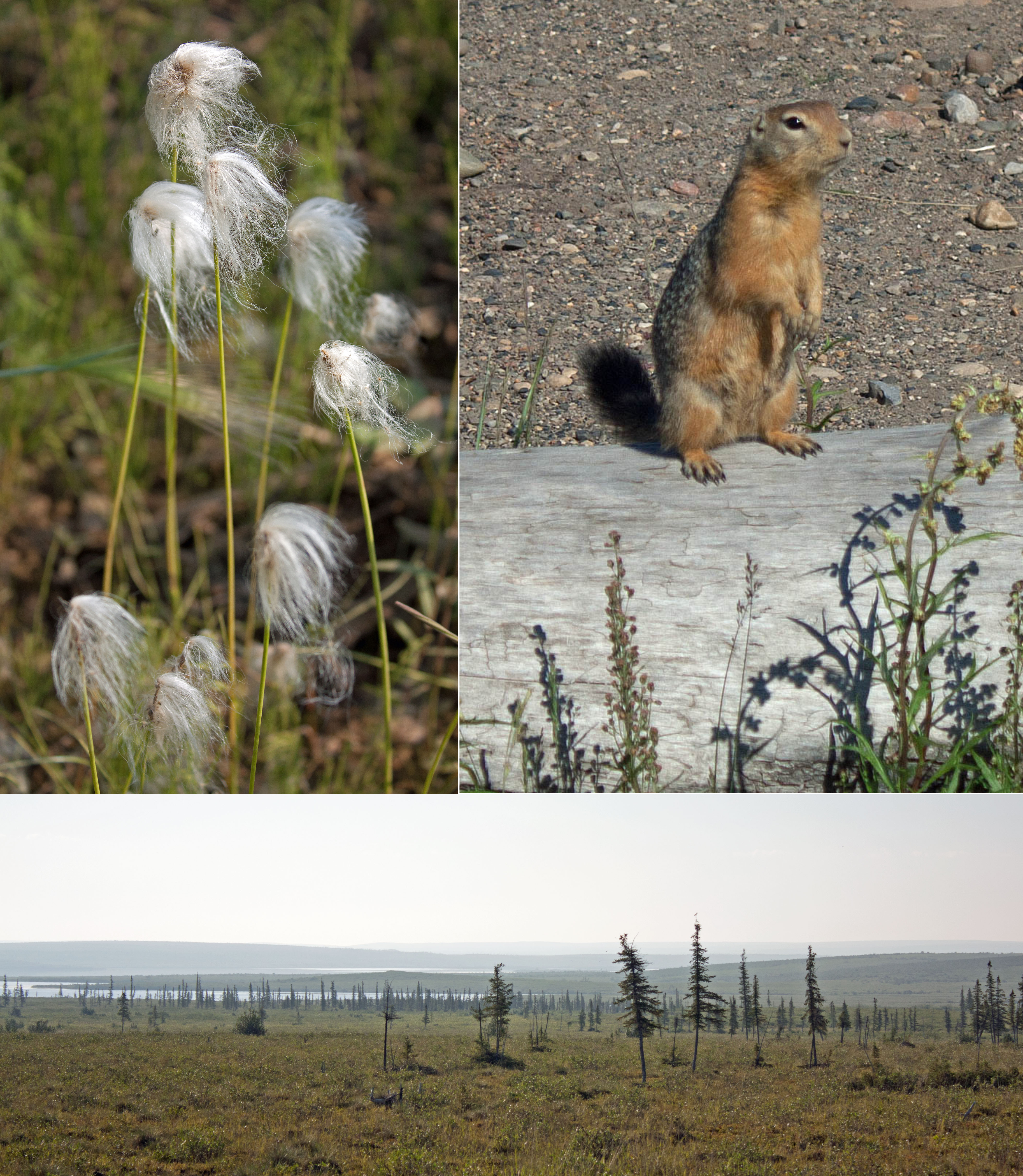
Scenes from in and near Tuk: top left, cottongrass; top right, ground squirrel; bottom, tundra scattered with spruce trees along Highway 10, NWT (photos by Nina Munteanu)
.
Nina Munteanu is a Canadian ecologist / limnologist and novelist. She is co-editor of Europa SF and currently teaches writing courses at George Brown College and the University of Toronto. For the lates on her books, visit www.ninamunteanu.ca. Nina’s bilingual “La natura dell’acqua / The Way of Water” was published by Mincione Edizioni in Rome. Her non-fiction book “Water Is…” by Pixl Press (Vancouver) was selected by Margaret Atwood in the New York Times ‘Year in Reading’ and was chosen as the 2017 Summer Read by Water Canada. Her novel “A Diary in the Age of Water” was released by Inanna Publications (Toronto) in June 2020.You can read her just released eco-fiction thriller Gaia’s Revolution by Dragon Moon Press.
Ice and snow cover the Otonabee River in winter, ON (photo and rendition by Nina Munteanu)
In my upcoming novel “Gaia’s Revolution,” one of the protagonists, Damien Vogel, contemplates in 2022 a key event from 2020 that only a few seem to take seriously:
In Siberia in June 2020, record heat of thirty degrees Centigrade, over the average of 11 degrees, collapsed permafrost and caused oil tanks in Norilsk to rupture. Over twenty thousand tonnes of diesel spilled into the Pyasina lake and river system. Damien remembers looking at the veins of red on satellite images from space. That disaster is just the beginning of what the ‘sleeping bear’ of methane hydrates promise to unleash when the permafrost reaches a critical thaw and those hydrates awaken. Melting permafrost is a quiet sleeper in the climate change procession, he considers. At a microscopic level, in the chemistry of the water and in the change in the atmosphere, a time bomb is ticking.
A decade later, Damien’s twin brother, Eric, notes that:
“Back in the ‘20s scientists started noticing major permafrost melt on the Siberian Shelf,” Eric goes on. “The melting released hydrates, which set the oil and gas companies frothing at the mouth with joy and the climate scientists spinning in a panic because of what they knew it meant for the planet. It was the harbinger of the largest methane ‘burp’ ever.”
Eric then adds:
“Permafrost thaw kicked us into this devastating global warming, Dame, and everyone—even the climate modellers—ignored it, because they didn’t have enough data. Gottverdammt! They’re all still asleep, Dame!”
In his book The Treeline, Ben Rawlence writes about the ongoing extinction of indigenous peoples in the north as the treeline migrates northward into tundra and the permafrost and sea ice change and go extinct themselves.
Ice fragments on the Otonabee River, ON (photo by Nina Munteanu)
Because methane is present in much smaller concentrations many scientists have mistakenly deemed it as important as carbon dioxide in the climate change equation; however, it is becoming obvious that methane poses a real and largely unacknowledged danger. Methane is twenty times more efficient in trapping heat than carbon dioxide. Permafrost—which is currently melting rapidly in the north—contains almost twice as much carbon as is currently in the atmosphere. In the rapidly warming Arctic (warming twice as fast as the globe as a whole), the upper layers of this frozen soil are thawing, allowing deposited organic material to decompose and release methane.
.
The clathrate gun hypothesis is the notion that sea temperature rises (and/or drops in sea levels) may trigger a catastrophic positive feedback on climate: warming would cause a sudden release of methane from methane clathrate (hydrate) compounds buried in seabeds, in the permafrost, and under ice sheets.
Something of this nature has already occurred in Siberia in 2020. In his book The Treeline Ben Rawlence reports the following warning by Dutch scientist Dr. Ko van Huissteden, a leading authority on permafrost:
“It is hard to measure methane release … [but] some studies have suggested that an unstable seabed could release a methane ‘burp’ of 500-5000 gigatonnes, equivalent to decades of greenhouse gas emissions, contributing to an abrupt jump in temperature that humans will be powerless to arrest.” (Wadhams, 2015)
Creation of gas hydrates requires high pressure; water; gas—mainly methane—and low temperatures. Three environments considered suitable for this process to occur include: sub-seabed along the world’s continental margins; permafrost areas on land and off shore; and a process for storing methane hydrates: ice sheets. As long as the climate is cold and the ice sheet stable, the gas hydrate zone remains stable. As the ice sheets melt, the pressure on the ground decreases; hydrates destabilize and release methane into rising seawater and finally into the atmosphere.
A recent study in Science revealed that hundreds of massive, kilometer-wide craters on the ocean floor in the Arctic were formed by substantial methane expulsions. Because methane is a powerful greenhouse gas, temperatures would rise exponentially. Once started, this runaway process could be as irreversible as the firing of a gun—and on a time scale less than a human lifetime.
The sudden release of large amounts of natural warming gas from methane clathrate deposits in runaway climate change could be a cause of past, future, and present climate changes.
Latest research on the Greenland ice sheet and elsewhere throughout the Arctic has revealed major methane discharges in Arctic lakes in areas of permafrost thaw. Scientists are exploring areas where methane is bubbling to the surface and releasing to the atmosphere.
If human emissions continue at their current rate, rapidly changing ocean currents and retreating ice sheets may uncork methane from under ice caps, ocean sediments and Arctic permafrost, causing a jump in radiative forcing. Even if rapid ice sheet disintegration were to scatter large amounts of ice into the oceans, the net cooling effect would be strongly countered and likely overwhelmed. The areas that did cool would likely trigger severe weather outbreaks.
As I write, we are pumping out CO2 into the atmosphere at a rate 10 times faster than at any point in the past 66 m years, with the resulting sea level rises, extreme weather events, heat waves, droughts, unseasonal storms, and stress on biodiversity around the globe. Research published in the journal Nature Geoscience demonstrates that “the world has entered ‘uncharted territory’ and that the consequences for life on land and in the oceans may be more severe than at any time since the extinction of the dinosaurs,” writes Damian Carrington of The Guardian.
In an interview with Guardian reporter John Abraham, Woods Hole expert Robert Max Holmes, exhorted:
It’s essential that policymakers begin to seriously consider the possibility of a substantial permafrost carbon feedback to global warming. If they don’t, I suspect that down the road we’ll all be looking at the 2°C threshold in our rear-view mirror.
Ice break up on the Otonabee River in early spring, ON (photo by Nina Munteanu)
Wadhams, Peter. 2015. “A Farewell to Ice.” Penguin.
Flowing water in a river, ON (photo by Nina Munteanu)
Nina Munteanu is a Canadian ecologist / limnologist and novelist. She is co-editor of Europa SF and currently teaches writing courses at George Brown College and the University of Toronto. Visit www.ninamunteanu.ca for the latest on her books. Nina’s bilingual “La natura dell’acqua / The Way of Water” was published by Mincione Edizioni in Rome. Her non-fiction book “Water Is…” by Pixl Press (Vancouver) was selected by Margaret Atwood in the New York Times ‘Year in Reading’ and was chosen as the 2017 Summer Read by Water Canada. Her novel “A Diary in the Age of Water” was released by Inanna Publications (Toronto) in June 2020.