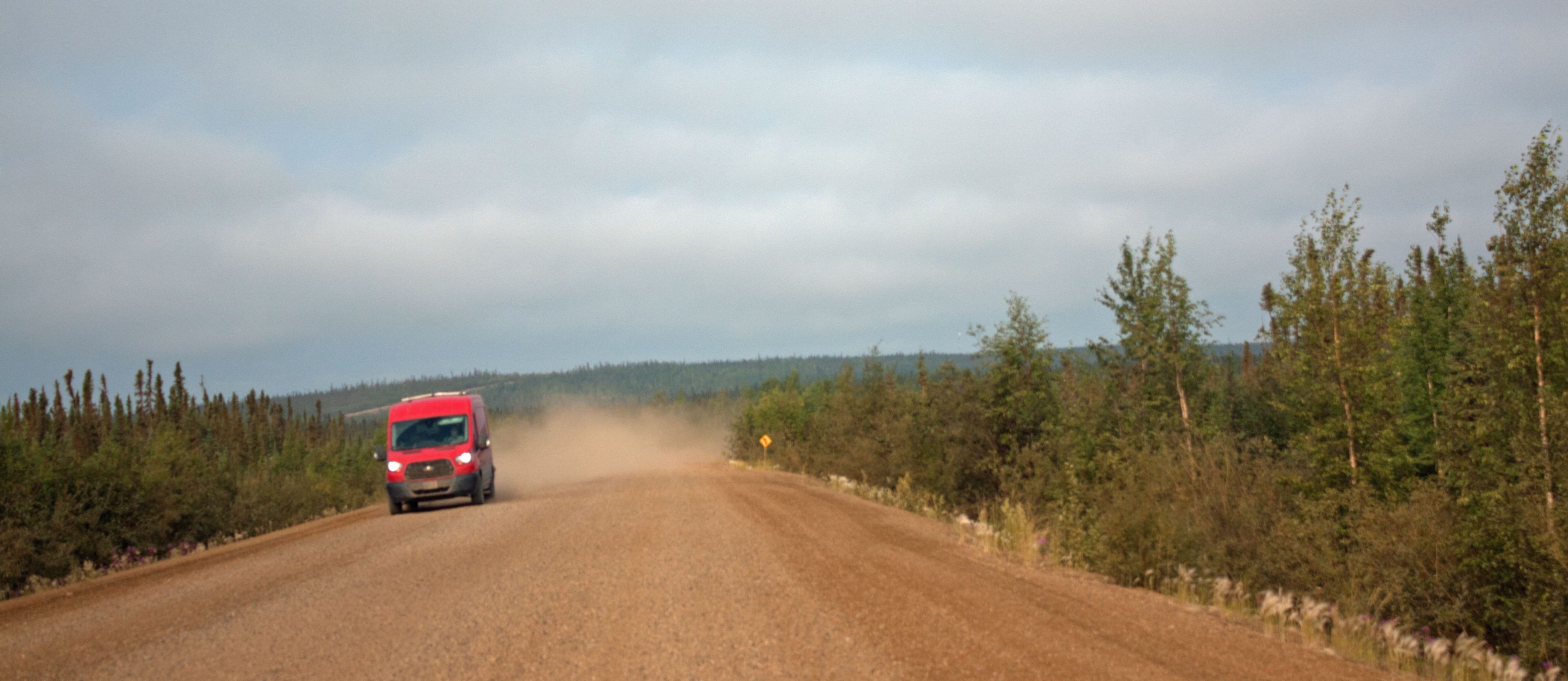
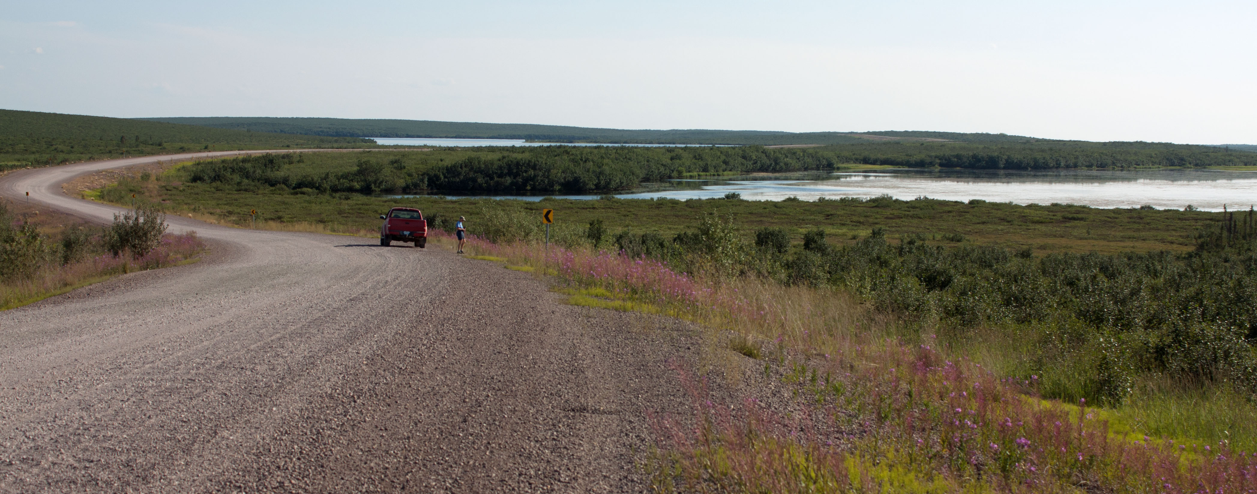
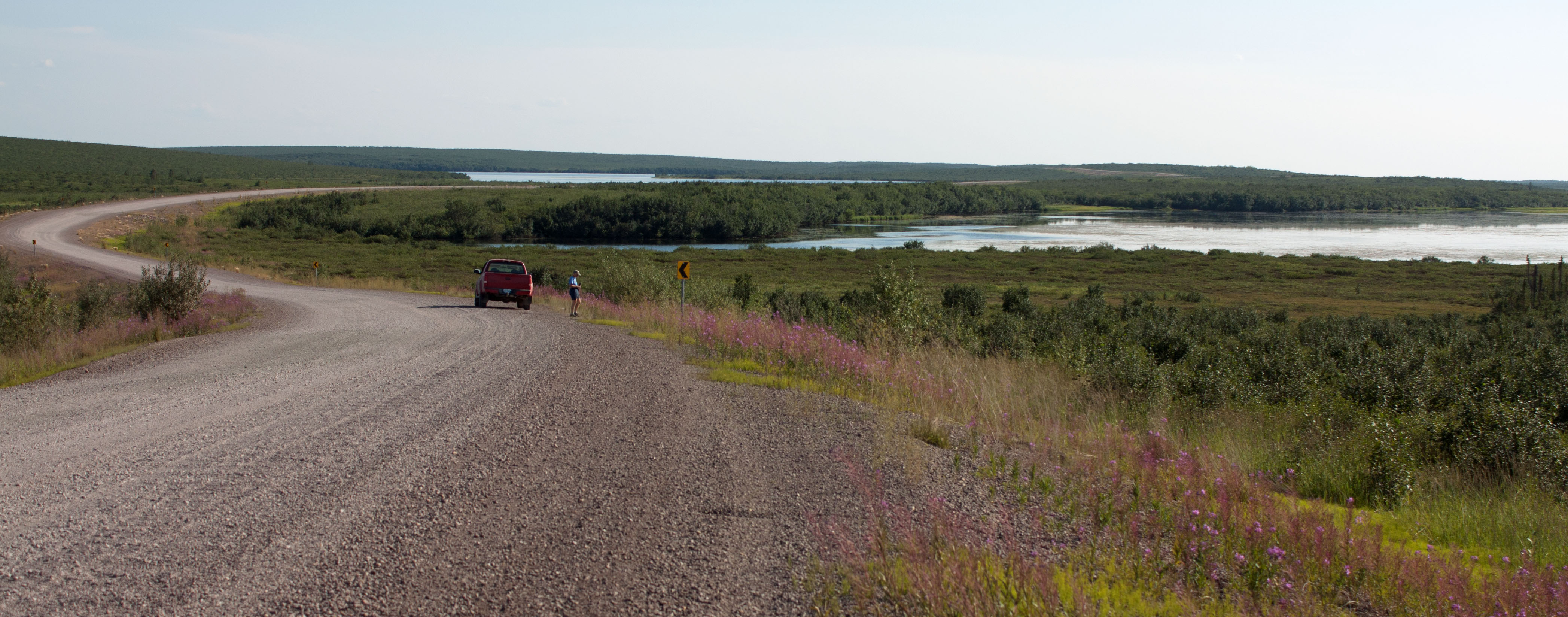
Dempster Highway, north of Fort McPherson, NWT (photo by NIna Munteanu)
.
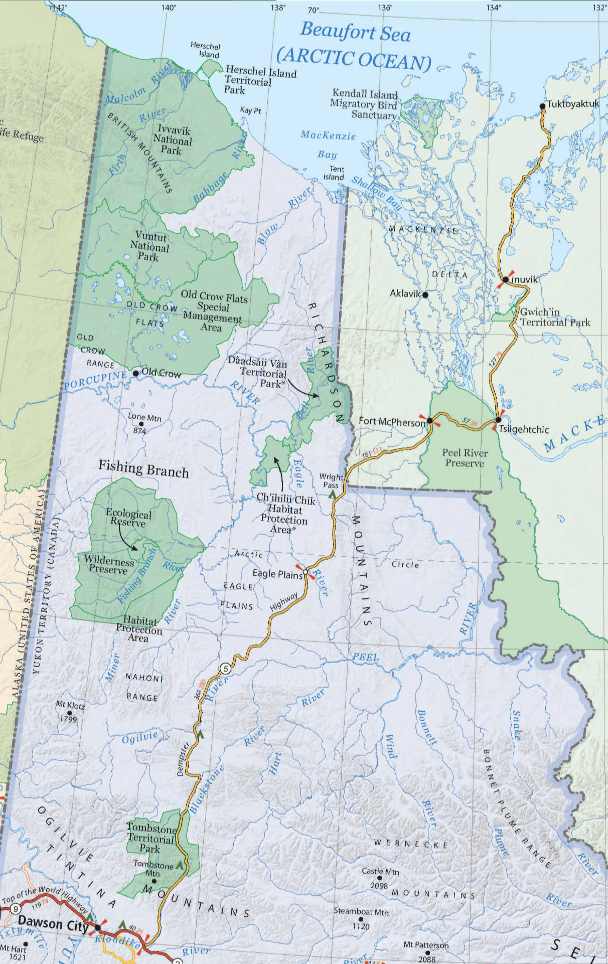
In my upcoming eco-fiction novel Thalweg, Gwich’in limnologist Bobby-Jo makes her way back home to Fort McPherson, NWT, after the sudden flood of the Peel River has all but destroyed her Arctic hometown. She starts in Dawson City and takes the challenging gravel Dempster Highway north.
The Dempster is renowned for its remote beauty and driving hazards. Drivers today are cautioned to take sufficient provisions, including a tire-fixing kit and spare tires. By the time Bobby-Jo is driving the Dempster in the 2050s, the permafrost is actively thawing. One of the characters describes it as: “a thin ribbon of shale and mud floating tenuously on an unstable sea of melting ice, slushy rock, and murky water.”
The Dempster is a temperamental gravel and shale road originally built in 1978 when explorers found oil and gas in the deep bedrock of Eagle Plains. The highway roughly follows Jack Dempster’s original trail that he learned from the Gwich’in and old dogsled routes. They used two-metre thick berms of gravel and shale to prevent the road from sinking into the ground; other materials would cause the permafrost to thaw and buckle the road, creating small lakes. When the uunjit discovered that the deposits weren’t large enough to exploit, the Dempster turned into a ghost road. The road to riches turned into the road to nowhere, abandoned to the rugged wilderness of mountains and tundra and the wildlife that inhabit it. The Dempster was left to itself and its people.
Below is a short excerpt of Bobby-Jo’s experience driving the Dempster north from Dawson City:
On a cloudy morning in late August, I drove the North Klondike Highway and turned north on the Dempster as it started to rain. After a few kilometres, the cracked pavement gave way to loose gravel. The car slid along the slick mud like a sled on snow.
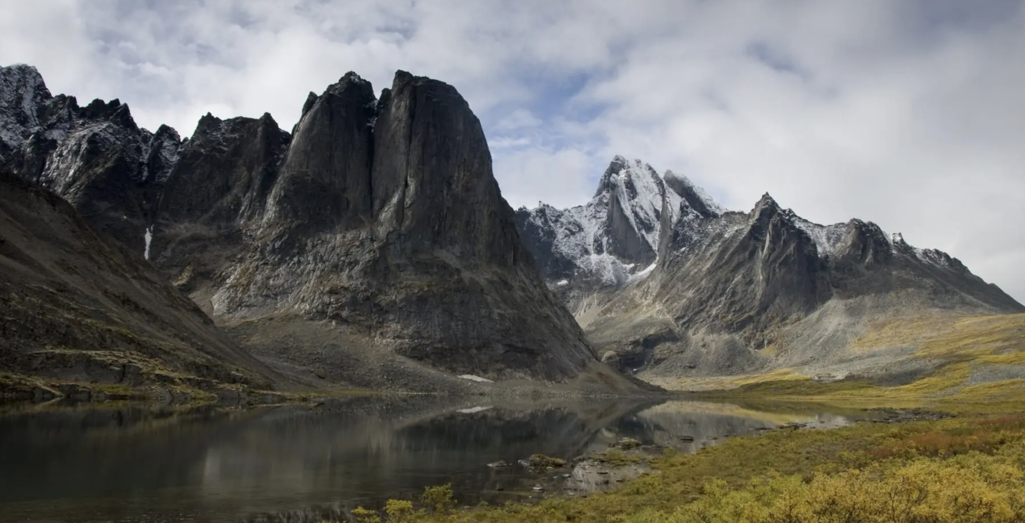
The first stretch of the Dempster followed a wide valley of moraines fed by glaciers in the high granite peaks of the southern Ogilvie Mountains. In Tombstone Territorial Park I stopped the car and stepped out into the cold breeze to rest my eyes on the bald sheer towering rock that rose out of a broad sloping alpine valley with peaks sharp enough to cut the sky like a knife.
Gold, russet, gray-green, stunning yellow and purple carpeted the valley floor with impressionistic swirls of lichen, alpine shrubs, cotton grass and blazing fireweed. Dark flecks of stunted spruce trees and dwarf birch and willow added contrast. A fine mist flowed and pooled in the depressions of the lower slopes.
I breathed in the freshness of sub-arctic air and moist earth. It had stopped raining, but the moisture that clung to the air brought out an incredible richness of fragrances, an aria of sweet floral scents mixed with earth and tree pitch. It smelled like home. I inhaled slowly and deeply, filling my lungs with ancestral energy. It resonated deep inside me where this place lay embedded in my soul.
.
Tombstone Territorial Park (photo by Yukon Travel)
.
My Experience on The Dempster and The North
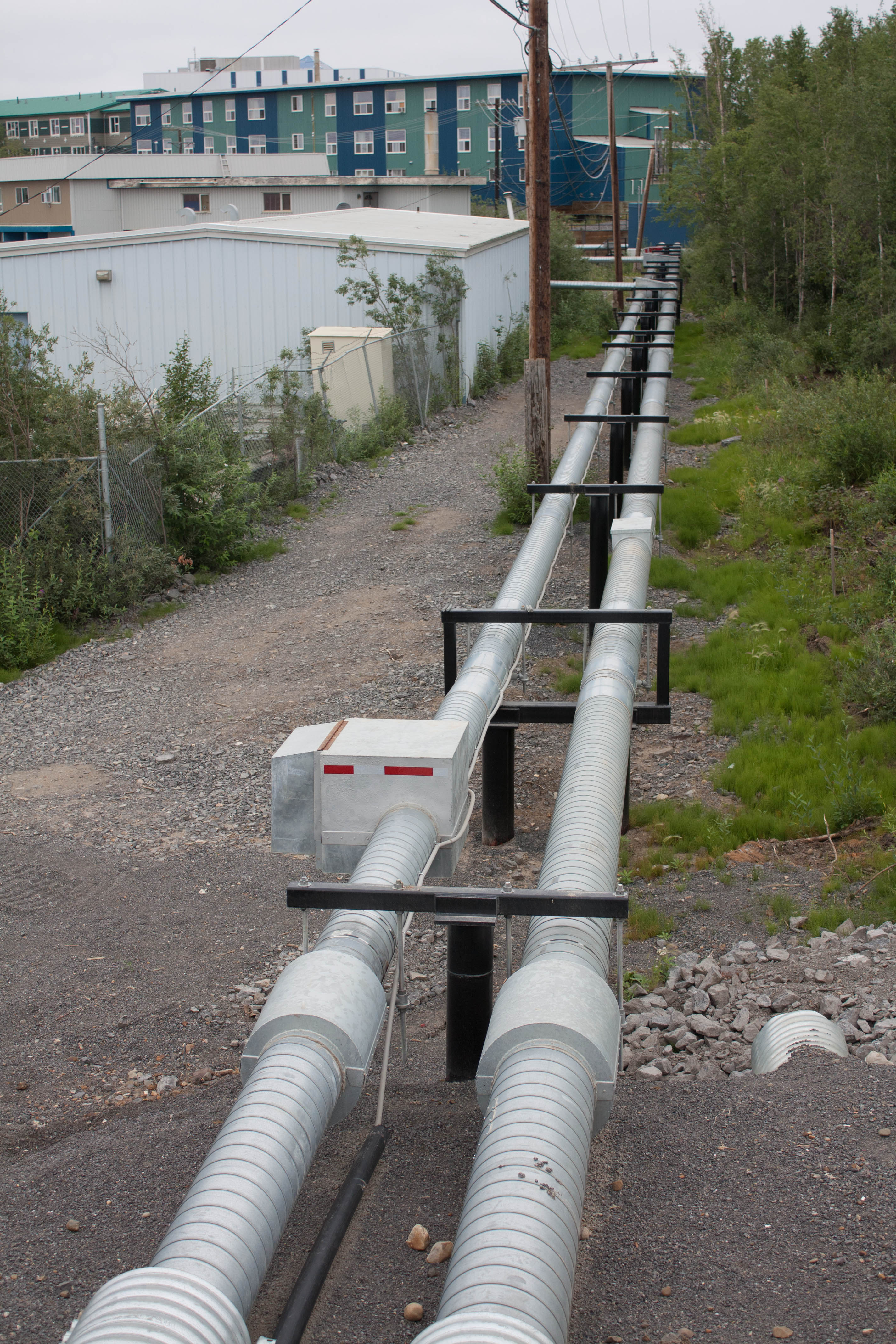
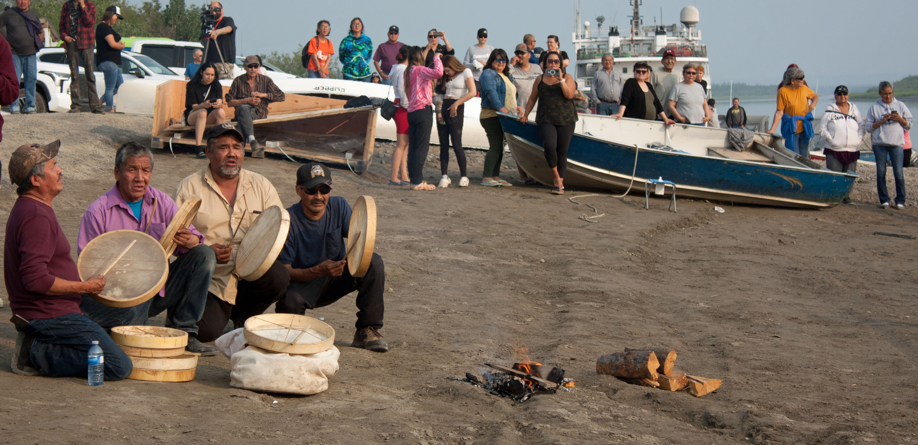
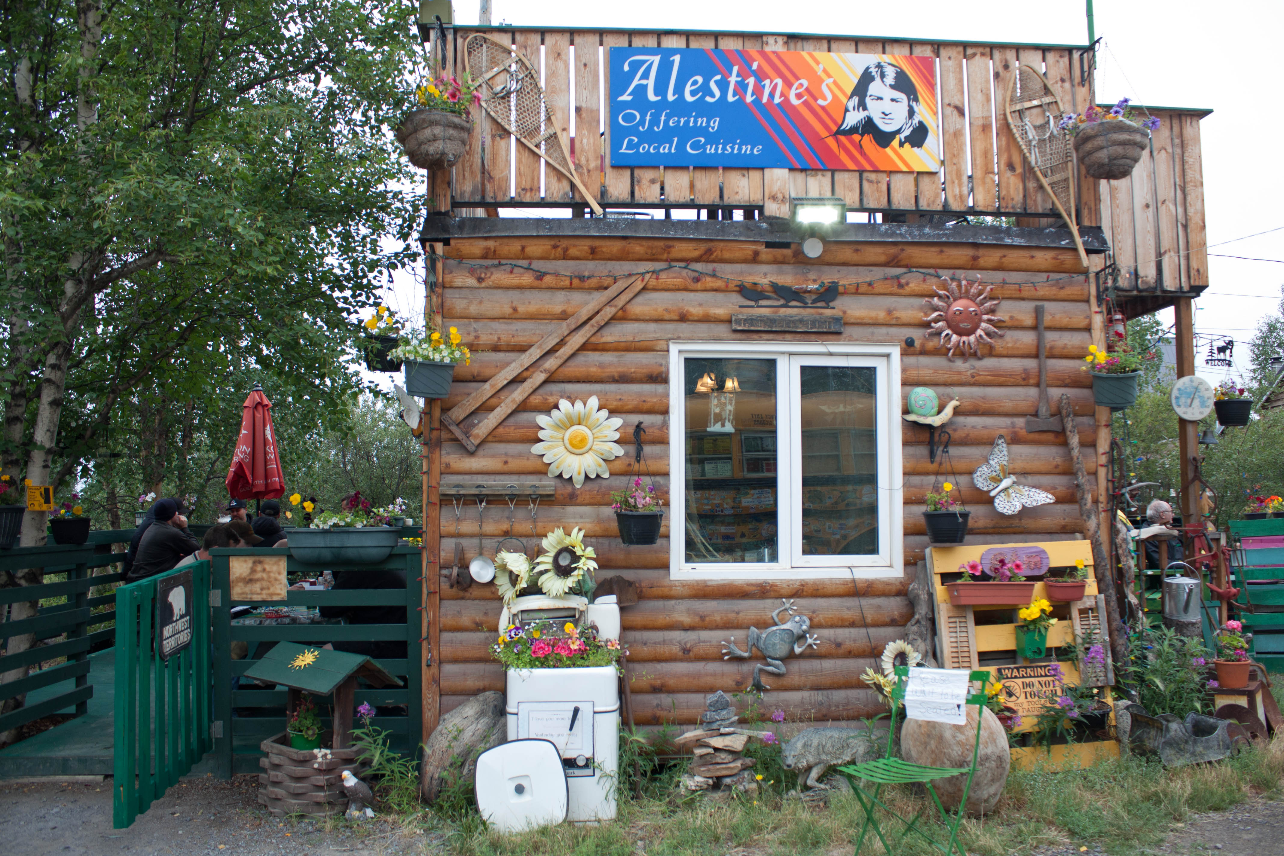
My good friend and story consultant Anne accompanied me on my research trip North. We first flew to Inuvik, whose stilted buildings all have utilidors (above ground piping) running among them to prevent the permafrost beneath from heating up. Already, some buildings were sinking and the new hospital developed a small pingo (ice pimple) beneath it; the ice was heaving and cracking the floors. Anne and I got to Inuvik just in time to witness a canoe race from Aklavik along the Mackenzie River, the first in many years. We ate whitefish tacos at Alestine’s, a funky bistro.
.
Utilidors in Inuvik, NWT (photo by Nina Munteanu)
.
Drummers bring in the canoes during the race from Aklavik, Inuvik, NWT (photo by Nina Munteanu)
Alestine’s Patio, Inuvik, NWT (photo by Nina Munteanu)
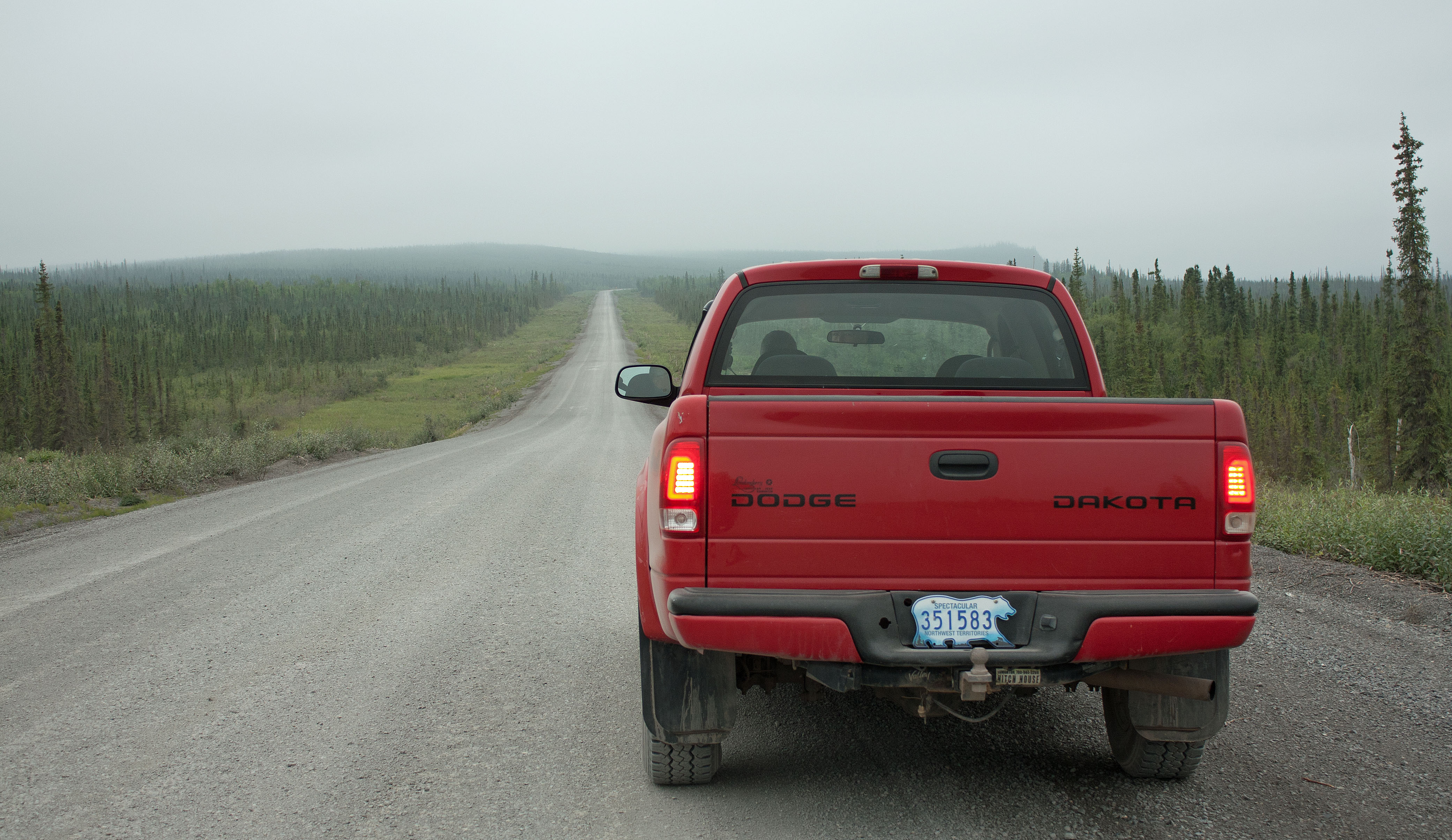
The Dakota truck on the Dempster Highway, NWT (photo by Nina Munteanu)
.
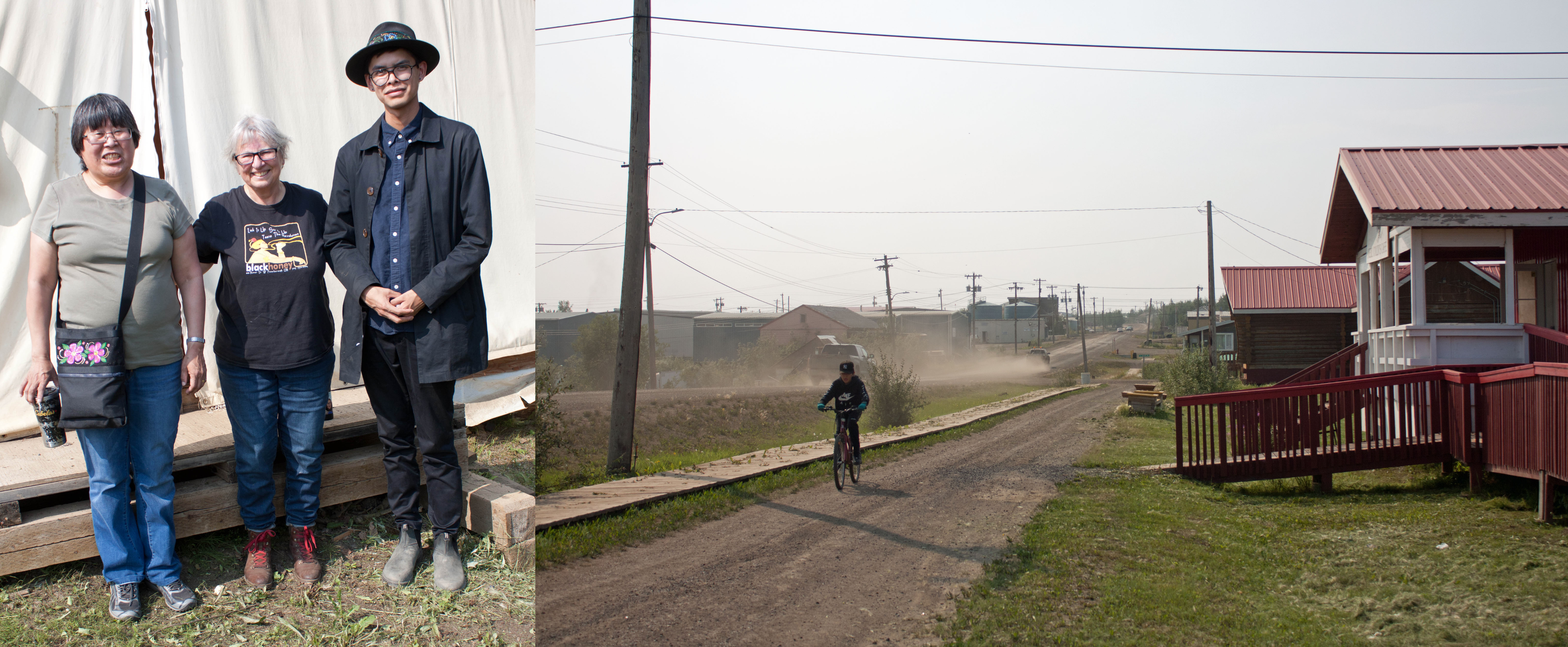
We rented a Dakota truck and drove the Dempster south to Fort McPherson on the Peel River to meet with my new Gwich’in friends who helped keep Thalweg authentic and respectful: Sharon Snowshoe (head of the Gwich’in Council) and Arlyn Charlie (a gifted writer). The town—which was totally destroyed in my speculative novel—was a small dusty community with one main street, a school, a church, and a few shops.
.
Left: Sharon Snowshoe and Arlyn Charlie with Nina Munteanu; Right: main street of Fort McPherson (photos by Anne Voute and Nina Munteanu)
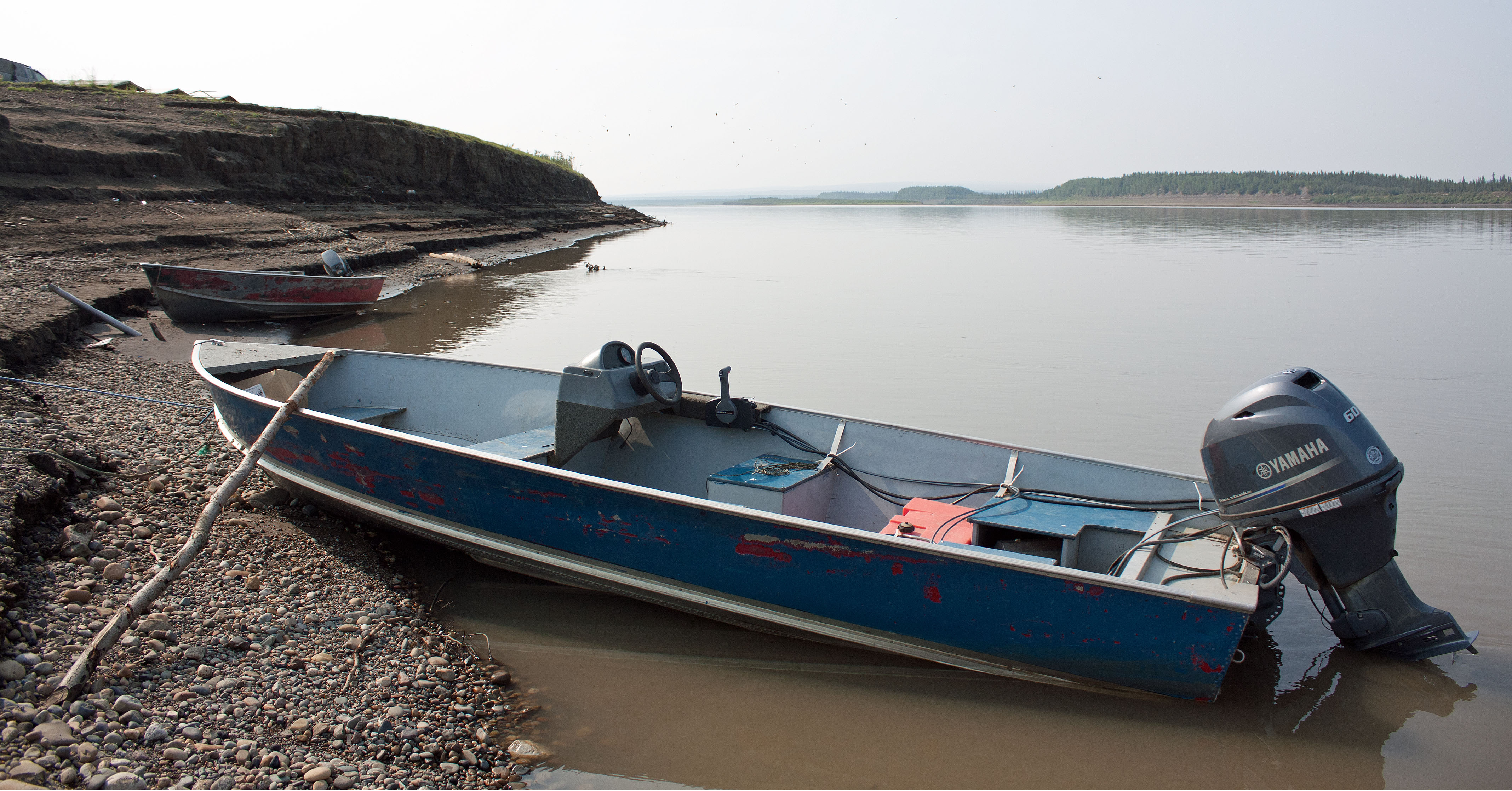
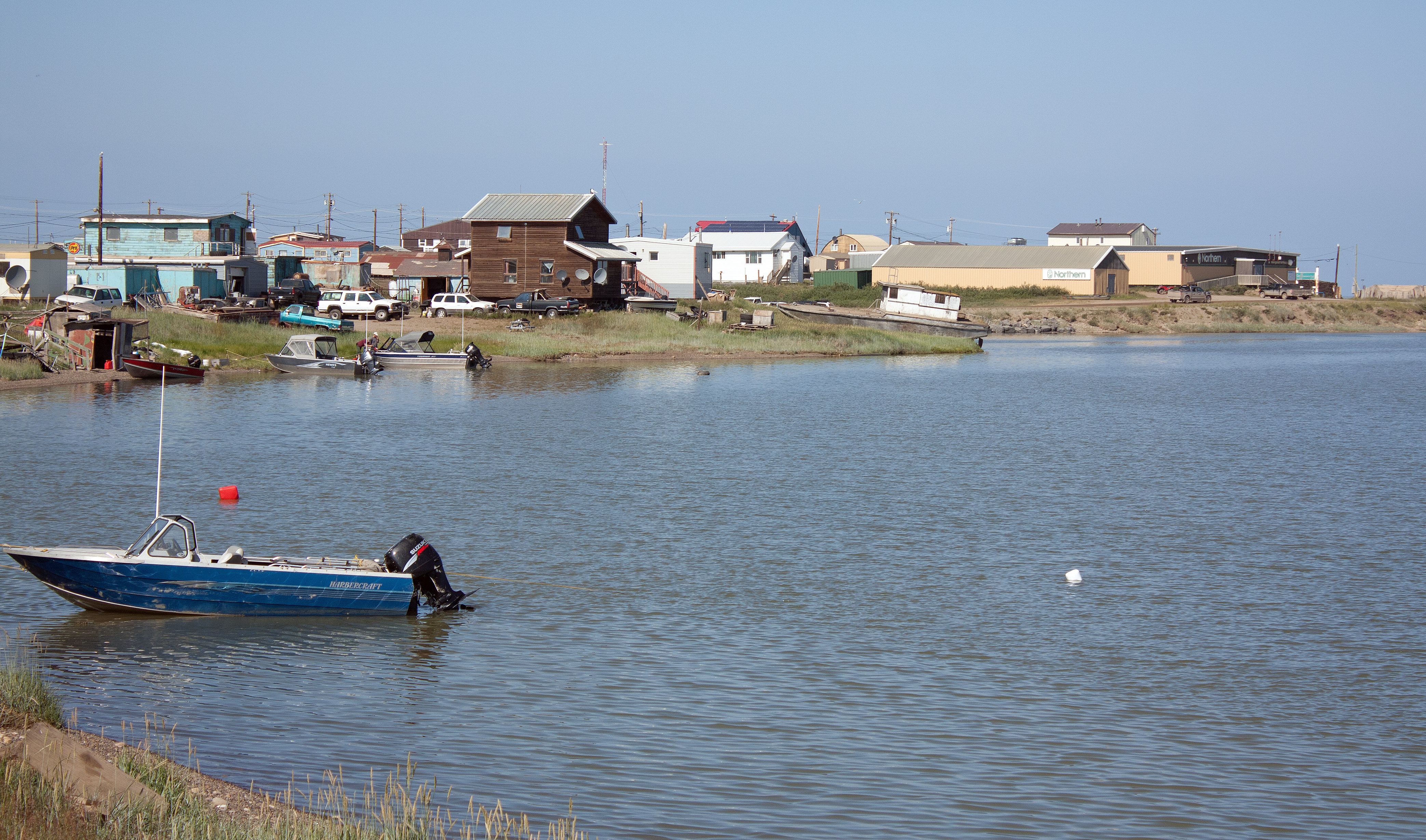
Boats moored on the Peel River, Fort McPherson, NWT (photo by Nina Munteanu)
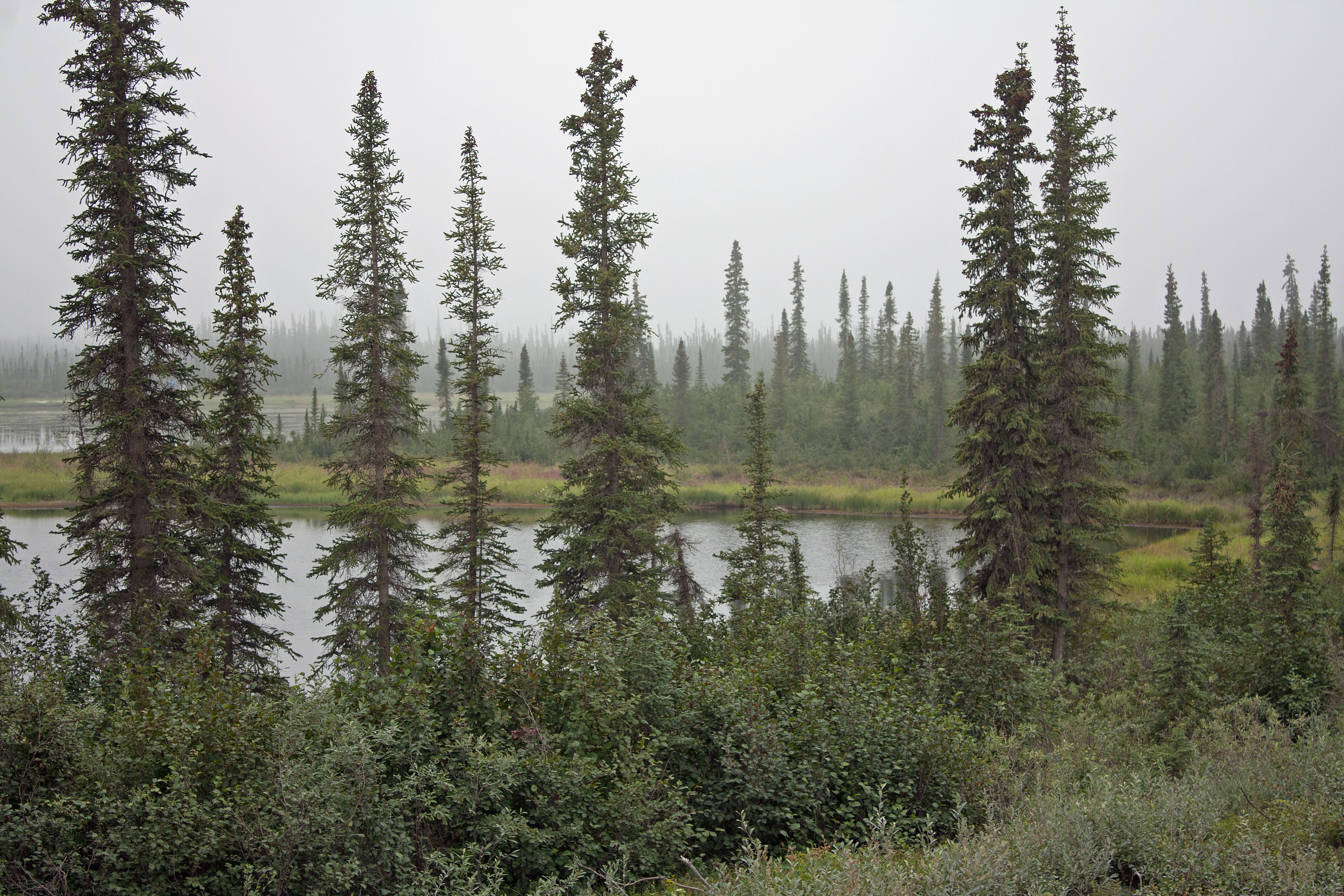
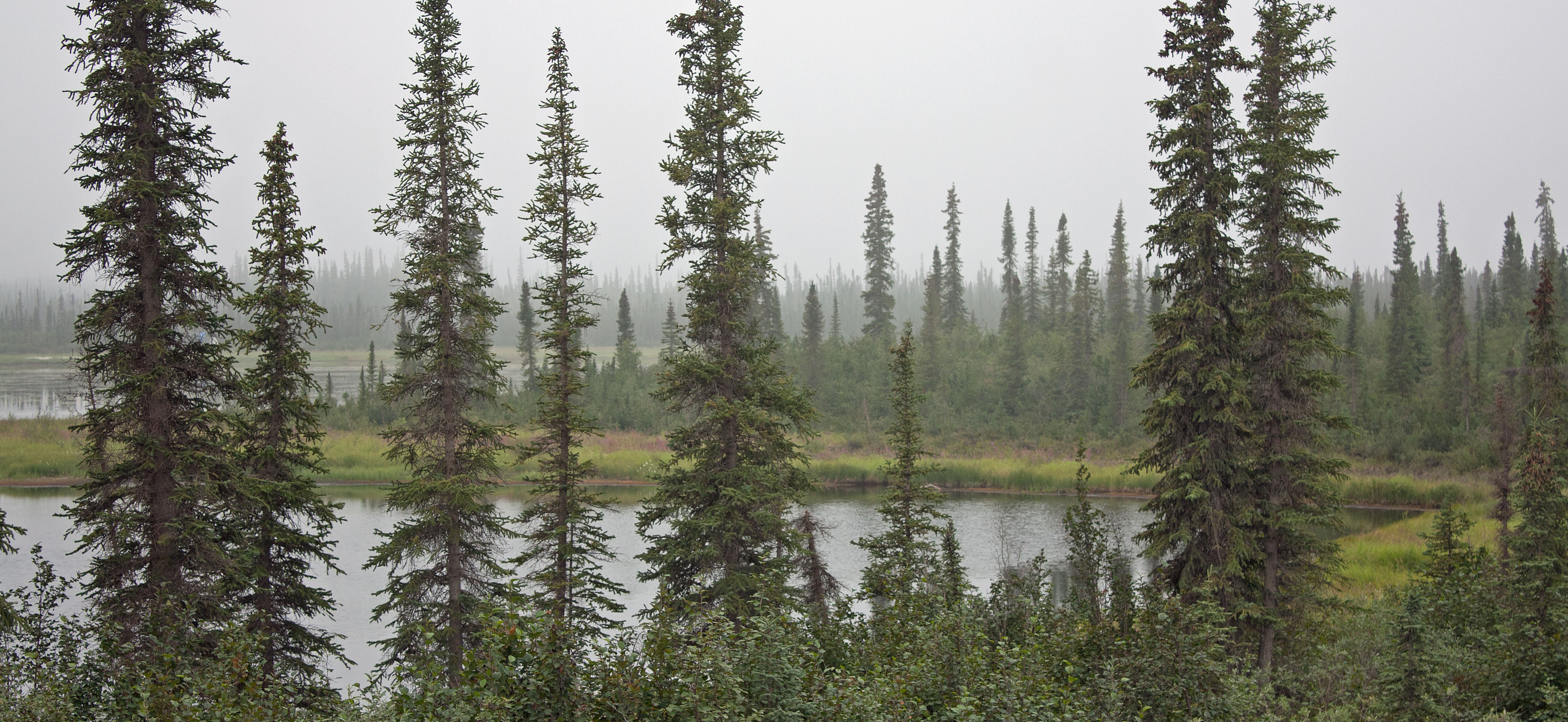
Black spruce forest and marsh in the morning mist off the Dempster Highway, north of Fort McPherson, NWT (photo by Nina Munteanu)
.
Driving the iconic Dempster through spruce forest and tundra / marsh, felt invigorating and humbling at the same time. This remote road to the Arctic North felt steeped in history and many stories. As I write this (three years after our trip) Anne, who was the driver, reminds me that the Dempster was surprisingly smooth; probably the result of a recent resurfacing.
.
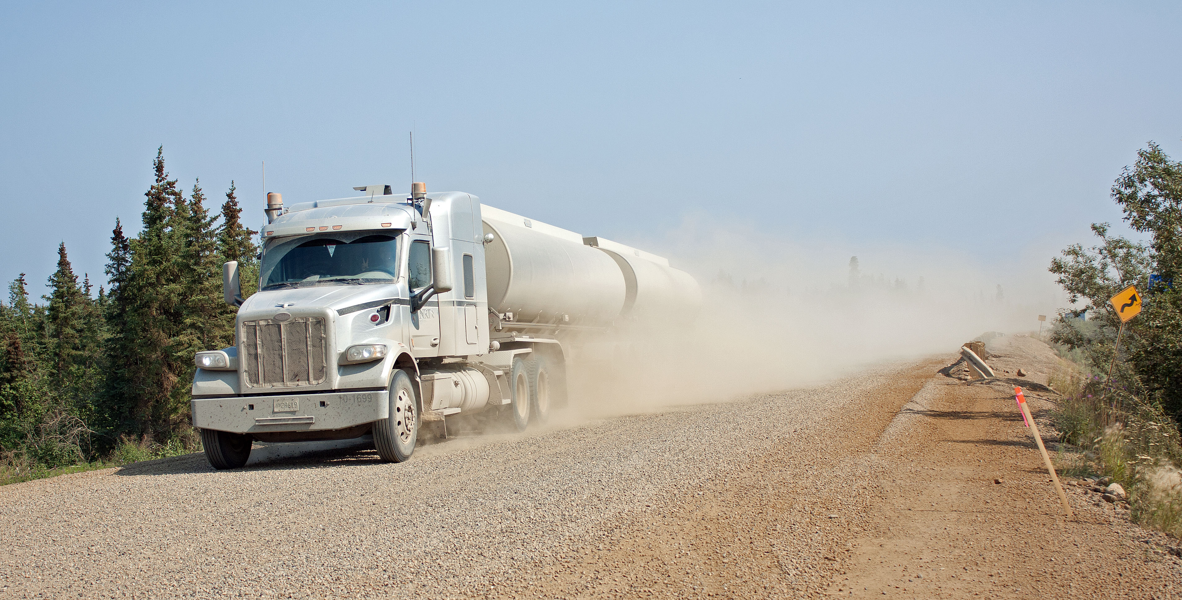
Tanker truck speeds past us on the newly graded Dempster Highway, north of Fort McPherson, NWT (photo by Nina Munteanu)
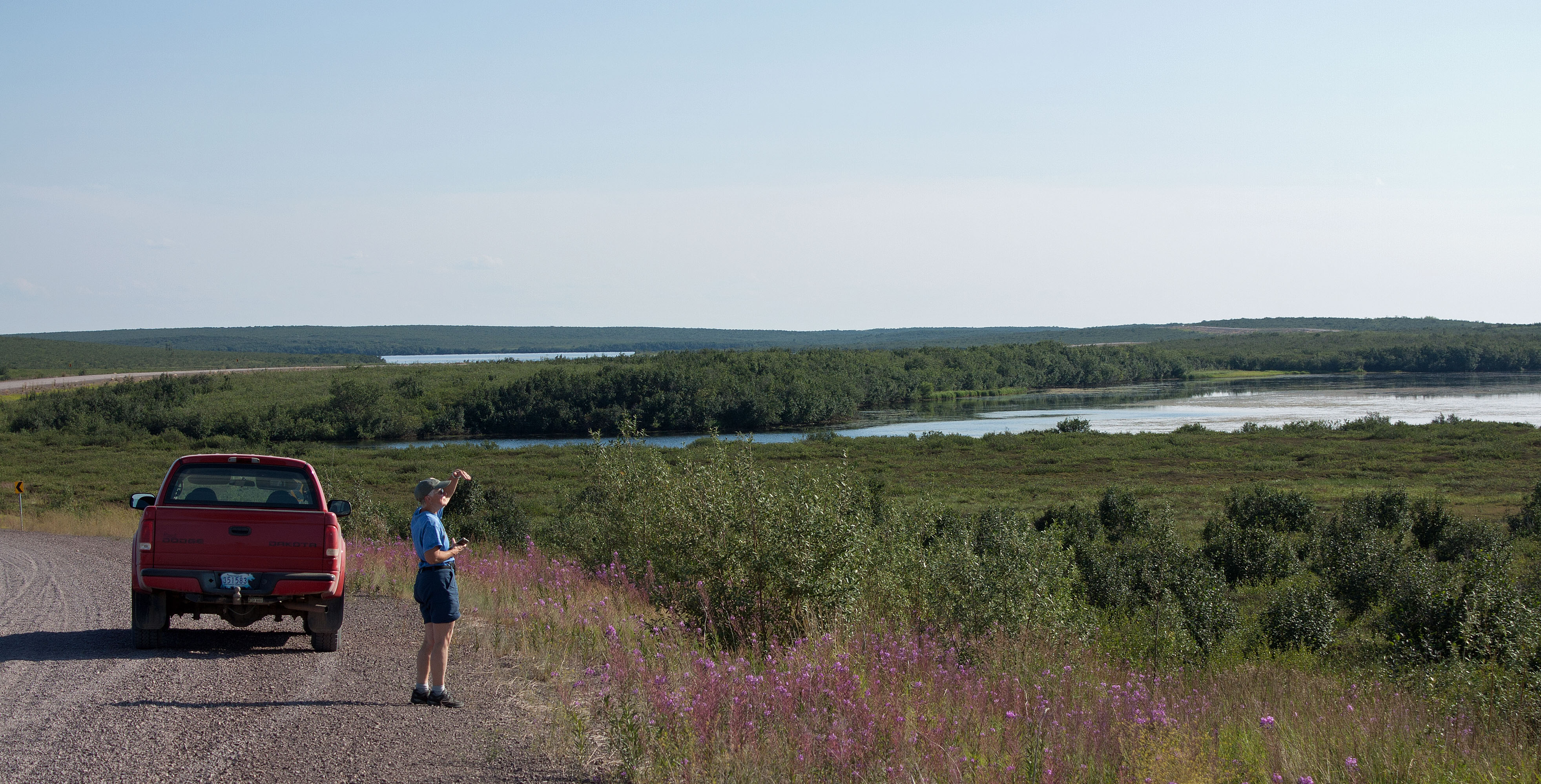
Anne stands by the Dakota, taking in the view from the Tuk Highway, NWT (photo by Nina Munteanu)
.
The new highway to Tuk, by contrast, was uneven and blemished with pot holes. The drive took us to the Beaufort Sea of the Arctic Ocean, which was surprisingly warm and fresh. I found no lingering marine smell or salt water tackiness to the touch. I then remembered that the Mackenzie River emptied into the Beafort Sea right next to the community. The best place to eat was Grandma’s Kitchen, where we enjoyed muktuk (whale blubber) and dried whitefish. Grandma Joanne served us out of her trailer and we ate overlooking the Arctic Ocean, kept company by ground squirrels looking for a handout.
.
Left: muktuk and dried whitefish served by Right: Grandma Joanne, Grandma’s Kitchen, Tuk, NWT (photos by Nina Munteanu)
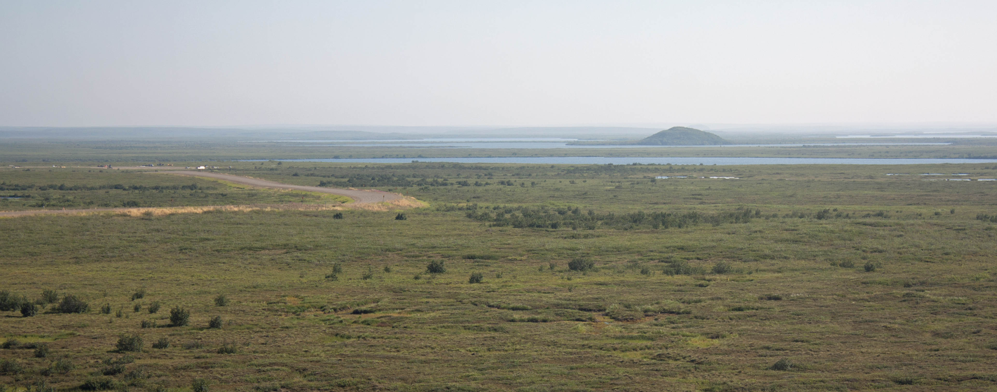
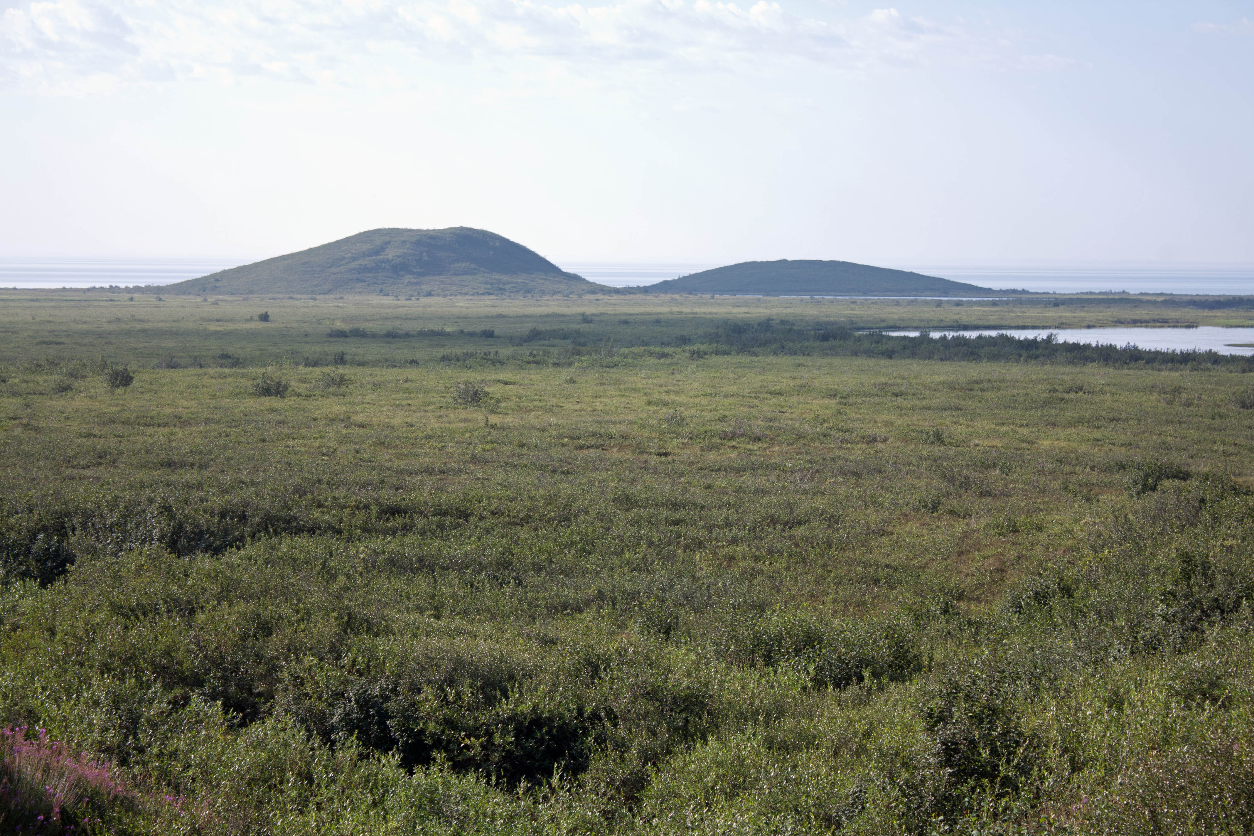
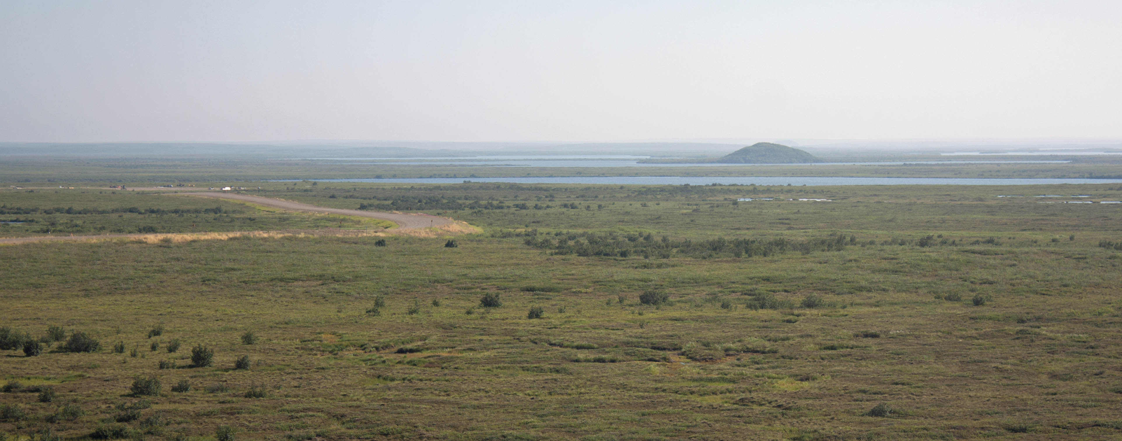
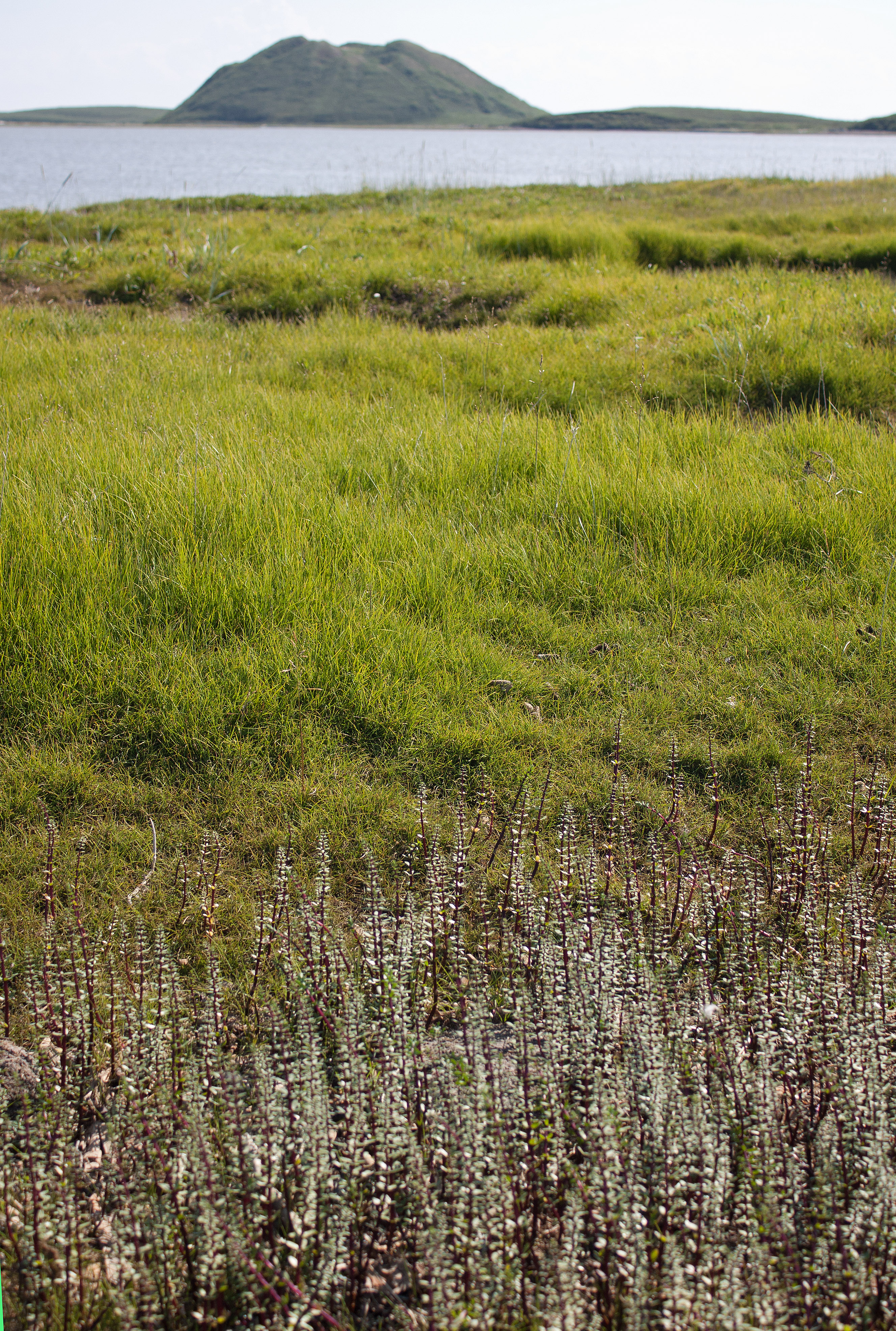
View of tundra and pingo from Tuk Highway, NWT (photo by Nina Munteanu)
.
I felt an abiding sense of home as I brushed through the tundra, among Labrador Tea, cloudberries and bearberries, boots sinking into sphagnum and crowberry, with a stunning view of Ibyuk and Split Pingos in the distance. Tuktoyaktuk sits on the edge of the Arctic Sea; boats of all kinds line the shores. Normally a quiet town, we’d landed there during some festivities, which brought in locals from all around. Anne and I strolled along the main street, talking with friendly Inuvialuit.
.
Shoreline of Arctic Ocean at Tuk, NWT (photo by Nina Munteanu)
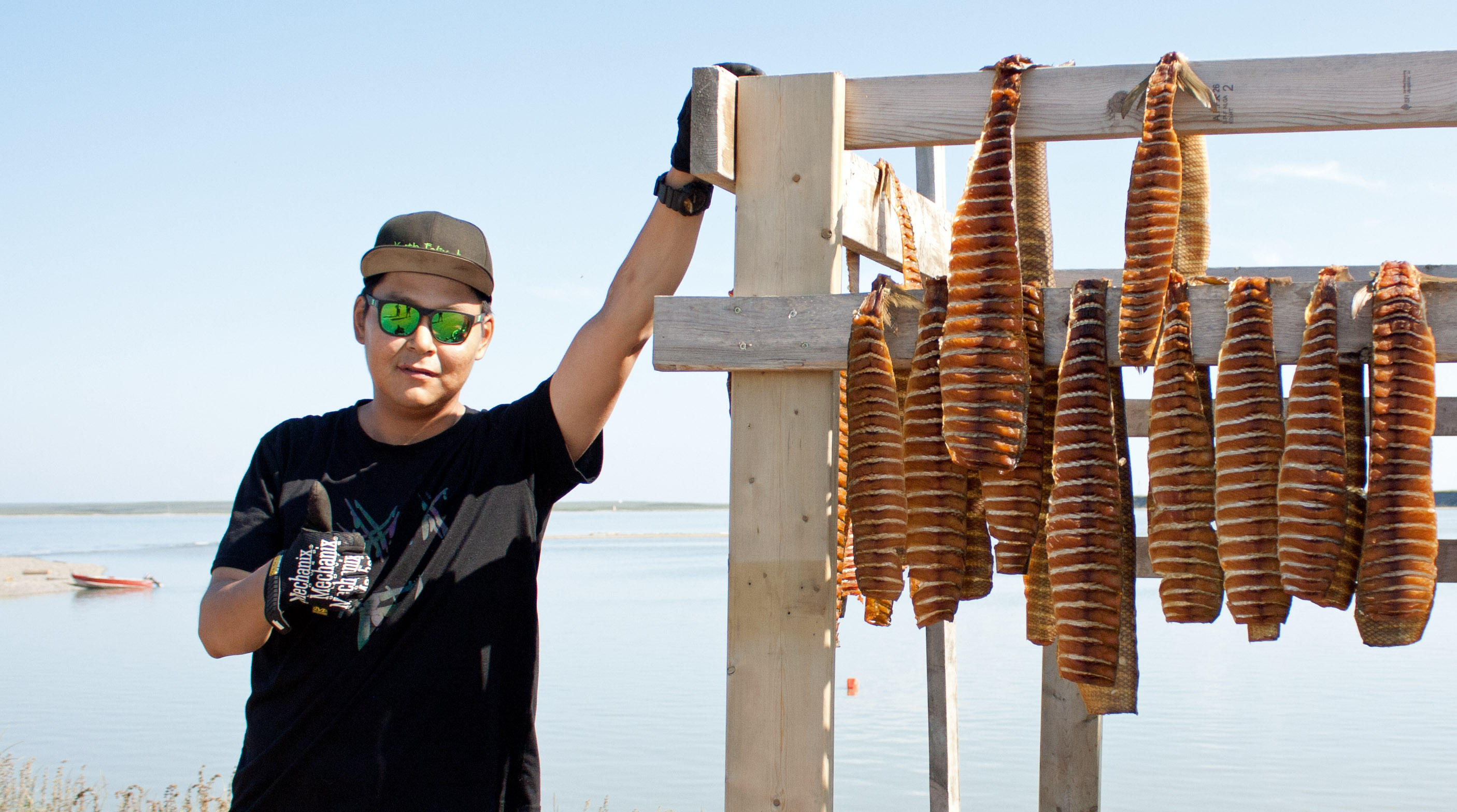
Kieth Felix stands next to his rack of drying whitefish, Tuk, NWT (photo by Nina Munteanu)
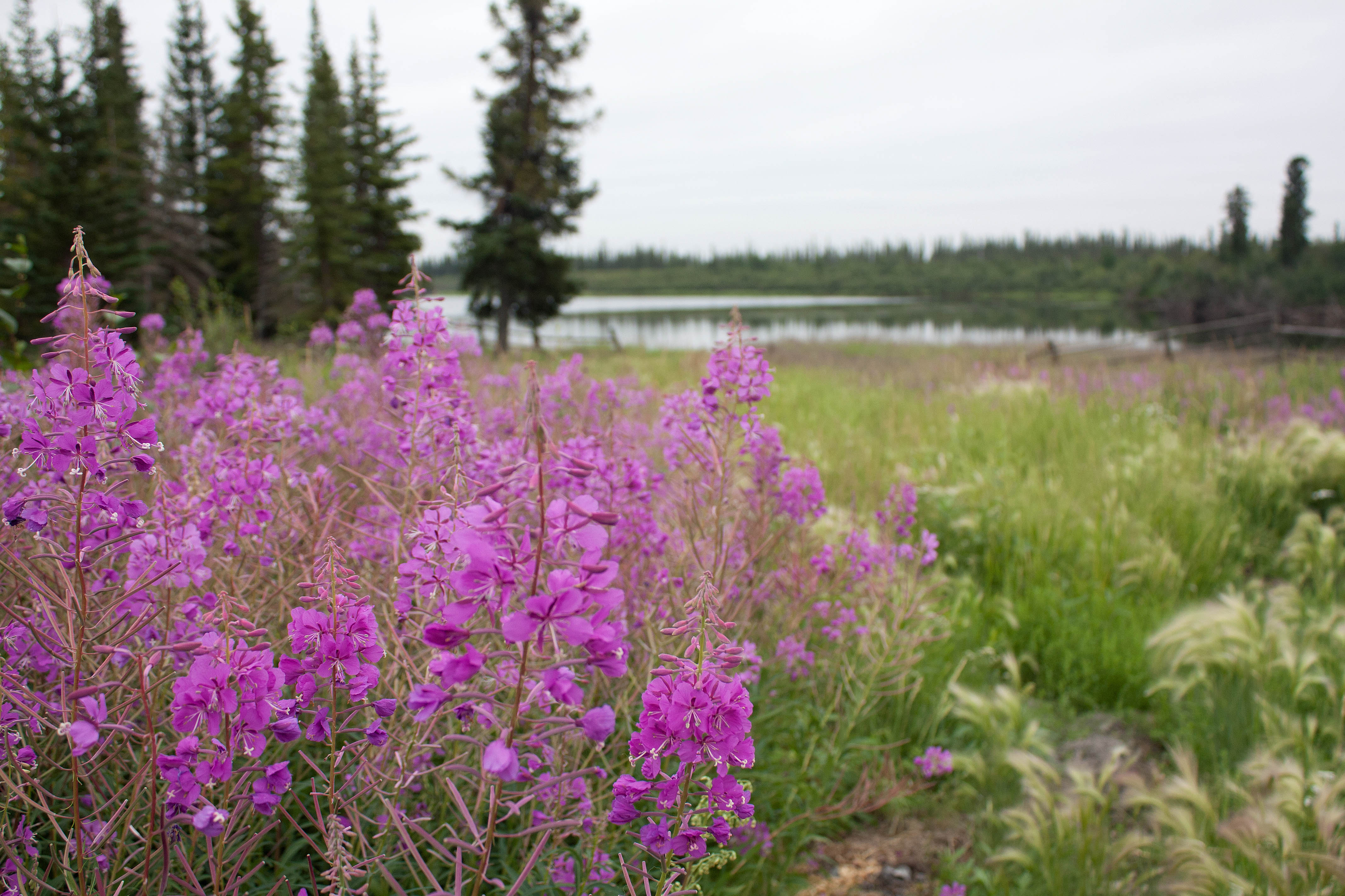
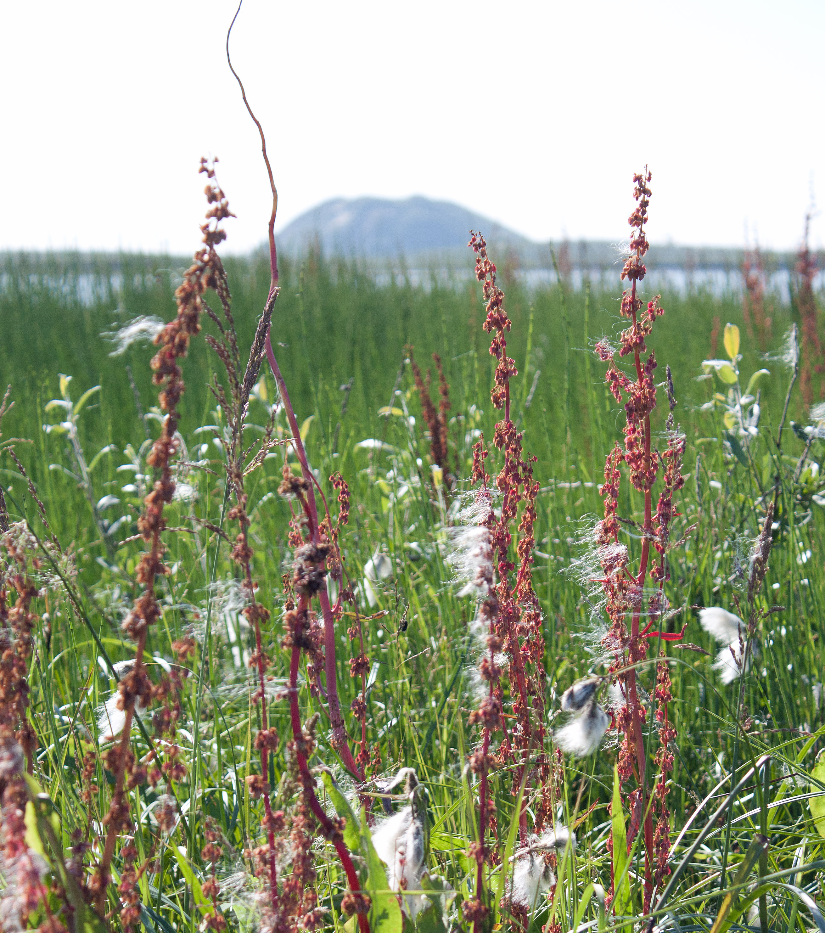
Fireweed and marsh near Inuvik, NWT (photo by Nina Munteanu)
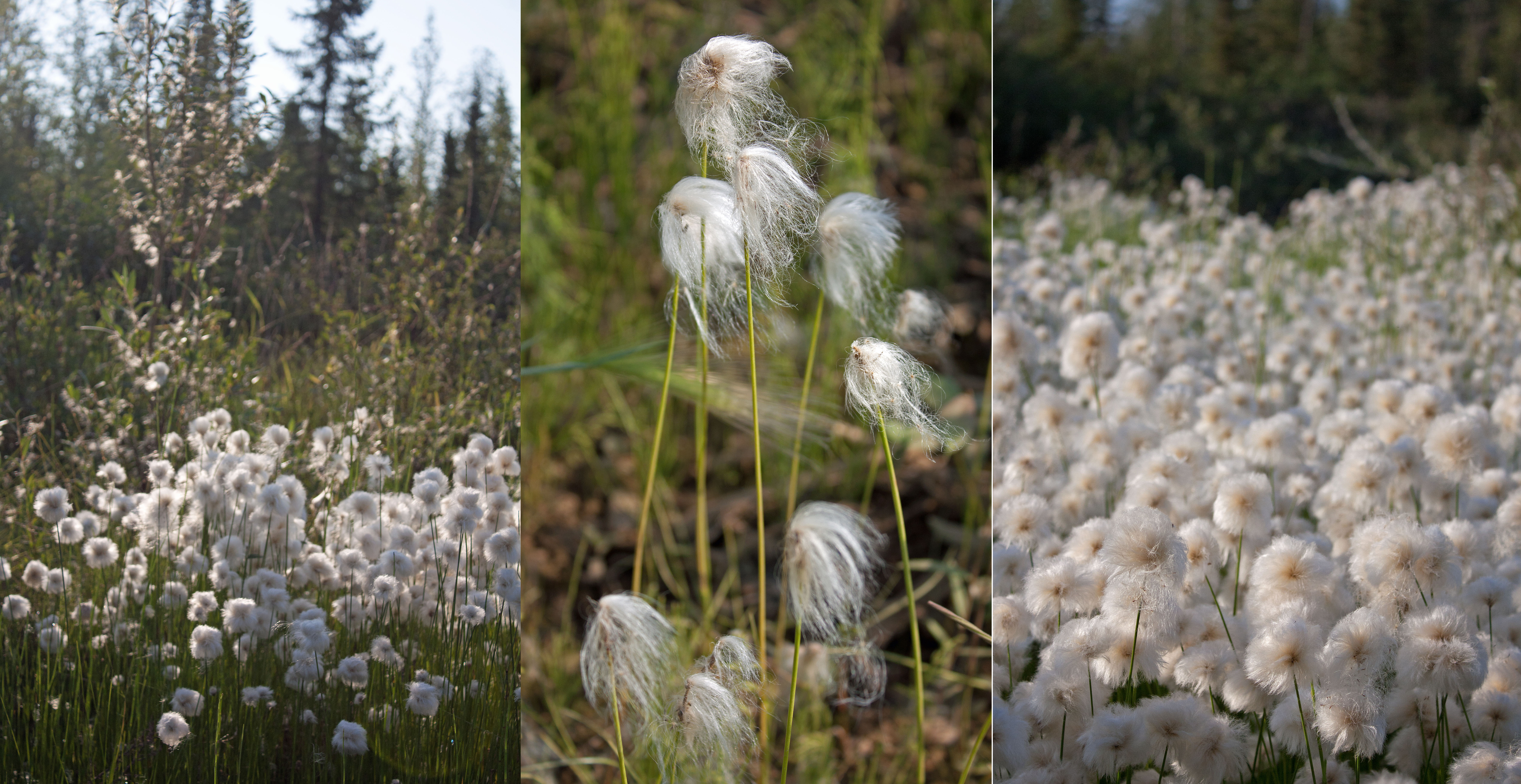
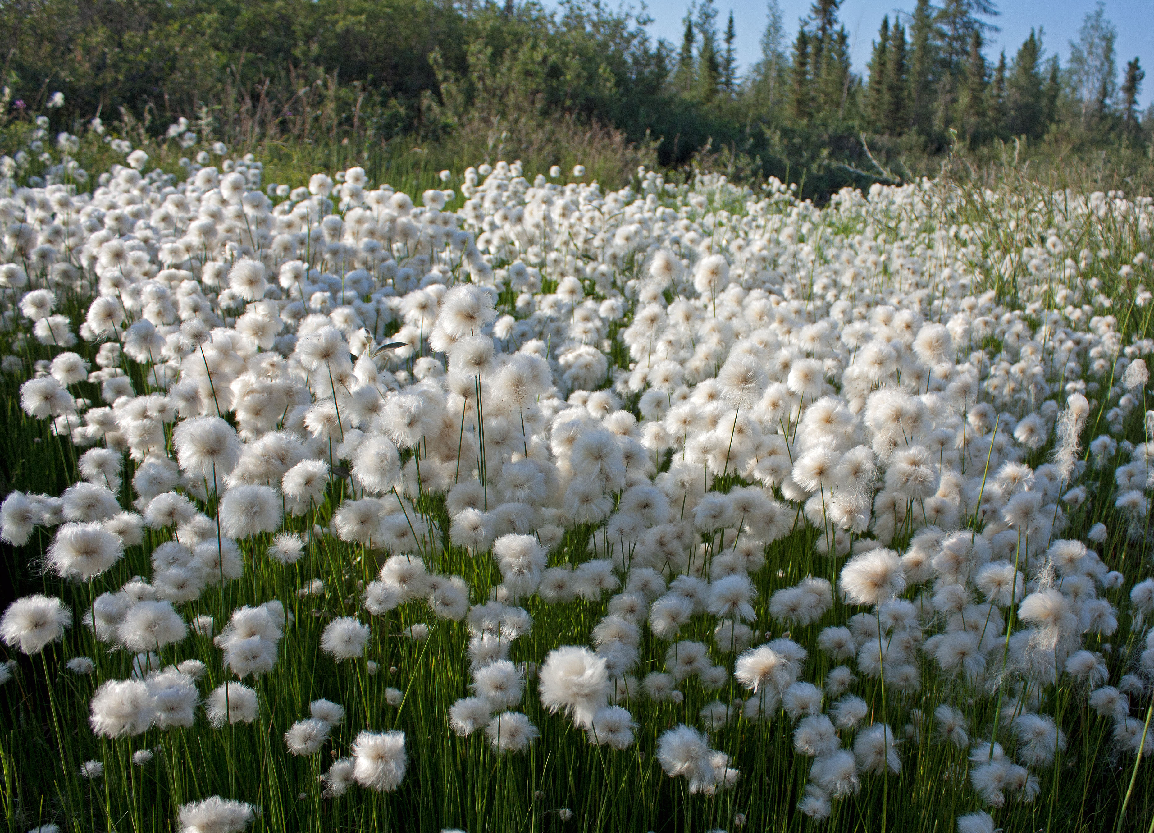
Iconic cotton grass found throughout the north along the Dempster and Tuk Highways, NWT (photos by Nina Munteanu)
.
The North is a celebration of contrasts. A wilderness of rugged beauty, often misunderstood. A place, both harsh and desolate yet incredibly rich and beautiful. A wild place that promises infinite possibilities.
.
Tuk Highway winds through tundra by the Eskimo Lakes, NWT (photo by Nina Munteanu)
.
Climate change is changing all that; the permafrost is thawing. along with the melting pingos, land is sinking and exposing dangerous sinkholes, ground slumping and landslides are increasing, coastlines are eroding to the sea, waterways are acidifying, and wildlife habits are changing:
Climate change and habitat destruction were silently destroying the Gwich’in’s way of life. Though, you’d never think it, looking at the pristine-like wilderness along the Dempster. That was the problem: much of the destruction was invisible. It isn’t seen; it’s felt I could hear Johnny say.
That was the North. More a mindset than a place. For most Canadians the North encompassed this collective myth of vast inaccessibility, and hostile grandeur. Early settlers’ portrayal of the North as hostile and isolated came from their inability to read the land and its rhythms, to know where the animals were and why they were there. The uunjit didn’t feel the land, Johnny kept saying. And because of that they would not know how to adapt to change.
Thalweg releases with Inanna Publications in Spring 2027.
.
.
The Dempster Highway
.
Nina Munteanu is a Canadian ecologist / limnologist and novelist. She is co-editor of Europa SF and currently teaches writing courses at George Brown College and the University of Toronto. For the lates on her books, visit www.ninamunteanu.ca. Nina’s bilingual “La natura dell’acqua / The Way of Water” was published by Mincione Edizioni in Rome. Her non-fiction book “Water Is…” by Pixl Press (Vancouver) was selected by Margaret Atwood in the New York Times ‘Year in Reading’ and was chosen as the 2017 Summer Read by Water Canada. Her novel “A Diary in the Age of Water” was released by Inanna Publications (Toronto) in June 2020.You can read her just released eco-fiction thriller Gaia’s Revolution by Dragon Moon Press.
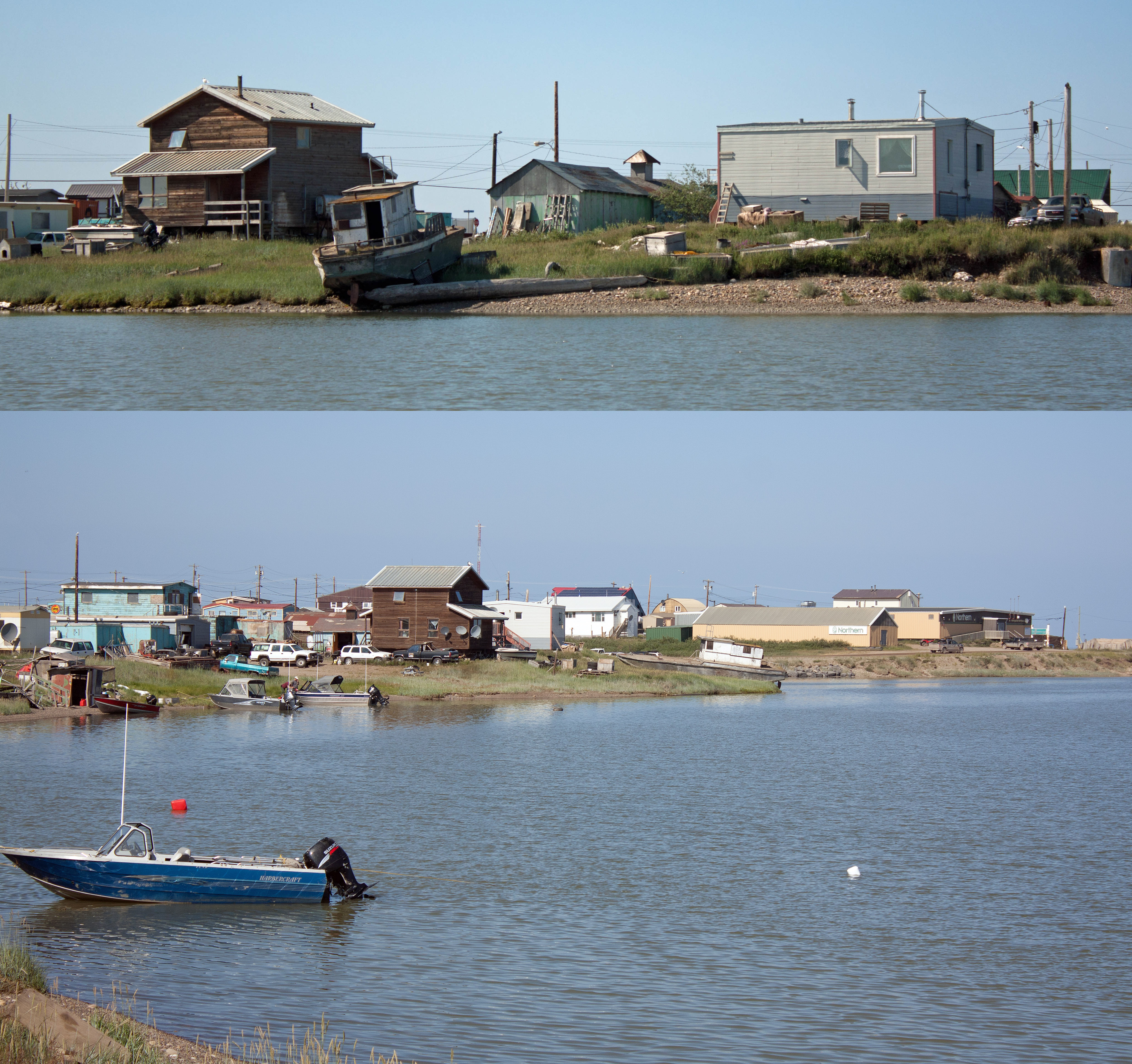
The sleepy village of Tuktoyaktuk on the Arctic Ocean, NWT (photos by Nina Munteanu)
.
A few years ago, I travelled to the village Tuktoyaktuk in the Northwest Territories on the Arctic Ocean. I was researching my upcoming eco-fiction book Thalweg with Inanna Publications (scheduled for release in early 2027). I drove with my friend Anne Voute; we rented a Dodge Dakota truck and drove the Dempster Highway north from Inuvik and the recently completed NWT Highway 10 (completed in 2017), which provides the remaining 140 km stretch to the Arctic Ocean.
.
Black spruce forest along the Dempster Highway north of Fort McPherson, NWT (photo by Nina Munteanu)
Highway 10 to Tuk winds through the tundra and Husky Lakes, NWT (photo by Nina Munteanu)
.
In Thalweg, main character Bobby-Jo is a Gwich’in limnologist who grew up in Fort McPherson in the Arctic Circle, land of permafrost.
.
Poster Child of Permafrost
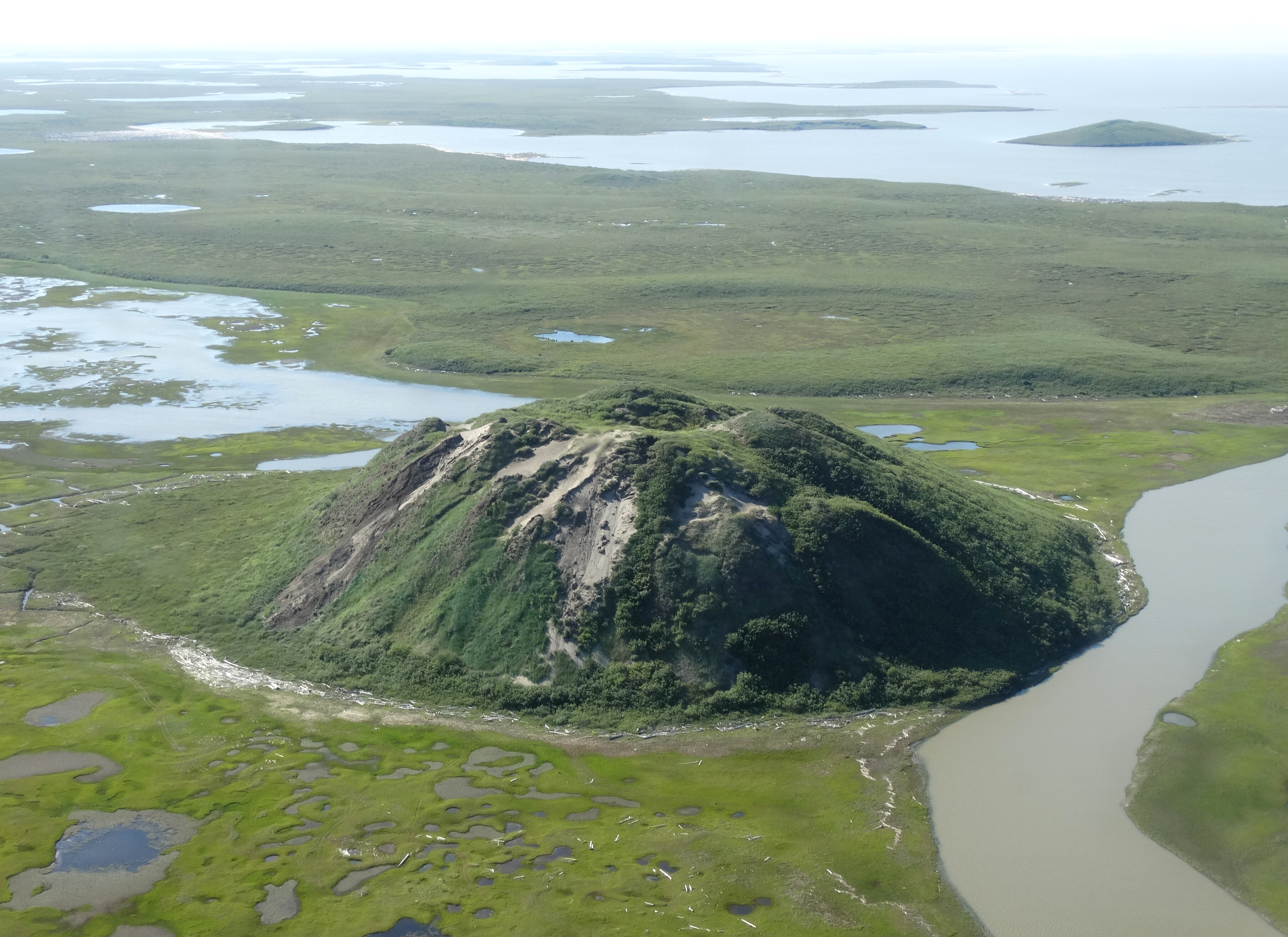
Ibyuk Pingo, near Tuk, NWT (photo shot from Cessna 172 by Adam Jones, 2013; Wikipedia Commons)
.
The poster child of permafrost is the conical ice-cored pingo, common in the Pleistocene Coastal Plain. Pingo is an Inuit word that means conical hill.
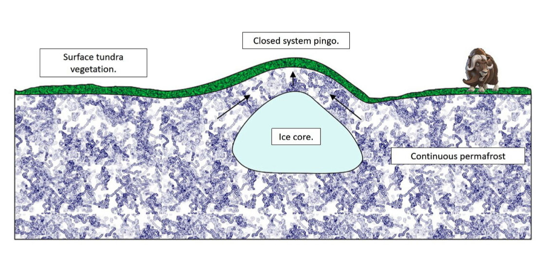
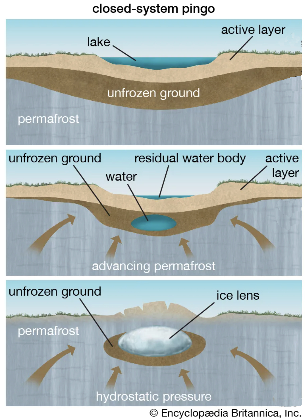
Pingos form when a mass of water is trapped beneath permafrost under pressure. Also called hydrolaccoliths, these huge mounds of earth with ice cores can reach up to 70 meters in height and 600 meters in diameter. Pingos usually grow a few centimeters a year, with the largest having taken decades or even centuries to form. Pingos eventually break down and collapse. They collapse when the ice core melts. This may happen when cracks form on the sides of the pingo that may reach down as far as the ice core, exposing the ice to warm air and sunlight. Once the core completely thaws, what remains is a doughnut-shaped ring of raised tundra enclosing a small round lake. Evidence of collapsed pingos in an area suggests that there was once permafrost there.
Hydrostatic (closed-system) Pingo (illustration by E. Ginn, 2021)
Development of closed-system pingo (illustration by Encyclopedia Brittanica)
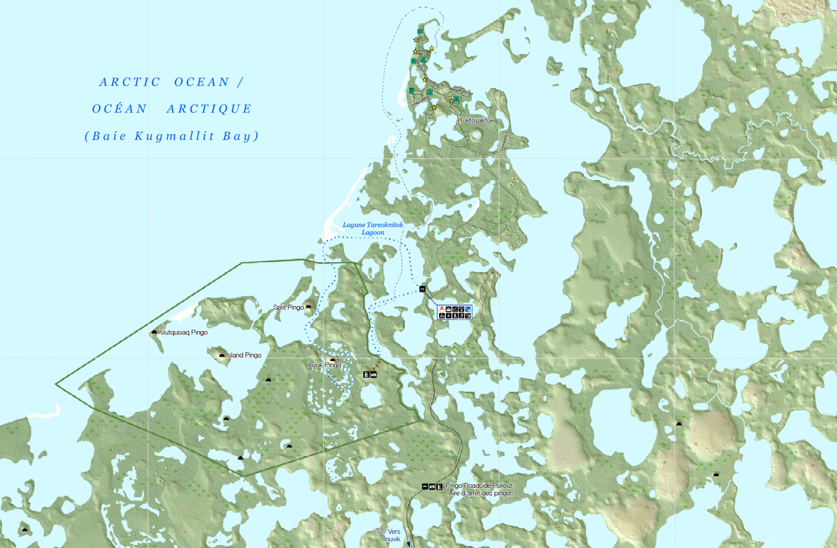
Map of major pingos in the Tuk area, NWT (pingos marked with black semi-circle)
.
One quarter of the world’s pingos, more than fourteen hundred of them, are in the Tuktoyaktuk Peninsula, part of the Mackenzie Delta of the Northwest Territories of Canada. The Inuvialuit and their Thule ancestors used these cone-like hills as navigational landmarks or lookouts when looking for caribou or whales. Hunters also used hollow pingos to freeze meat.
.
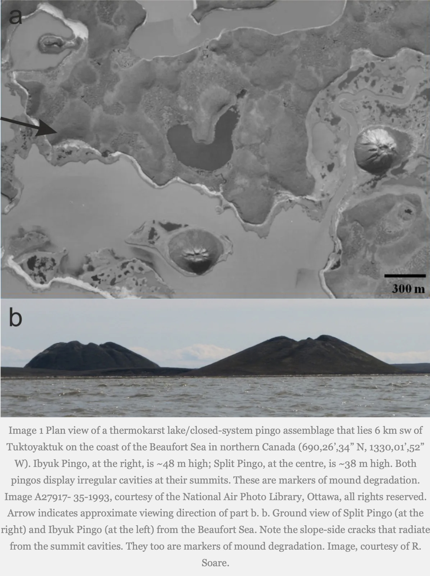
Ibyuk and Split Pingos (photos by National Air Photo Library, Ottawa)
.
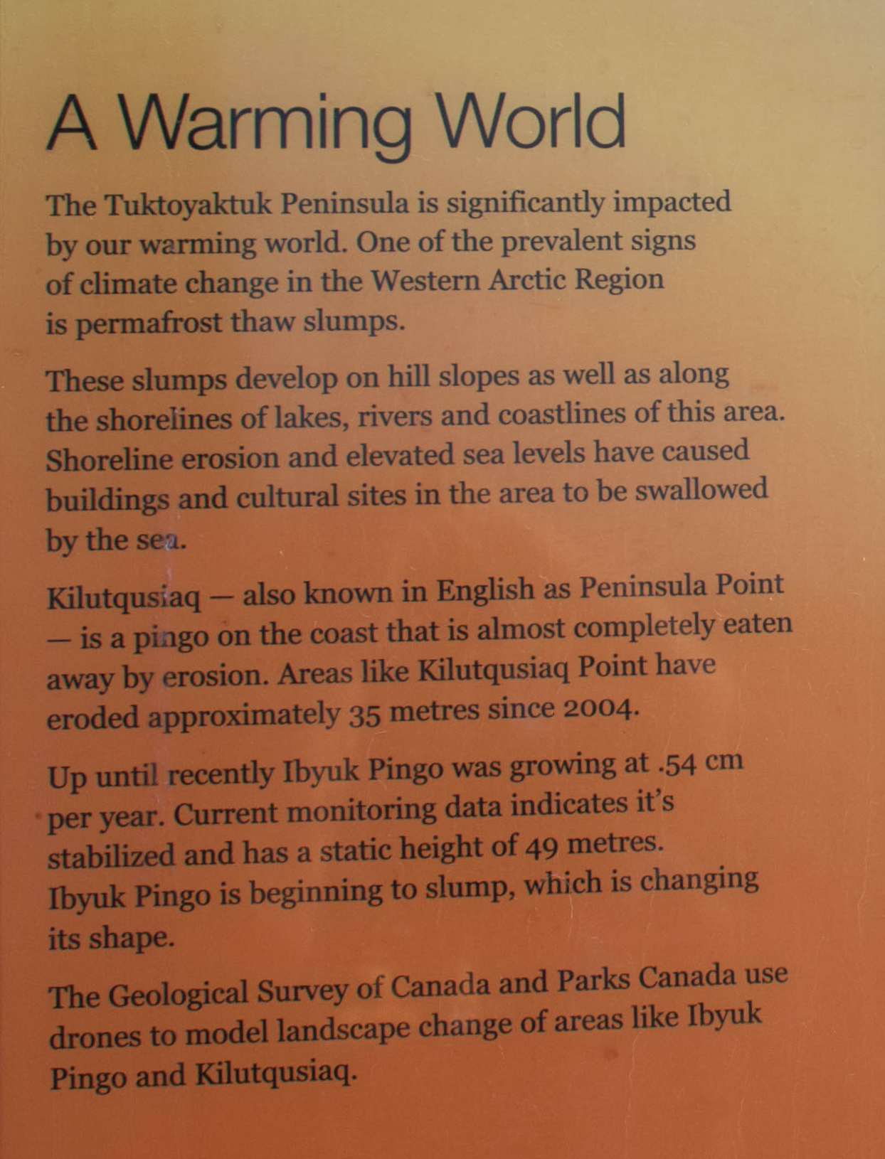
Pingo National Landmark protects eight pingos with the most famous being Ibyuk and Split. Ibyuk is about 50 meters high; it is the tallest pingo in Canada and the second tallest in the world and estimated to be more than 1,000 years old. It is also the world’s largest growing pingo, up to recently growing at a rate of about half a centimeter per year. With ongoing climate change, this is also changing. A local information sign in Tuk mentioned that Ibyuk Pingo has stopped growing and is beginning to slump, which is changing its shape. Kilutqusiaq—Peninsula Point—is a pingo on the coast that is almost completely eaten away by erosion: having eroded about 35 metres since 2004.
.
Pingos viewed across tundra near Tuk, NWT (photo by Nina Munteanu)
.
Climate change in the Arctic has caused some permafrost thaw slumps on lake shores, rivers and coastlines; shoreline erosion and sea level rise has swallowed buildings and cultural sites in the Tuk area. Kilutqusiaq—Peninsula Point—is a pingo on the coast that is almost completely eaten away by erosion: having eroded about 35 metres since 2004.
.
Tuk sign on warming climate impact on pingos
.
In the time of my novel Thalweg—2050s—hundreds of pingos near Tuktoyaktuk are caving in and forming circular ponds due to climate change. Giant ice-pimples are exploding as methane-rich gas hydrates decompose and form pressure bombs of combustible methane. The subsidence creates huge sink holes as wide as a house and deeper than hell.
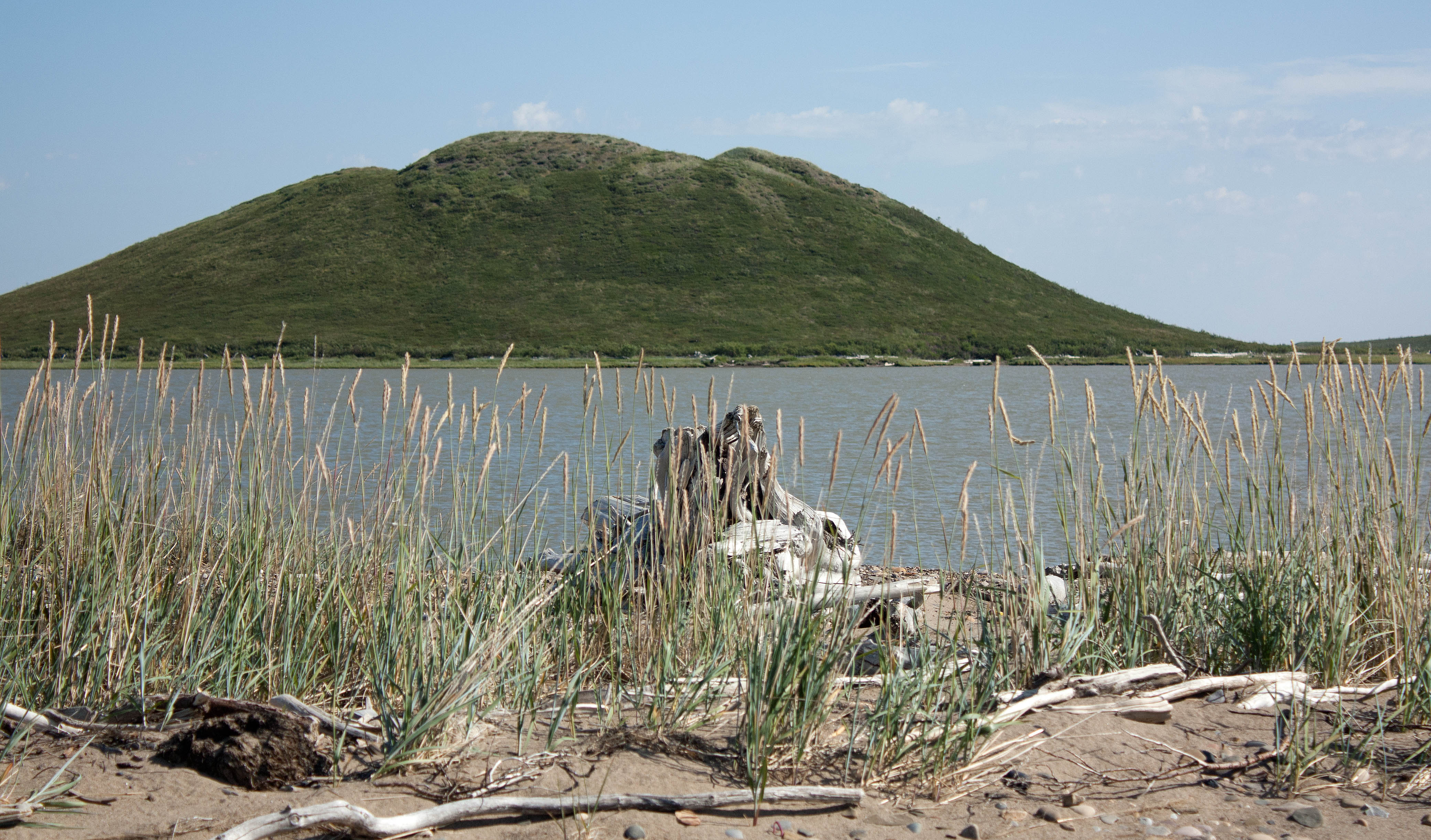
Ibyuk Pingo seen from nearby sandspit, NWT (photo by Nina Munteanu)
.
During her travels, Bobby-Jo thinks of her Inuvialuit friend Mary Steen in Tuk where giant pingos are thawing and exploding—thanks to climate change and permafrost thaw.
When we were kids, Mary took me up the Ibyuk Pingo, the giant cone mountain over a thousand years old. It’s the second highest in the world at forty-nine metres high and three hundred metres across and was still growing a few centimeters a year at its centre—despite the warming climate. Ibyuk is a hydrostatic pingo, which means it formed in an area of continuous permafrost and grew up from a large thermokarst lake. Expelled pore water from permafrost aggradation pushed up the old lake silts and sands from below, and the ice-mountain rose up like a giant frozen pimple above the ancient drained lake flats.
Ibyuk Pingo from a nearby spit of cottongrass and marsh grass, NWT (photo by Nina Munteanu)
.
We shouldn’t have been there; regrowth from trampling is extremely slow, often taking over half a century. The tundra moss, lichen, shrubs and krummholtz help insulate the pingo against ice core melting. When the ice core of the ice-cone is exposed, particularly if the vegetation blanket has broken open by dilation cracks or through erosion, the ice thaws and the mountain eventually collapses. During our climb, Mary and I noticed deep furrows in the vegetated soil layer. They cut down the slope as if a giant bear had clawed it and revealed the pingo’s icy sores.
When Mary and I returned to Tuk from our adventure, she got into trouble with her parents; someone had spotted us climbing the ice mountain and told them. I got a lecture and Mary was grounded for a week.
Because I was visiting, I was grounded alongside her. Pingos are living things, her parents told us sternly. They breathe, they grow, they shrink, they ebb and flow like water; they pulsate vertically. And we’d been in great danger. The Ibyuk Pingo was unstable—not just from a warming climate but from yahoos sliding down its steep sandy slopes and kids climbing where they shouldn’t. Did we know that the depth to its ice crust under the crater pond was shallow and fragile? When we were at the summit, the crater could have collapsed with sudden drainage of the pond and we would have disappeared in a roiling black sink hole!
When I last spoke with Mary five months ago, she told me that the area was starting to look like a moonscape, with craters everywhere. I thought of our little adventure on Ibyuk and decided that my analogy of a pimple or boil was appropriate given that pingos ruptured and flung their icy guts outward with explosive force. Mary admitted in a voice trembling with emotion that Ibyuk, the giant pingo we’d hiked up, had finally collapsed from massive coastal erosion and sea level rise. But not before it exploded.
.
.
Thalweg releases with Inanna Publications in Spring 2027.
.
Road through tundra to Tuk with pingo in background, NWT (photo by Nina Munteanu)
.
Glossary:
Pingo: A dome-shaped mound consisting of a layer of soil over a large core of ice in a permafrost area. Pingos form when a mass of water is trapped beneath permafrost (ground that is frozen for at least two years) under cryostatic or hydraulic pressure. One quarter of the world’s pingos are in the Tuktoyaktuk peninsula, more than fourteen hundred. Most are closed-system hydrostatic pingos, pingos formed in an area of continuous permafrost from pore water expulsion caused by permafrost aggradation at the bottom of a drained lake.
Permafrost Degradation: A naturally or artificially caused decrease in the thickness and areal extent of permafrost (Jorgenson, 2013). Widespread degradation of near-surface permafrost (40-80%) is projected by 2100 (Abbott & Jones, 2015). Release of greenhouse gases from thawing permafrost is likely the largest terrestrial feedback to climate change and one of the most likely to occur (Abbott & Jones, 2015). Degradation of permafrost soils can lead to the collapse, drainage and disappearance of water bodies (Vincent et. al., 2011). Jorgenson categorized twenty-three types of permafrost degradation based on dominant ice type, hydrologic regime, heat source and mass transfer.
.
Cottongrass field with black spruce behind, off the Tuk highway, NWT (photo by Nina Munteanu)
.
References:
Abbot, Benjamin W. and Jeremy B. Jones. 2015. “Permafrost collapse alters soil carbon stocks, respiration, CH4, and N2O in upland tundra.” Global Change Biology 21: 4570-4587.
Jorgenson, M.T. and T.F. Osterkamp. 2005. “Response of boreal ecosystems to varying modes of permafrost degradation.” Can. J. For. Res. 35: 2100-2111.
Jorgenson, M.T. 2013. “Thermokarst Terrains.” In: John F. Shroder (Editor-in-chief), Giardino, R., and Harbor, J. (Volume Editors). Treatise on Geomorphology, Vol 8, Glacial and Periglacial Geomorphology, San Diego. Academic Press. pp. 313-324.
Harris, S.A.., French, H.M., Heginbottom, J.A.., Johnston, G.H., Ladanyi, B., Sego, D.C., van Everdingen, R.O., (eds.). 1988. “Glossary of permafrost and related ground-ice terms.” Technical Memorandum 142, Permafrost Subcommittee, National Research Council of Canada.
Mackay, J.R. 1998. “Pingo growth and collapse, Tuktoyaktuk peninsula area, western Arctic coast, Canada: a long-term field study.” Geographie Physique Quaternaire 52(3): 1-53.
Munteanu, Nina. 2027 (upcoming release; in press). “Thalweg.” Inanna Publications, Toronto, ON.
Vincent, Warwick F., et.al. 2011. “Ecological Implications of Changes in the Arctic Cryosphere.” Ambio 30: 87-99.
Ibyuk Pingo seen from nearby grass-covered sandspit, NWT (photo by Nina Munteanu
.
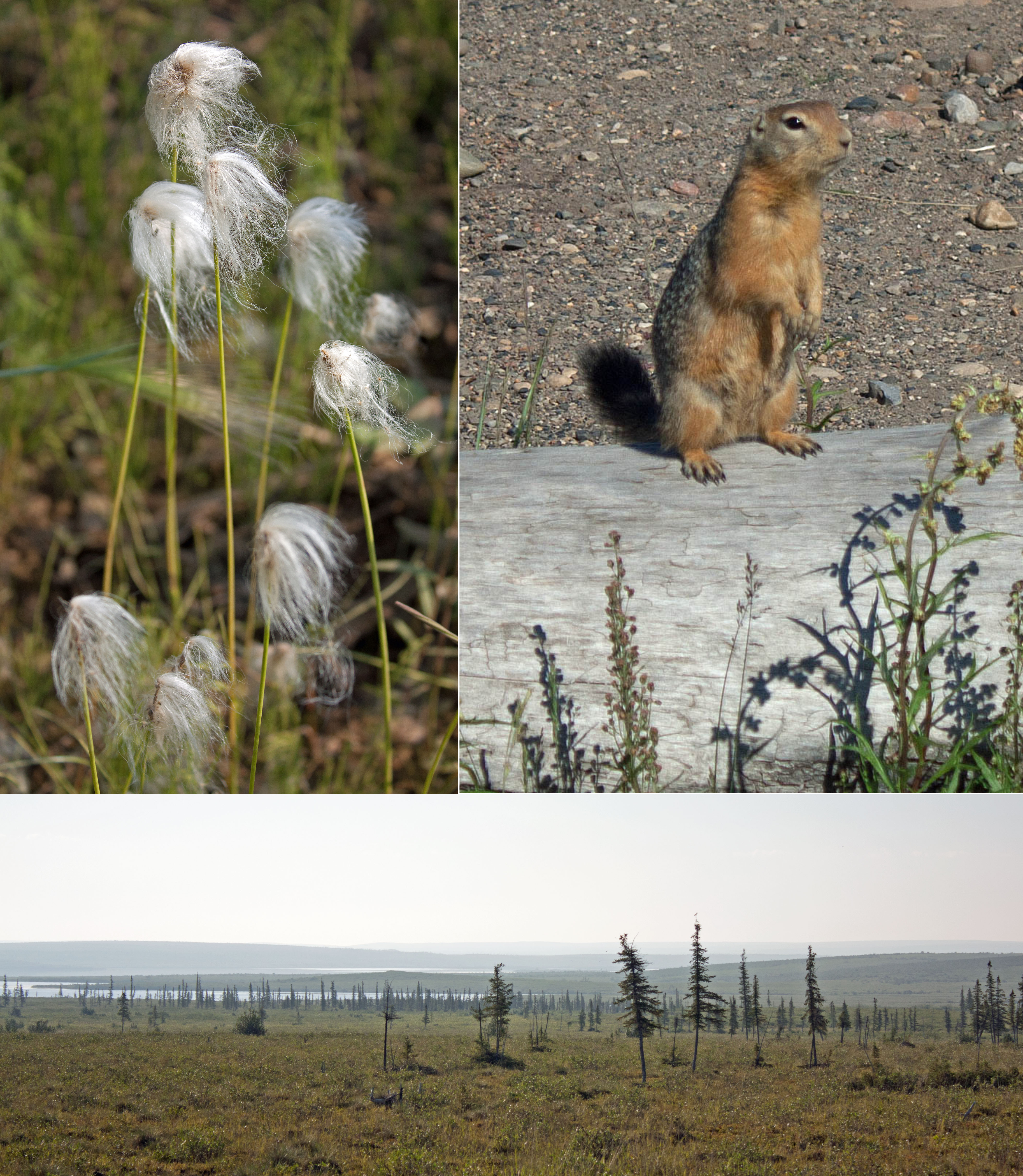
Scenes from in and near Tuk: top left, cottongrass; top right, ground squirrel; bottom, tundra scattered with spruce trees along Highway 10, NWT (photos by Nina Munteanu)
.
Nina Munteanu is a Canadian ecologist / limnologist and novelist. She is co-editor of Europa SF and currently teaches writing courses at George Brown College and the University of Toronto. For the lates on her books, visit www.ninamunteanu.ca. Nina’s bilingual “La natura dell’acqua / The Way of Water” was published by Mincione Edizioni in Rome. Her non-fiction book “Water Is…” by Pixl Press (Vancouver) was selected by Margaret Atwood in the New York Times ‘Year in Reading’ and was chosen as the 2017 Summer Read by Water Canada. Her novel “A Diary in the Age of Water” was released by Inanna Publications (Toronto) in June 2020.You can read her just released eco-fiction thriller Gaia’s Revolution by Dragon Moon Press.